See comments on Mastodon, LinkedIn (via myself, Better Streets), Reddit (r/sydney [peaked at #3], r/australia, r/westconnex), Hacker News or below. See the Bicycle NSW article written since this post.
Ever wondered why there are random dead ends for cycle paths in Sydney? This is a deep dive on how one particular missing link might not get fixed after more than seven years of planning. Let this be a record of how hard it is to get safe cycling intersections built in Sydney, even when the improvements are required approval conditions of a $4.3 billion portion of a motorway project (yes, international readers – Sydney is still building urban motorways this century).
On the 30th of August, Transport for NSW (TfNSW) updated the project page for the improved Sydney Park Junction, a project to “improve the safety, performance and efficiency of the Princes Highway and Sydney Park Road intersection”.
The project was mandated to include “traffic calming initiatives along Princes Highway, improvements in accessibility to Sydney Park and the provision of upgraded cycle and pedestrian facilities” as part of the approval conditions for the M8 Motorway (Westconnex).
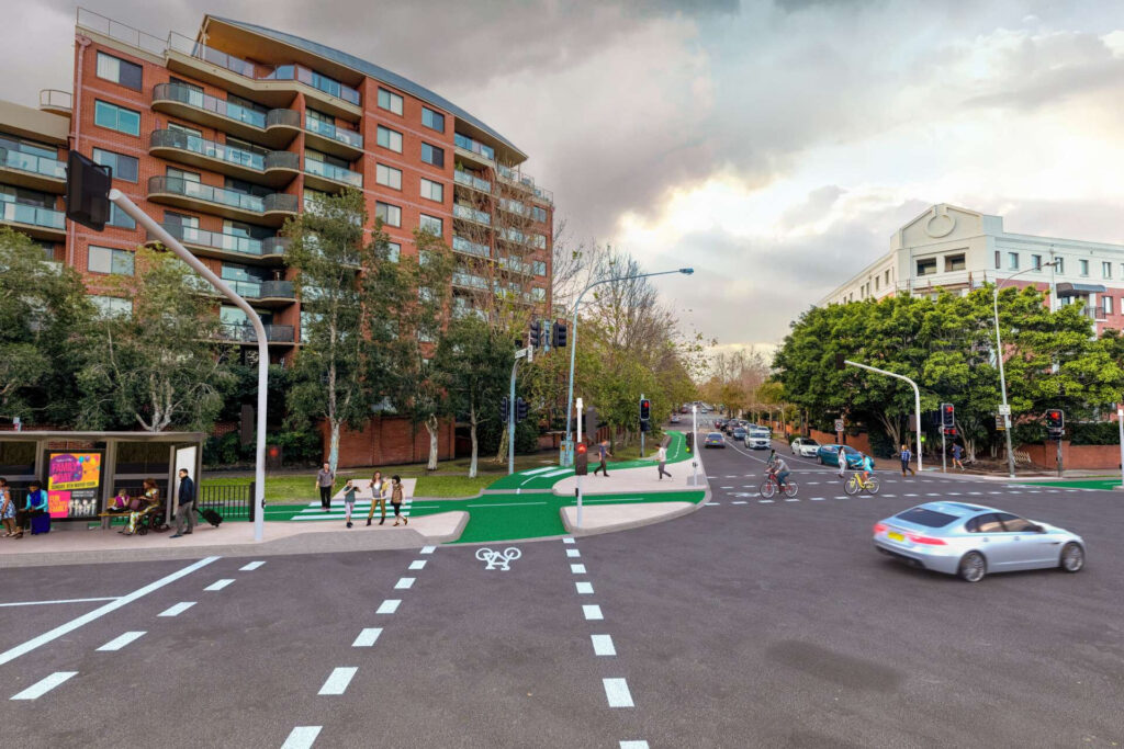
This project included a stunning new intersection fixing the infamous missing link – the gap between the Mitchell Road cycleway to the Sydney Park Road pop-up cycleway. In 2021 Bicycle NSW commented “The project will be of enormous benefit to the community” and that “This project sets an exciting precedent for better place outcomes throughout Sydney.”
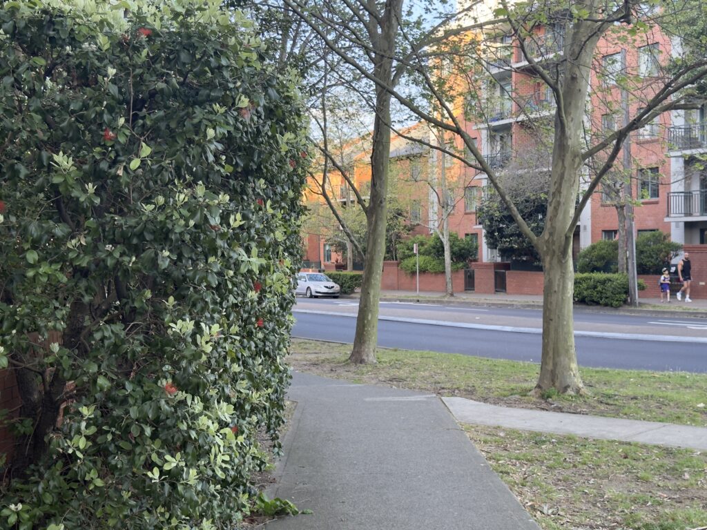
By fixing this missing link, TfNSW was also improving pedestrian safety by reducing the number of folks cycling on the narrow 1.8 metre wide footpath with blind corners, and adding a missing pedestrian crossing on Sydney Park Road. This is a main entrance to Sydney Park, with a large volume of families, kids and their pets using this thoroughfare every day.
Thanks as always to the Internet Archive, we can see exactly what text TfNSW updated on October 30th 2024:
- “We expect to start construction in mid to late 2024.” has changed to “We expect to start construction in late 2024.”
- “To keep up to date with this project and download the submissions report visit the Sydney Park Junction Portal” has changed to “To keep up to date with this project download the Submissions Report – March 2022 (PDF, 40.18 MB).”
Little does the public know, on August 1st TfNSW (the state transport department) told the City of Sydney’s Cycling Advisory Committee meeting (which I attended as a volunteer of Better Streets) that the cycleway would be implemented “replacing the full extent of the existing pop-up cycleway” – that is by omission, only part of the project was going ahead.
That a “major design feature” (Review of Environmental Factors, PDF pg. 68) or “key consideration of the proposal” (Submissions report, PDF pg. 35) could be deleted in secret, 2 years after going through community consultation, 3 years after the Review of Environmental Factors, 7 years after the initial M8 approval condition B51 concept design, and announced by omission floored everyone in the room.
A City of Sydney employee is recorded in written minutes stating the change was “breaking earlier promises to the City and the community”. Council employees also verbally stated that when designing the Mitchell Rd separated cycleway they were instructed by TfNSW to not build up to the intersection, as TfNSW would fix that gap (the City was instructed to end the cycleway where it is).
Almost a full month later, the 30th of August TfNSW project page update wilfully or negligently misled the public by omitting that the project (stated in TfNSW slides Aug 1st to begin construction in September 2024 – that is, this month!) had secret, major design changes. There has not been any community update since February 2023, and on these this particular intersection since March 2022.
After Bicycle NSW wrote to the Secretary of Transport (TfNSW) seeking direct clarification, the response was a similarly vague response of deletion by omission, with a map as confirmation.
It shouldn’t be this hard to get safe cycleway intersections built in Sydney.
Overview
- 1. What are the current plans?
- 2. Was this change brought on by a newly signposted shared path?
- 3. The design changes are not consistent with the Walking Space Guide or mandatory Road User Space Allocation Policy
- 4. Why make these changes to the design?
- 5. Approval conditions for the M8 motorway (Westconnex)
- 6. Undermining confidence in TfNSW following Rozelle Interchange inquiry recommendations
- 7. A brief history of broken Westconnex promises
- 8. What can I do about this?
- 9. Appendix
- Section 1 shows current (secret) plans do not include the design in the Review of Environmental Factors for the project, and leave the option open for it to never be completed
- Section 2 explains the complex history of the shared path that TfNSW is not upgrading
- Section 3 explains that the project does not meet TfNSW policy for prioritising walking and active transport
- Section 4 guesses at why TfNSW would make these changes
- Section 5 drills into the details of the Westconnex approval conditions that mandated a separated cycleway at this intersection
- Section 6 outlines why this change and behaviour is not in line with recommendations made from the “Impact of the Rozelle Interchange” parliamentary enquiry
- Section 7 briefly looks at previously broken promises to the community regarding active transport projects as part of Westconnex
- Section 8 has more info on what you can do to advocate for the original project going ahead
- Section 9 includes photos and tables indicating safety risks of the existing infrastructure
My background is in computer science and I work as a software engineer – I am not a traffic engineer and this analysis is a side project. Please let me know of any mistakes, corrections, improvements or constructive criticism in the comments below, via Mastodon or privately to [email protected].
Thanks to the tireless advocacy of Bicycle NSW and the City of Sydney on this project and other life saving cycleway infrastructure in Sydney. I wrote this over a weekend; they’ve been tackling this for years.
Clover Moore as Lord Mayor of the City of Sydney council has been a considerably outspoken supporter of safe cycling infrastructure and other progressive urbanism even when politically inconvenient, against targeted criticism from conservative tabloid media. She has never lost any state government or council contest and is seeking reelection for a record 6th term, for which she has my full support.
1. What are the current plans?
In short – it is not publicly known, and unclear at best. Below is a timeline of letters that may suggest clues of the current plans.
On the 15th of November 2023 a community member wrote to the TfNSW Network Integration Community Engagement Team requesting an update when construction would begin. The 13th December response stated “details are still being worked out with City of Sydney and Inner West Council” and “we will issue a notification in early 2024 when we have news to share”. The community member did not receive an early 2024 notification (and still hasn’t).
On the 22nd of March 2024 (a full two years since the previous public project newsletter on the cycleway design) this community member wrote to Jo Haylen, requesting confirmation “whether this project has been canceled”. It included:
In the face of silence and inactivity, interested residents and groups have had to resort to private enquiries. The information TfNSW provides in return is scant and unreliable. For example, on 13 October 2022, the Network Integration Community Engagement Team advised me by e-mail that ‘Transport are working with the local councils on finalising the designs’. (This ‘finalising’ was now almost one-and-a-half years ago.) A further twelve months passed, when I contacted the team again. In their response (an e-mail of 13 December 2023), I was advised that ‘we will issue a notification in early 2024 when we have news to share’.
It’s exactly the type of project that TfNSW ought be proud of, and marketing loudly. Instead, nothing further has been heard.
Letter from community member to Jo Haylen, 22nd March 2024
The community member received a response from Marjorie O’Neill (Parliamentary Secretary of Transport) on the 7th of May 2024, which was shared publicly by the Friends of Erskineville organisation on Elon Musk’s X.
It includes:
I am pleased to advise that this project has not been cancelled and that Transport for NSW, the City of Sydney and Inner West Council have been working together to refine the design over the last two years. Construction on this transformative project is expected to start later this year. I also understand that a representative from Transport for NSW contacted you on 18 April 2024 and provided you with a project update.
I appreciate that it may have appeared that the project had been delayed, however, the refinement process is crucial and requires a large investment of time to ensure that the design and implementation of the project are as successful as possible.
You may be assured that once there is new information about this project, it will be shared to the community via print notification, email, Transport for NSW website updates and social media posts.
Letter (7th May 2024), Marjorie O’Neill to community member, shared publicly on X
This reference to ‘contact’ on 18th April 2024 was a phone call from TfNSW. The community member recalls the TfNSW staff member dismissing his concern about the project being canceled, then confidently stating: “I wish I could tell you more, but there will be news very, very shortly”.
As of the time of the original publication of this blog post (September 9th) or this modification to it (September 14th) there has still not been any public project update.
I received consent to publish this correspondence from the community member without their personal details.
Following the August 1st 2024 Cycling Advisory Committee meeting, Bicycle NSW wrote to Josh Murray (Secretary, Transport for NSW) on the 9th of August to seek clarification. This letter expressed disappointment with the design changes and requested evidence that Road User Space Allocation Policy had been applied for the intersection changes.
On the 5th of September, Clover Moore wrote to John Graham (Minister for Roads) and Jo Haylen (Minister for Transport). The letter to John Graham requested the project proceeds with the September 2021 design. I became aware of this letter since the initial publication of this blog post and am unaware of a response. The letter included the following clues:
The pedestrian crossing in front of Sydney Park Brick Kilns, which we are refurbishing and activating for public use, has been removed. TNSW is also retaining the slip lane into Barwon Park Road instead of removing it.
Letter (5th September), Clover Moore to John Graham (Minister for Roads). Letter published with permission.
As recently as July, the project was further reduced to remove the critical cycling connection at the western end of Sydney Park Road (connecting to King Street) between Sydney Park Road and the existing cycleway on Mitchell Road, leaving gaps in the bike network. TfNSW will also not plant street trees on the south side of Sydney Park Road and have limited speed reduction to 40 km/h along Princes Highway, which will reduce safety and amenity for all road users in the area.
TfNSW replied to Bicycle NSW in a letter on the 6th of September 2024. The letter did not directly state there was no intersection upgrade, but made it clear by omission.
Damningly, it stated:
Transport acknowledges that the existing shared path connection between the Mitchell Road cycleway and the Sydney Park Road cycleway is narrow and is investigating options to provide improved connectivity between the two on-road cycleways.
Letter: Executive Director Planning & Programs (Greater Sydney) on behalf of Secretary of Transport for NSW, “Re: Sydney Park Road cycleway”, 6 September 2024.
This investigation has already been done in 2017 in the WestConnex M8 Pedestrian and Bicycle Transport Network Review as required by the M8 approval condition B50. The result was the design as depicted in the implementation strategy (B51 as required in the M8 approval conditions) and detailed in the 2021 Sydney Park Junction Review of Environmental Factors. It is not clear from this statement (or from the rest of the letter):
- if “investigating options” is within the scope of the project
- if implementation of this investigation is part of this project
Considering the project is due to start this month, I assume not. In any case, it leaves enough ambiguity to drive a bus through.
Another peculiarity in the Secretary’s reply is the mention that the intersection of King Street
and Sydney Park Road would be “consistent with the project Review of Environmental
Factors” – that is, again by omission, the intersection of Mitchell Road and Sydney Park road would not be consistent with the Review of Environmental Factors.
The existing shared path connection does not meet TfNSW design policy (see section 3) and has numerous safety concerns (as detailed in the Appendix at the end of this post).
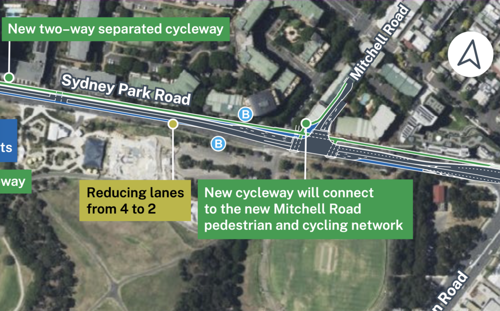
What else is missing? Potentially lots – the new map doesn’t have the cycleway between Mitchell Rd and Euston Rd (~270m of separated cycleway). Will the Princes Highway mid block crossing remain? Will Princes Hwy still be reduced from 6 lanes to 4? The speed limit for 60 to 40? It’s hard to trust that other aspects haven’t been removed also.
edit: Clover Moore’s 5th September letter suggests at least the Sydney Brick Kilns pedestrian crossing, western end of Sydney Park Road separated cycleway, street trees on the south side of Sydney Park Rd, and some speed limit reductions have been removed in the design.
1.1 A new pedestrian crossing has also been removed from the plan
The supplied map does not include the proposed and approved new pedestrian crossing on the west side of Mitchell Road at Sydney Park Road. This means cyclists as well as pedestrians have to navigate multiple crossings and wait multiple long traffic signal cycles just to get to their local park.
This is reminiscent of the recent TfNSW Western Distributor project that removed the pedestrian crossing at Allen St & Harris St to increase the traffic flow into the city from Anzac Bridge (and the Rozelle Interchange / Westconnex), which Bicycle NSW described as …”out of step with 21st century planning” and WalkSydney also strongly condemned.
2. Was this change brought on by a newly signposted shared path?
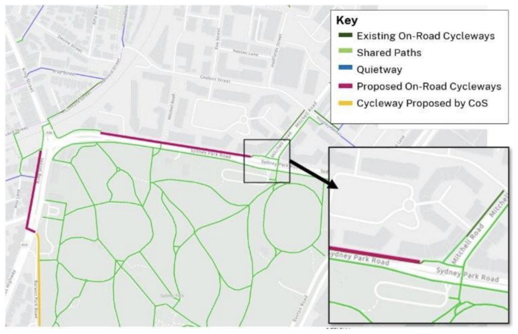
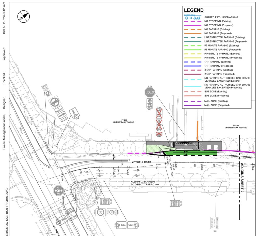
This is the only map I know of depicting the post-change design.
The map differentiates between current and proposed on road cycleways (purple vs dark green). It does not include any title, name, caption, date or data source, however some cutoff text is slightly visible below it.
It is unclear whether the map represents the current or future shared paths network (again, ambiguity).
It appears to depict the current network of shared paths, as could reasonably be assumed given future on road cycleways are highlighted, and that a previous paragraph references this “existing shared path connection”.
In the 19th of August 2021 the City of Sydney Local Pedestrian and Cycling Traffic Calming Committee exhibited plans for the cycleway (item 44). The engineering plans did not include shared path linemarking or signage (while they were marked in other areas and were in the map key), while the recommendation text did include “A Shared Path on the western side of Mitchell Road, between Sydney Park Road and the point 54.6 metres north of Sydney Park Road”. At this meeting the decision “This matter was deferred.” As there is no video / audio recording or more detailed minutes I’m not able to see why.
The plans were re-exhibited on the 17th of March 2022 (item 19), where plans were also missing shared path linemarking or signage and the recommendations still included a shared path on the west side, and the item received a “Recommendations Determined”.
The item comments include:
The proposal includes the provision of a Shared Path on the western side of Mitchell Road between Sydney Park Road and the access to Sydney Park Village, a private road. As part of future proposals to upgrade Sydney Park Road, through the King Street Gateway project, the separated cycleway in Sydney Park Road will connect to the proposed cycleway on Mitchell Road.
Item 19, “Traffic Treatment – Separated Cycleway – Mitchell Road and Huntley Street,
Alexandria”, Background PDF page 3, City of Sydney Local Pedestrian, Cycling and Traffic Committee meeting 17 March 2022.
This shows the City of Sydney believed that a state government project would include a future upgrade to a separated cycleway to connect the missing link.
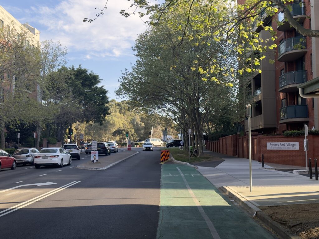
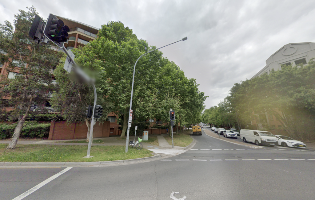
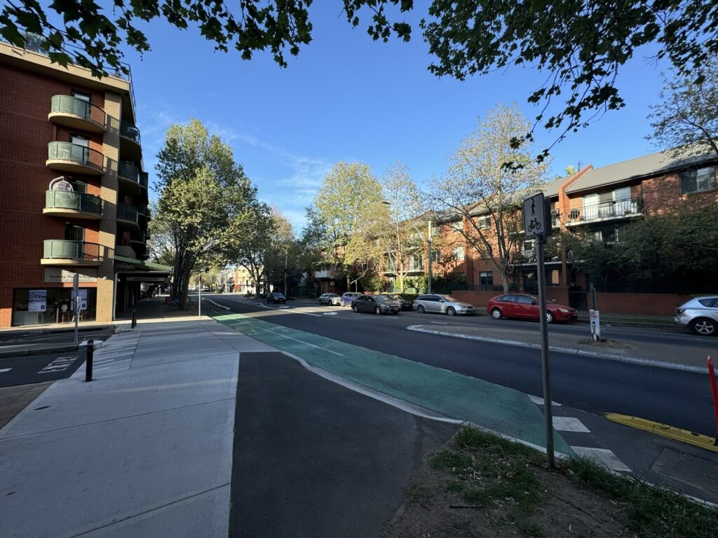
On May 25th, 2023 I surveyed the path and recorded it on OpenStreetMap as a 1.8 metre wide concrete footpath, without R8-2 signage or a blue painted line that would permit cyclists, which would suggest the signage had not yet been installed if I did not make an error: https://www.openstreetmap.org/way/1050723997/history/2
On the 8th of September 2024 I noted new shared path signage present and recorded it in OpenStreetMap. It is unclear when it was installed as there has been no Google, Apple or Mapillary imagery since the cycleway or signage was installed. The sign shares a pole with “no stopping” signs, with a “May 2023” label present. There is no blue shared path line marking (which is not strictly necessary) in contrast to the blue line on the Sydney Park Road shared path segment and the east side of Mitchell Park Road.
It was not yet marked on:
- OpenStreetMap (and therefore the TfNSW Trip Planner)
- the TfNSW Cycleway Finder
- Google Maps
- Apple Maps
Could this sign have been the enabling factor of this design regression, even after the City of Sydney stated TfNSW would be upgrading the intersection in the document that permitted it?
3. The design changes are not consistent with the Walking Space Guide or mandatory Road User Space Allocation Policy
Given that the only current TfNSW commitment is “investigating options to provide improved connectivity” which does not have a required deadline (like bus lanes on Parramatta Road didn’t), it is likely future changes will be delayed for some time or indefinitely.
The 1.8 metre wide concrete footpath does not meet the required width for a footpath, let alone a shared path in this busy location connecting dense residential neighbourhoods and the third-largest park in inner-city Sydney. The Walking Space Guide Summary states a “Main street footpath – Medium activity / Local footpath – High activity” with 70 or more people per hour at peak times should have a minimum target width of 3.2 metres, and an intervention trigger width of 2.2 metres.
The TfNSW “Shared Paths: Discussion of research findings and key safety issues” report (August 2015) states “The recommended minimum [shared] path width is between 2.5 and 3.0 metres“. The TfNSW Cycleway Design Toolbox (PDF page 50) states that the “desired minimum width of a shared path is 4.0m“. The Austroads “Guide to Road Design Part 6A: Paths for Walking and Cycling” (AGRD06A-17, 2017) states that 3.0m is a workable minimum in a location like this (heading A.2, Figure A2: “Shared path operation”, PDF page 90, document page 83).
The location has a high level of pedestrian and cyclist activity, and a shared path is not a suitable long term solution, as per TfNSW Cycleway Design Toolbox 3.4.3 (PDF page 50). The March 2022 Submissions report included:
The high pedestrian and cyclist activity at the King Street/Sydney Park Road, Princes Highway/May Street and Mitchell Road/Sydney Park Road intersections, as well as along King Street to access St Peters Station and Sydney Park, is one of the key considerations of the proposal, as noted above and discussed in Sections 3.3, 4.3.2 and 5.2.5 of Appendix C (Traffic and transport assessment) of the REF.
March 2022 Submissions report, TfNSW, PDF page 36
As Bicycle NSW noted in their letter, the newly updated the Road User Space Allocation Policy (July 2024) provides Transport for NSW with a stronger mandate to find a better balance between movement and place, with priority given to people walking, cycling and using public transport.
The policy states among other requirements that Transport must:
- document the strategic intent of all road user space allocations, including all
changes - track how the road space allocation principles are being implemented against the
strategic intent and outcomes identified as part of strategies or plans - document road user space trade-off decisions, providing evidence and reasons
- ensure proper endorsement by the relevant Transport governance body
- demonstrate adherence to this policy as part of internal Transport assurance
reviews and INSW reviews for projects proposing changes to road space - report periodically on all road-related projects to enable monitoring against this
policy - adhere to these principles ahead of any guidance that seeks to protect or
maintain private vehicle level of service.
Not only has compliance against these principles not been published, the design itself is still secret!
4. Why make these changes to the design?
edit: Clover Moore’s 5th September letter (which I was not previously aware) of suggests the project is not going ahead due to funding reasons:
TINSW advised the City that it is unable to fund the previously agreed and exhibited design. Meanwhile, it is continuing to allocate significant funding and resources to develop the Western Distributor Road Network Improvements project, even though the safety and transport arguments justifying this project are highly questionable.
Letter (5th September), Clover Moore to John Graham (Minister for Roads). Published with permission.
Short answer (again) – it is not publicly known. TfNSW has not yet stated in direct language that this intersection is not getting built privately, and made no public announcements.
Could it be a cost cutting exercise? If so, given the large ticket cost of Westconnex this leaves a very sour taste.
Could it be a political / local community concession? Considering the community consultation was released two years ago, it seems unlikely.
Could it be be to minimise the project duration? It is well known that traffic signal redesign projects take some time, however considering the original concept was documented in 2017 and construction has not begun this doesn’t make much sense.
Could it be to increase the curve radii? Considering the proposal including the separated cycleway supported turning buses, this seems unlikely.
The most likely explanation seems to be increasing the number of car lanes available, with the vehicle-throughput-maximising side effect of leaving one signalised pedestrian crossing missing.
Perhaps we will get a public update explaining the reasoning and how it implements the mandatory NSW Movement & Place Guidelines, but I’m not holding my breath.
5. Approval conditions for the M8 motorway (Westconnex)
The Sydney Park Junction project (with upgraded cycle and pedestrian facilities) was mandated in approval conditions for a section of Westconnex. The Review of Environmental Factors stated “Approval conditions for the M8 Motorway (Stage 1) project also specify the introduction of traffic calming initiatives along Princes Highway, improvements in accessibility to Sydney Park and the provision of upgraded cycle and pedestrian facilities”. (PDF pg. 33, REF)
The M8 motorway was the second major underground stage of Westconnex. City of Sydney employees were recorded in written minutes of the August 1st meeting that this change was “breaking earlier promises to the City and the community”.
Approval conditions for the M8 Motorway project are located under M8 Environment Documents. The Sydney Park Junction Review of Environmental Factors describes the relevant approval conditions:
The proposal would be consistent with approval conditions B44, B50 and B51 for the M8 Motorway project by providing traffic calming initiatives along Princes Highway, improvements in accessibility to Sydney Park for the residential areas of St Peters, Newtown and Erskineville and the provision of upgraded cycle and pedestrian facilities within one kilometre of the St Peters Interchange.
Page 33 of the Sydney Park Junction Review of Environmental Factors
5.1 M8 approval condition B50
Condition B50 states:
The Proponent must undertake a Pedestrian and Cycleway Network Review. The Review must be prepared and approved by the Secretary within six months from the date of this approval (or as otherwise agreed by the Secretary) to identify pedestrian and cycle facilities that are to be provided by the Proponent as part of the SSl. The Review must be prepared by a suitably qualified and experienced person(s) that has been approved by the Secretary. The Review must be undertaken in consultation with the relevant councils and Bicycle NSW and address the matters raised during consultation.
The Review must identify (and consider), but not be limited to:
a) current and future land use and associated pedestrian and cycle demand and needs;
b) pedestrian and cycle impacts associated with the project;
c) the King Street Gateway Project, including potential Princes Highway traffic calming initiatives;
d) Alexandra Canal initiatives;
e) regional and local pedestrian and cycling strategies;
f) pedestrian and cycle safety, accessibility and connectivity, including to the public realm;
g) intersection and signal phasing opportunities to reduce waiting and crossing times for pedestrians and cyclists;
h) provision of upgraded cycle and pedestrian facilities within 1,000 metres of the boundary of the St Peters Interchange, apart from the areas addressed in conditions 862(c) and 864; and
i) concept designs for pedestrian and cycleway infrastructure and implementation timeframes.
The Review is also to consider the delivery of the ‘M5 East Green Link’ between Kingsgrove and Mascot approved as part of the M5 East Motorway project. The review shall address past constraints to the delivery of this project and options to overcome these constraints.
The Review must not result in a reduced level of cycle and pedestrian infrastructure as identified in the documents referred to in condition 42, unless required by these conditions.
The resulting report is contained in WestConnex M8 Pedestrian and Bicycle Transport Network Review (17 May 2017).
5.2 M8 approval condition B51
Condition B51 states:
A detailed Pedestrian and Cycle Implementation Strategy must be submitted to the Secretary within 12 months of the date of this approval (or as otherwise agreed by the Secretary) and implemented at the commencement of project operations, except as permitted by this approval.
The strategy must be prepared in consultation with relevant councils and Bicycle NSW. The Strategy must be consistent with the approved Pedestrian and Cycleway Network Review and include:
(a) pedestrian and cycle engineering and safety standards;
(b) a safety audit of existing and proposed pedestrian and cycle facilities to address the above standards (including the shared path audit undertaken for the King Georges Road Interchange Project SSI-6547);
(c) details of selected routes and connections to existing local and regional routes;
(d) timing and staging of all works;
(e) infrastructure details, including lighting, safety, security, and standards compliance;
(f) signage and wayfinding measures; and
(g) details of associated landscaping works.
The Strategy shall be endorsed by a suitably qualified and experienced person(s) approved by the Secretary. The endorsement shall address each of the listed matters in this condition.All identified works arising from this condition are to be implemented by the Proponent.
Approval condition B51, M8 Motorway Project
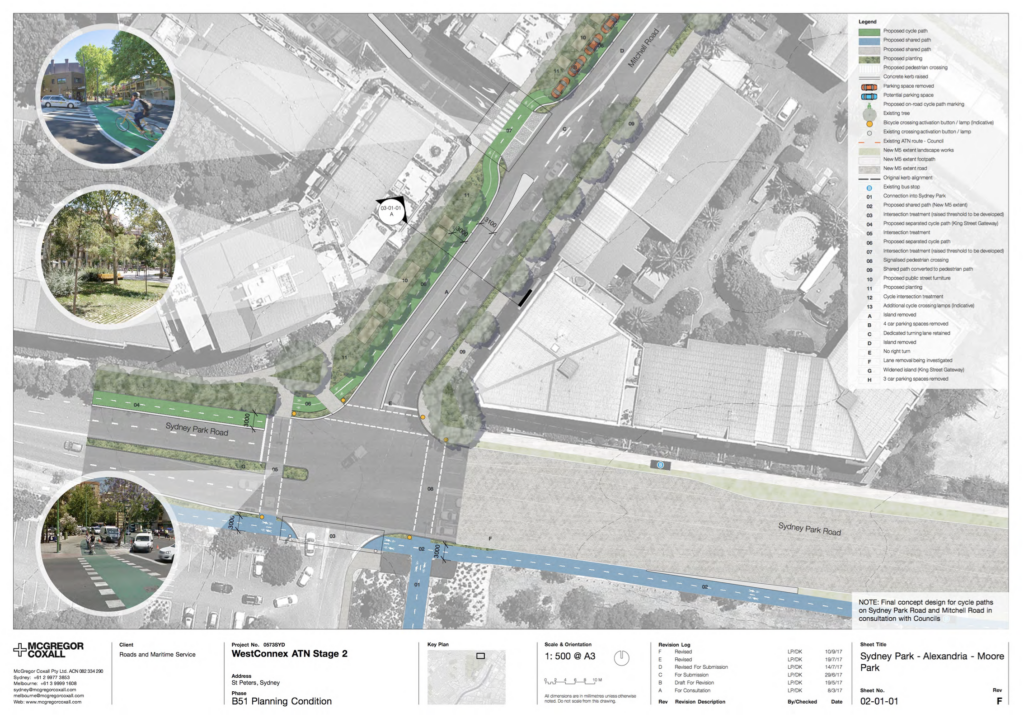
The resulting report of this planning condition is captured as the report titled “WestConnex M8 Pedestrian and Cycle Implementation Strategy ” (or “WESTCONNEX ATN ST2 PLANNING CONDITION B51 – Pedestrian & Cycle Implementation Strategy”), February 2019.
Heading “5.6 SYDNEY PARK – ALEXANDRIA – MOORE PARK” of this report (PDF page 38) contains the following:
The Condition B50 review has identified a gap between the existing shared paths within Sydney Park and the on road cycleway in Belmont St connecting to Alexandria. At the north side of Sydney Park exiting across Sydney Park Road onto Mitchell Road is a proposed off road bike lane. It is associated with road works on the local streets surrounding the St Peters Interchange. It is 3m wide and it turns onto Huntley Street where it remains 3m wide. It connects to Belmont Street which is a council planned regional route, linking to Redfern and Moore Park. The route connects back into Sydney Park which has an existing shared path. Additional parking will be provided along Sydney Park Road, Huntley Street and Belmont Street to maintain the existing amount of on-road parking.
The Belmont Street on road bike path will also connect through to the future shared paths along the north side of Euston Road and McEvoy Street associated with the Alexandria to Moore Park Connectivity Upgrade Project, which is currently in planning phase.Final concept design for cycle paths on Sydney Park Road and Mitchell Road are in consultation with Councils.
Refer Appendix 05 for detailed drawings of the Mitchell Road separated cycle path.
“5.6 SYDNEY PARK – ALEXANDRIA – MOORE PARK”, “WestConnex M8 Pedestrian and Cycle Implementation Strategy “, PDF page 38
The implementation strategy report goes on to depict the proposed implementation diagram of this cycleway in Appendix 5. It includes “NOTE: Final concept design for cycle paths on Sydney Park Road and Mitchell Road in consultation with Councils”. Revision A is dated 8/3/17, revision F (depicted) is dated 10/9/17.
5.2.1 Endorsement of B51
The B51 approval condition includes that “The Strategy shall be endorsed by a suitably qualified and experienced person(s) approved by the Secretary.”.
This endorsement was made by then managing director of Sustainable Transport Consultants, and detailed in a letter dated 20th September 2017 (listed as Appendix item 15, PDF page 264, in the B51 report). This letter endorses (among other projects) “City of Sydney Regional Cycle Route R8 connection north of Sydney Park”:
The proposal in Section 5.6 of the Strategy provides a separated cycleway link between the intersection of Mitchell and Sydney Park Roads and the intersection of Huntley and Belmont Streets. The concept design shown in Figure 5.12 and Appendix 5 of the Strategy, proposes a separated two-way bicycle path along the northern edge of Mitchell Road between Sydney Park Road and Huntley Street continuing along the northern edge of Huntley Street to Belmont Street.
Paragraph 4.6, “City of Sydney Regional Cycle Route R8 connection north of Sydney Park”, PDF page 267, B51 report. (emphasis mine)
6. Undermining confidence in TfNSW following Rozelle Interchange inquiry recommendations
This change has occurred in fresh memory of the damning July 2024 “Impact of the Rozelle Interchange” inquiry report where inquiry participants raised a “lack of transparency regarding decisions made by the government following consultation” (paragraph 5.3, PDF pg. 97) and made recommendations:
- …that there is greater transparency, accessibility and accountability of community consultation processes. (Recommendation 5)
- That the NSW Government ensure that all future road-based projects prioritise the inclusion of safe and accessible active transport infrastructure.” (Recommendation 15)
It does not give confidence that TfNSW is learning from the lessons of previous failures around transparent consultation and active transport inclusion in major projects.
7. A brief history of broken Westconnex promises
This is not the first broken promise made to the community as part of the Westconnex project. These are ones that come to mind, but I’m sure this is not exhaustive (comments & feedback on improving this section is welcome).
Parramatta Road
The Sydney Morning Herald article “‘Hollow promises’: Years after opening, WestConnex tunnel conditions still not met” (August 2021) states “More than two years after the first WestConnex motorway tunnel opened in Sydney, the NSW government is yet to meet a condition of approval by dedicating two lanes of Parramatta Road solely to public transport.
Victoria Road
As recorded in the July 2024 “Impact of the Rozelle Interchange” inquiry report:
As promised in the EIS, there should be separated cyclepaths all the way from the beginning of the Rozelle interchange—that’s the junction between Victoria Road and the City West Link—all the way up and over, up Victoria Road and over the top and down the other side to the Iron Cove Bridge. That was promised in the EIS, as was a separate cycleway which I think is over two kilometres along Lilyfield Road. None of those have been built at all.
Paragraph 4.48, PDF page 86, Footnote 405.
That is, a condition of the Environmental Impact Statement of the project was Victoria Road would include a separated cycleway.
8. What can I do about this?
Bicycle NSW published an article on the 13th of September (“Another Broken Promise from Transport for NSW”) about Sydney Park Road utilising research from this article, however they also included some great suggestions on what you can do to make this project happen as originally promised!
See under the “A call to action” header on https://bicyclensw.org.au/another-broken-promise-from-transport-for-nsw/
Their article also details other TfNSW projects that have been neglected or delayed.
9. Appendix
9.1 Safety risks on Mitchell Rd
PDF page 110 of “WESTCONNEX NEW M5 PEDESTRIAN & BICYCLE TRANSPORT NETWORK REVIEW” by McGregor Coxall (17 May 2017) includes safety risks on the state of Mitchell Rd at the time.
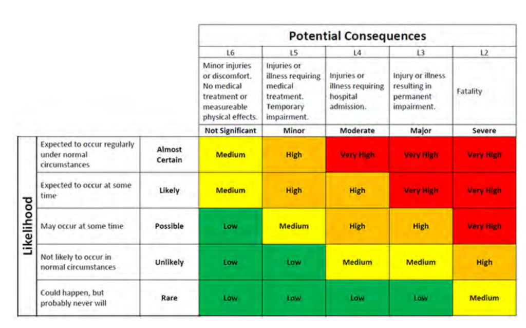
The risk matrix (below) indicates “Moderate” severity indicates injuries requiring hospital admission, and “likely” probability as “Expected to occur at some time”.
| Code | Description | Safety issue | Probability | Severity of consequence |
| A1 | Accumulation of soil and other sediments at low point in pavement (various locations) | Cyclist may lose traction over dirt | Possible | Minor |
| A2 | Uneven pavers due to tree roots (various locations) | Cyclist may hit uneven surface | Possible | Minor |
| A3 | Overgrowth of plants narrows shared path (various locations) | May cause congestion and a collision | Likely | Minor |
| A4 | Blind corner driveway | May cause congestion and a collision | Likely | Moderate |
| A5 | Blind corner driveway | May cause congestion and a collision | Likely | Moderate |
| A6 | Overgrowth of plants narrows shared path (various locations) | May cause congestion and a collision | Likely | Minor |
| A7 | Uneven surface (various locations) | Cyclist may hit uneven surface | Possible | Minor |
| A8 | Uneven surface (various locations) | Cyclist may hit uneven surface | Possible | Minor |
| A9 | Uneven surface (various locations) | Cyclist may hit uneven surface | Possible | Minor |
| A10 | Shared path narrows to 1.6m | May cause congestion and a collision | Possible | Minor |
| A11 | Narrow shared path and edge level drop off | Cyclist may via off path and become unstable on level change | Possible | Minor |
| A12 | Service pit lid provides uneven surface | Cyclist may hit uneven surface | Possible | Minor |
| A13 | Accumulation of soil and other sediments at low point in pavement (various locations) | Cyclist may hit dirt | Possible | Minor |
| A14 | Shared path ends, limited signage, no designated crossing | Confusing for cyclists, lack of priority | Possible | Not significant |
| A15 | Accumulation of soil and other sediments at low point in pavement (various locations) | Cyclist may loose traction over dirt | Possible | Minor |
| A16 | Pavement cycle symbol in car park zone | Cyclist may follow symbol too close to parked vehicles | Unlikely | Minor |
| A17 | Road break | Cyclists have to merge onto footpath and may cause conflict with pedestrians | Likely | Not significant |
| A18 | Tree roots | Tree roots may hinder future development of path | N/A | N/A |
Leave a Reply