Category: Cycling
-
Updates to Australian Cycleway Stats
Australian Cycleway Stats now compares cycleway length per resident and per sq/km – comparing Australian councils with world-leading cities. This tool remains AGPLv3 open-source.
-
Better Streets Submission for Walking and Cycling Improvements between South Eveleigh and Waterloo Metro (Henderson Road)
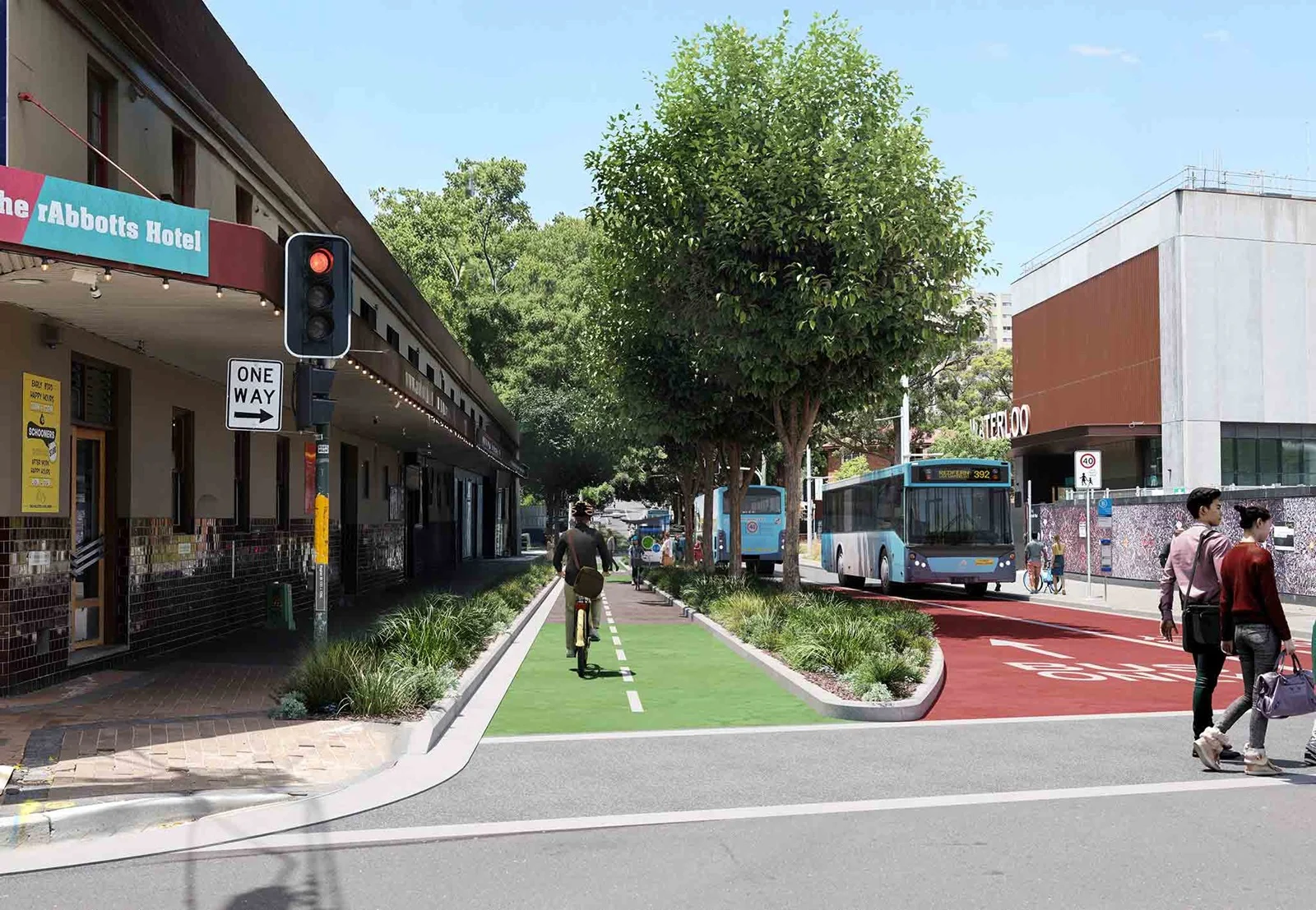
I wrote this submission on behalf of Better Streets for the proposed Walking and Cycling Improvements between South Eveleigh and Waterloo Metro (Henderson Road).
-
List of pedestrian, cyclist and personal mobility device road deaths in NSW in 2025
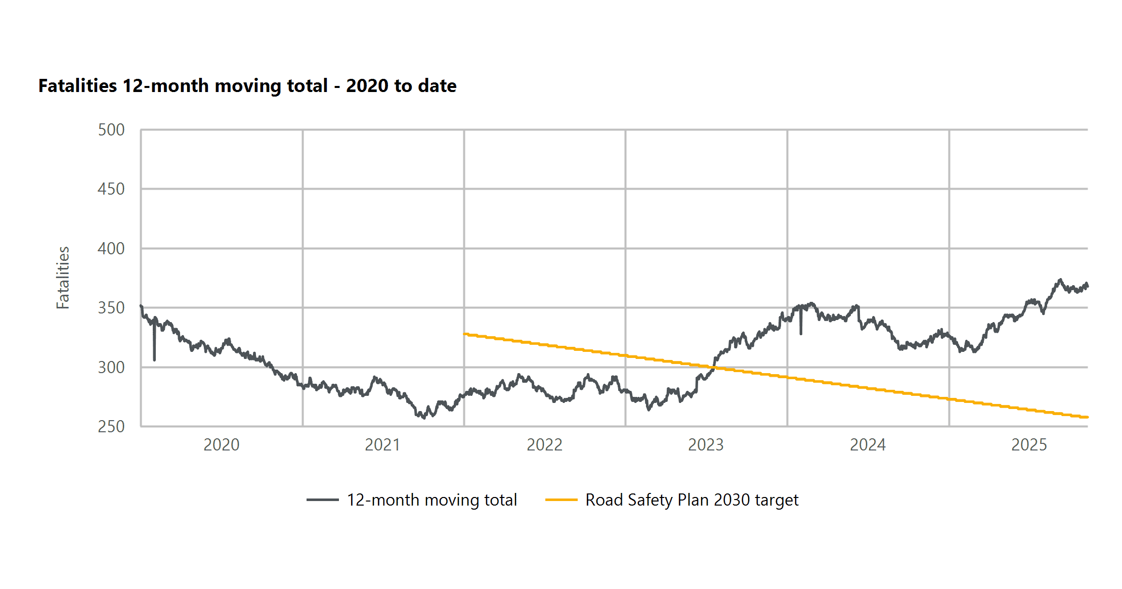
This page is a list of pedestrian, cyclist and personal mobility device road deaths across New South Wales (Australia) in 2025, sourced from NSW Police press releases and daily government statistics. It is not guaranteed to be complete or up to date; BITRE monthly bulletins should be referenced for complete statistics (though preliminary and subject…
-
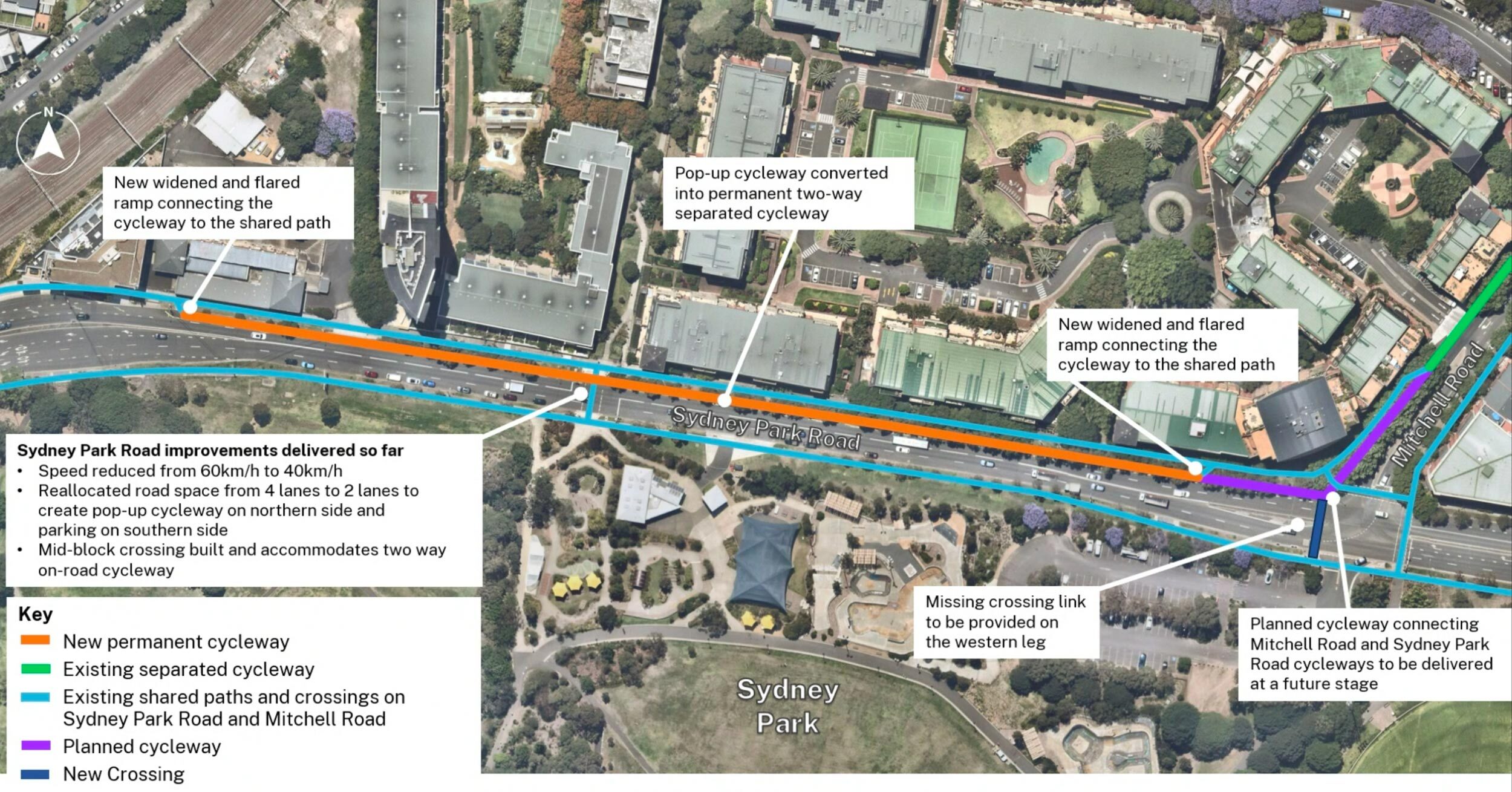
Not enough funding for Sydney Park Junction – Addendum REF to cut scope
On the 20th of November 2024, Jenny Leong (the Green’s MP for Newtown) asked the State Minister for Transport 21 detailed questions in NSW Parliament regarding the status and fate of the infamous TfNSW Sydney Park Junction project. The public received a response from the Minister for Transport on the 20th of December 2024, which only included answers…
-
Sydney Park Junction: TfNSW Won’t Commit to Original Scope Despite Ministerial Intervention
TfNSW won’t confirm the Sydney Park Junction project scope even though “Haylen’s office confirmed the upgrades would take place as the initial proposal publicly exhibited in 2021”.
-
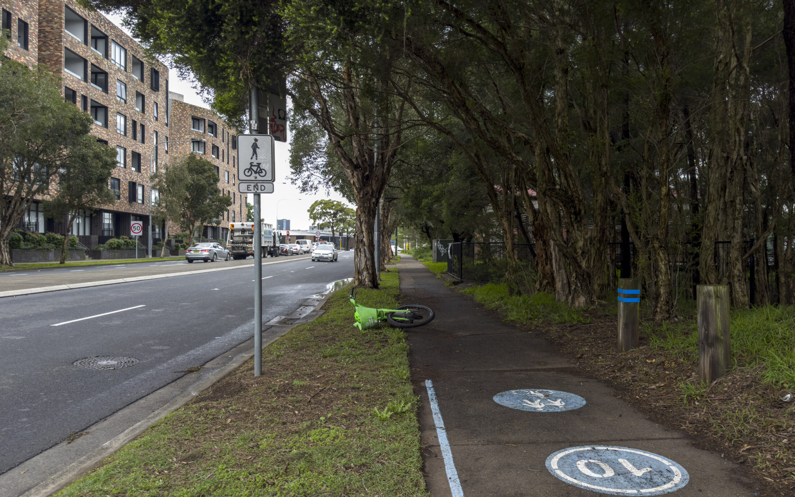
Another broken WestConnex promise: secret Sydney Park Junction design changes
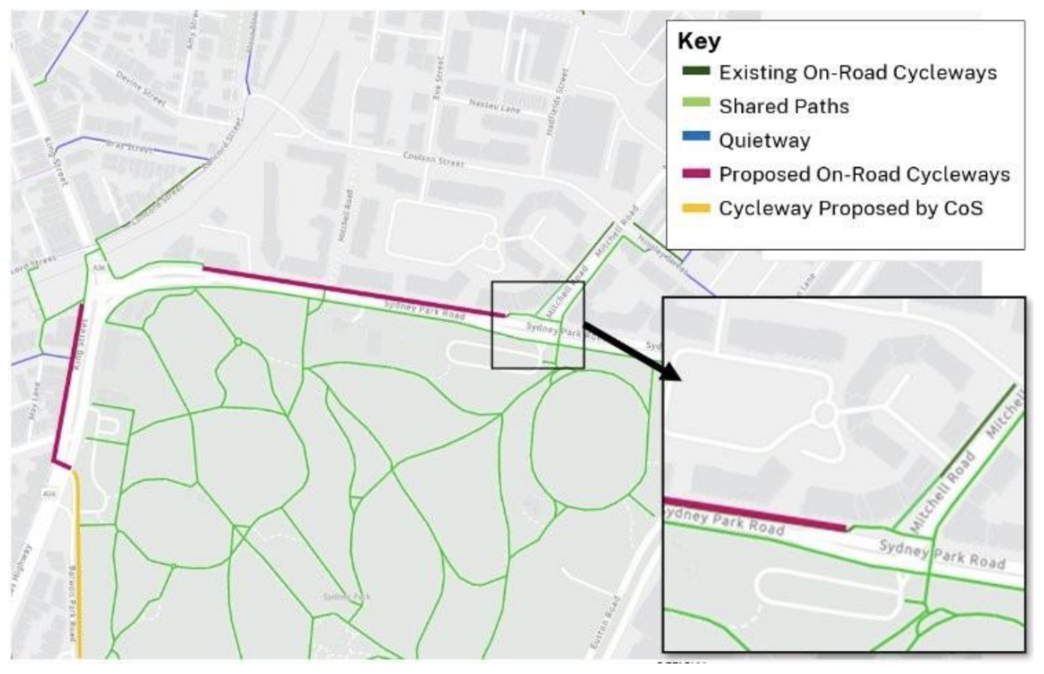
Ever wondered why there are random dead ends for cycle paths in Sydney? This is a deep dive on how one particular missing link might not get fixed after more than seven years of planning. Let this be a record of how hard it is to get safe cycling intersections built in Sydney, even when…
-
Which Australian councils are building the most cycleways?
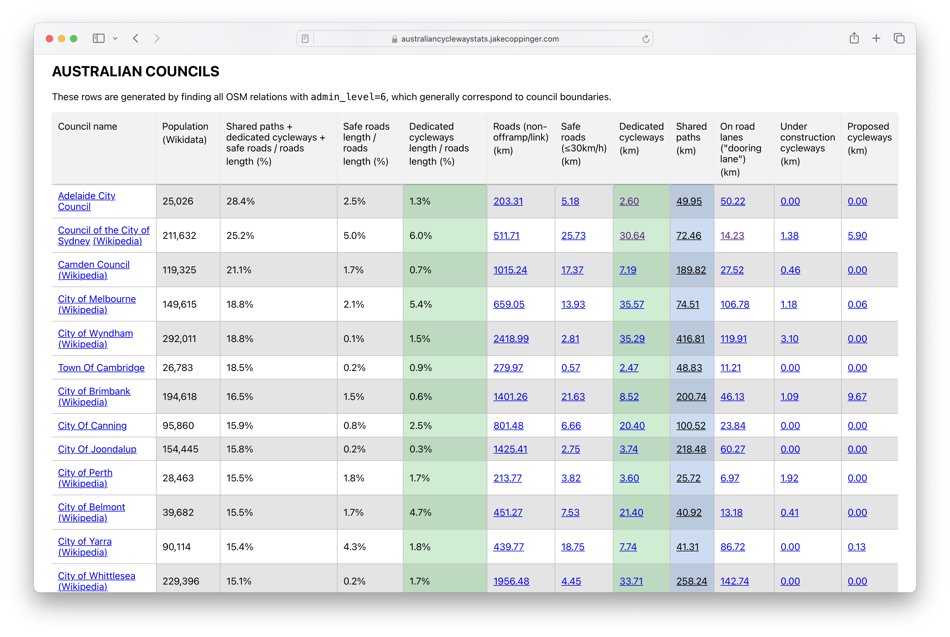
Australian Cycleway Stats is a dashboard that provides an in-depth look at the kilometres of cycleways and safe streets in every Australian council, encompassing current, under-construction, and proposed projects, as well as international benchmarks.
-
Contraflow streets in the City of Sydney
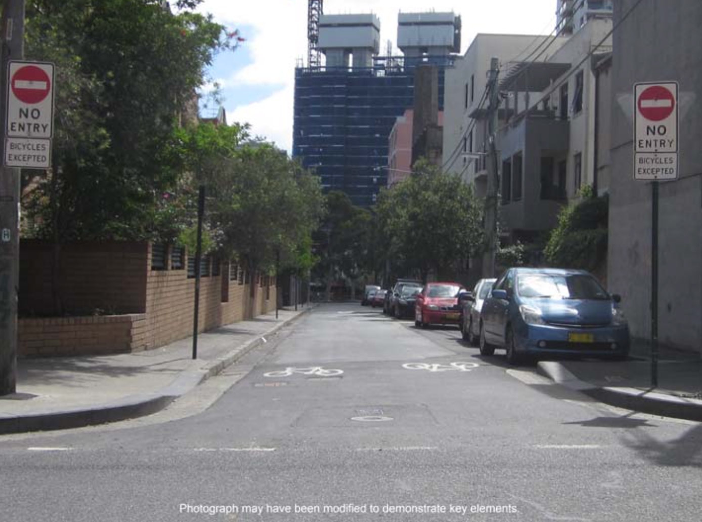
The City of Sydney has recently approved 159 suitable streets across 24 suburbs, which will greatly improve the network of legal cycling routes in inner city Sydney. This blog post is a proposal of additional streets which may be suitable for basic contraflow cycling infrastructure that the council could install in future, with a focus…
-
Shining a Light on the Traffic Signals of Sydney
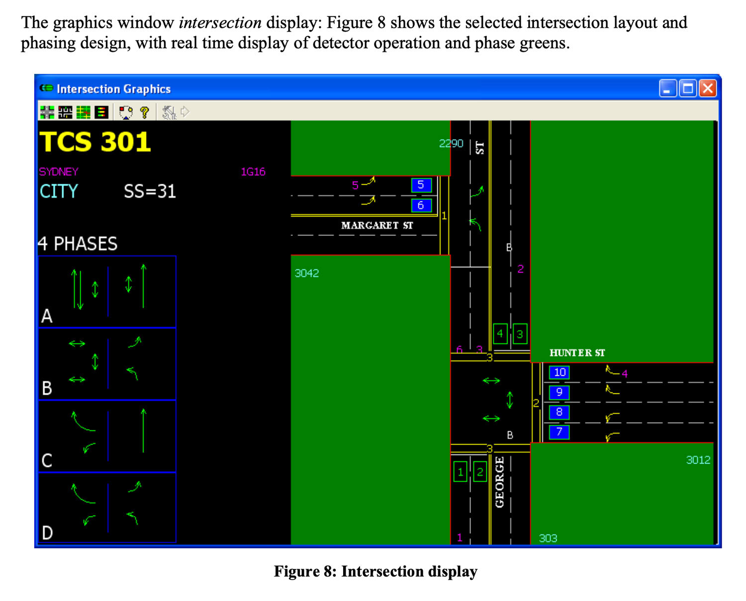
This blog post provides an overview of traffic signal operation in Sydney (focusing on the inner city), based on technical documentation, conversations with government & industry experts and data I’ve collected after building Better Intersections.
-
Mapping pedestrian traffic light timing in Sydney, Australia
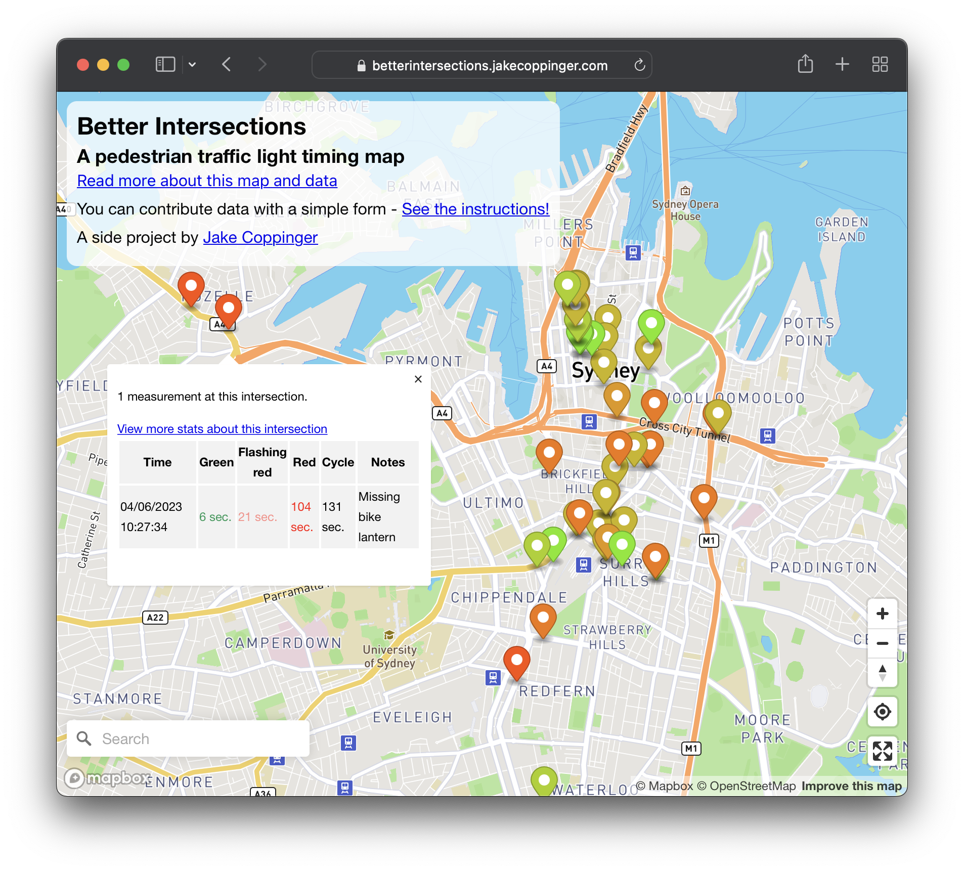
Better Intersections is a tool to record and visualise timing details for pedestrian and bicycle signals. In the absence of traffic light timing data, and as we hold hope for it to become publicly available; the aim of Better Intersections is to crowdsource measurements and inform where positive changes could be made.
-
Canada Bay Council plans to remove Heath St cycleway due to a misleading traffic report
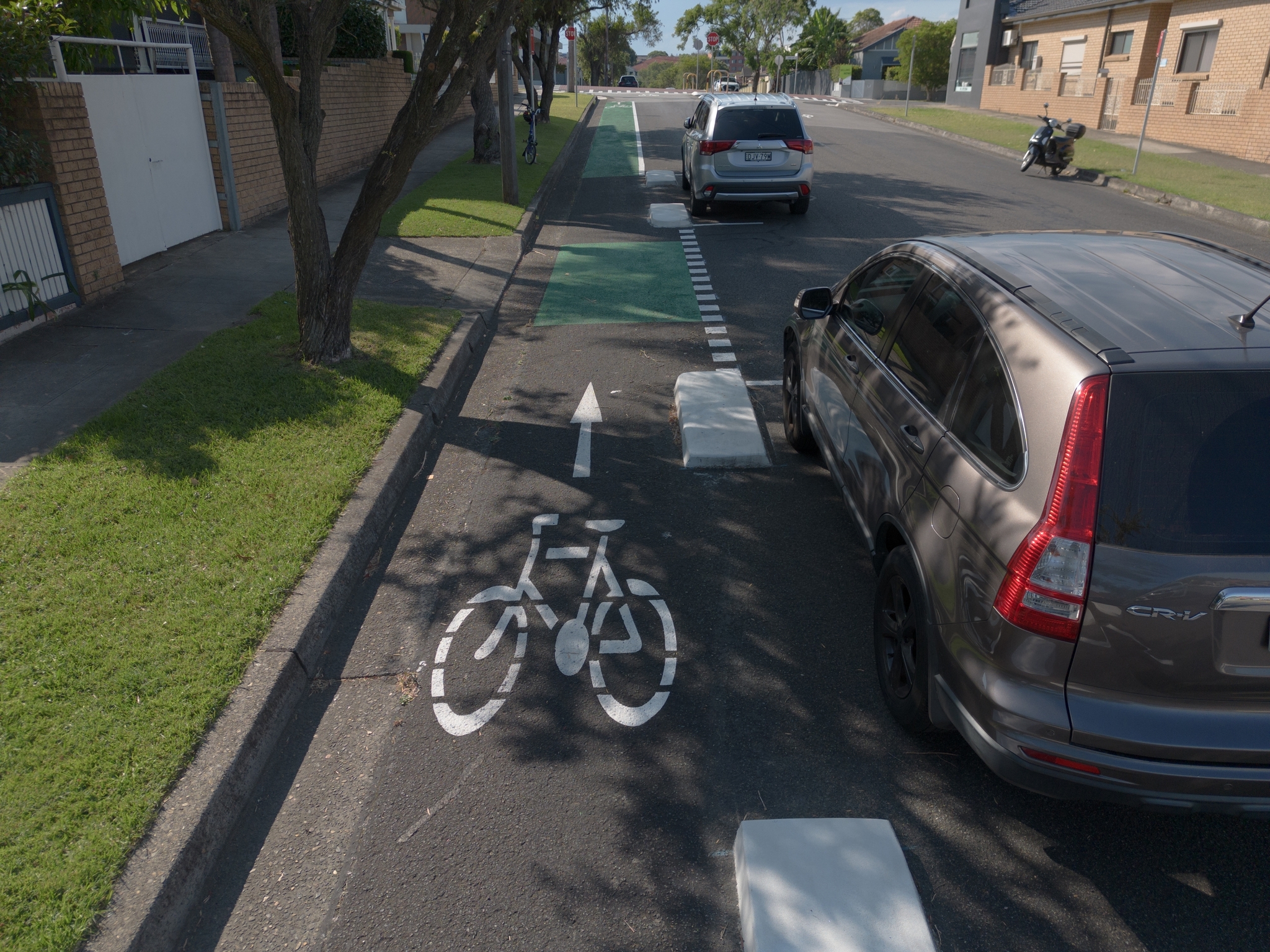
Canada Bay Council plans to remove the cycleway it received $7m of state funding for. In this analysis I outline errors and flaws in the engineering report recommending the removal (which has now been hidden from the Canada Bay Council website).
-
Lane-accurate street maps with OpenStreetMap – writing a vector tileserver for osm2streets
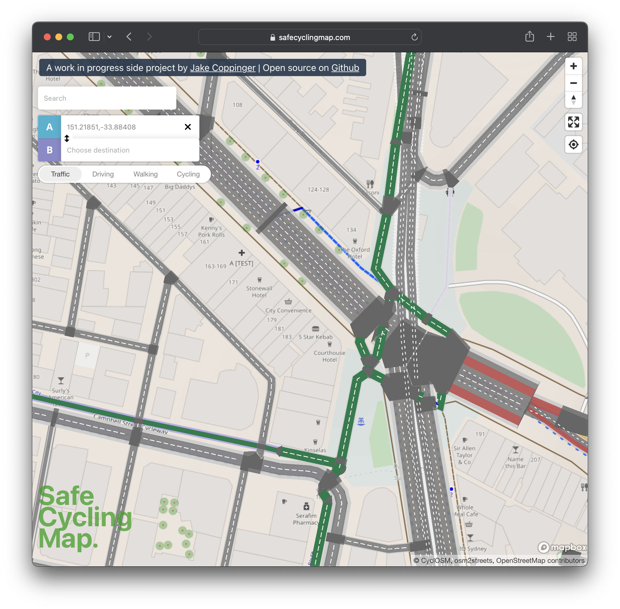
I’ve built safecyclingmap.com, an open-source proof of concept map that renders cycleways and streets down to the individual lanes, to assist cyclists picking safe routes in cities with little dedicated cycling infrastructure.
-
Creating aerial imagery with a bike helmet camera (GoPro) and OpenDroneMap
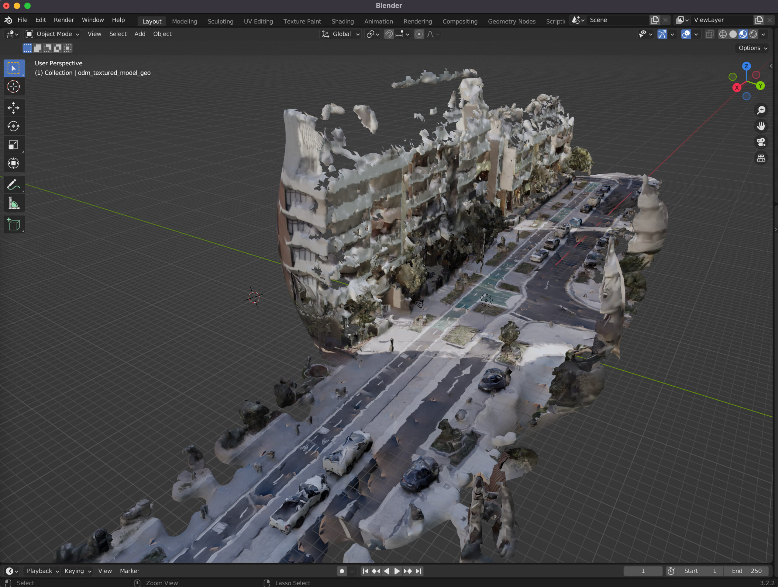
This technical guide details how you can create your own orthorectified (aka satellite view/bird mode) imagery, point clouds and 3D models of streets with nothing but a 360 degree camera mounted on bicycle helmet, and the open source photogrammetry software OpenDroneMap.
-
Observations from Australia’s first Micromobility Conference

Over the weekend I attended Australia’s first micromobility conference. The sessions were organised into themes reflecting the challenges Australia faces in transitioning it’s transport network and urban planning – from car and highway dominated streets to a safer, lower emission and more pleasant city permitting cycling, walking and other journeys.
-
The Best Apps for Bicycle Directions
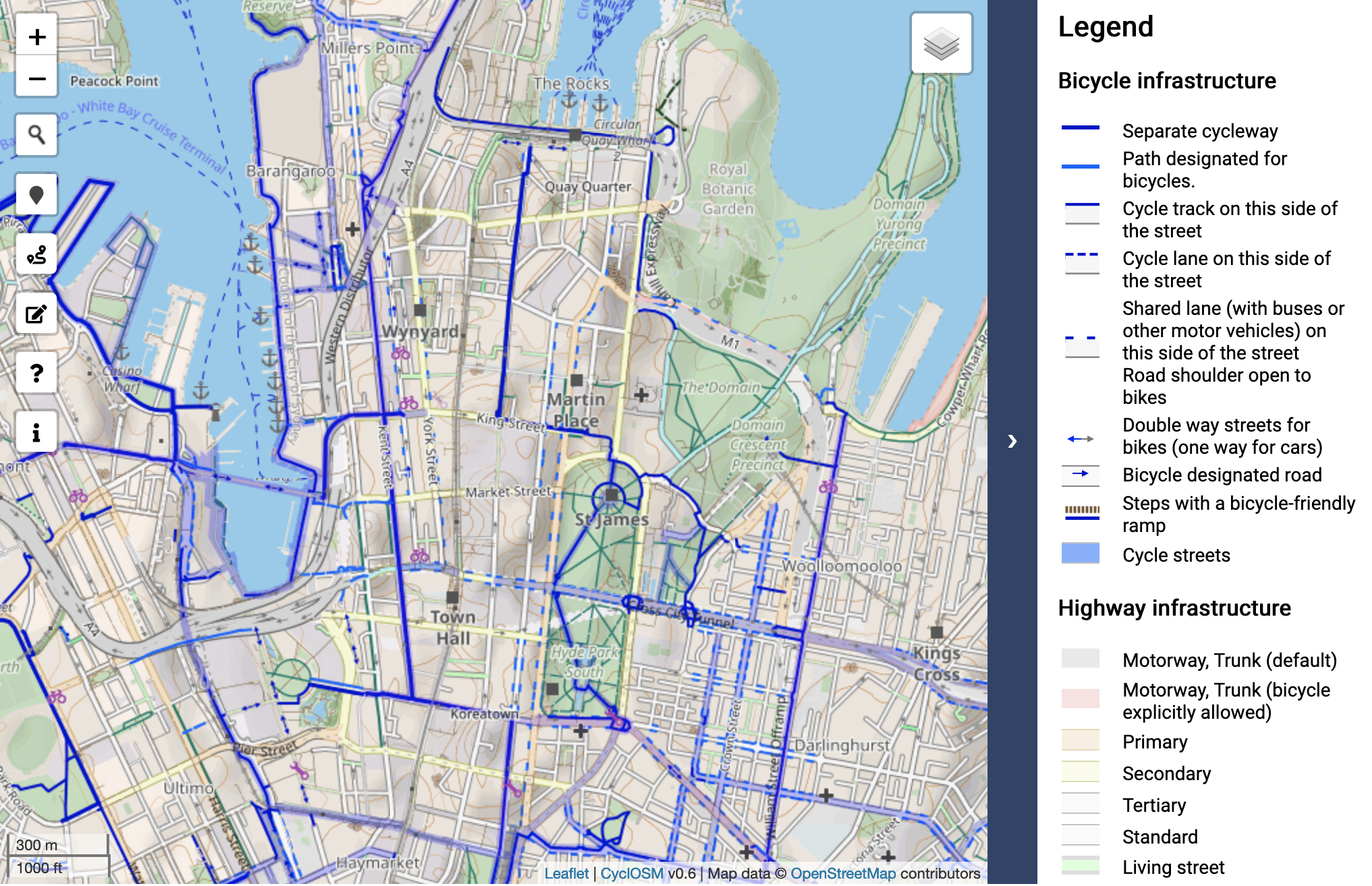
Even though some cities have dedicated bicycle infrastructure, it’s of no use if you don’t know where it is. While Google Maps is excellent for car navigation (and the dominant market leader), it often has patchy cycle infrastructure coverage and tends to generate cycle routes on busy roads. The best dataset of cycle infrastructure worldwide…