Note: This is my third blog post on this project. If you are missing context, have a read of Another broken WestConnex promise: secret Sydney Park Junction design changes (2024-09-09) and Sydney Park Junction: TfNSW Won’t Commit to Original Scope Despite Ministerial Intervention (2024-11-26).
On the 20th of November 2024, Jenny Leong (the Green’s MP for Newtown) asked the State Minister for Transport 21 detailed questions in NSW Parliament regarding the status and fate of the infamous TfNSW Sydney Park Junction project (more details of which the Sydney Morning Herald published this morning).
The public received a response from the Minister for Transport on the 20th of December 2024, which only included answers for 3 of the 21 questions (and one of them could be misleading – see section below “(f) Reducing the design speed in the project area to 40 km/h or below?”).
A local community member was so disappointed with this lack of transparency they made a successful Government Information Public Access (GIPA) request to TfNSW regarding the status of the project. You can read the full PDF here.
Thanks to their work the public now has a more complete picture. So complete in fact, I’m going to have a crack at answering the questions Jenny Leong asked, based on information documented to be available within TfNSW months before the Minister’s response. These questions were asked in NSW Parliament – detailed, accurate and straightforward answers are clearly in the public interest.
We now have a new Minister for Transport and Minister for Roads, and I hope John Graham and Jenny Aitchison are across this project.
I have made every effort to provide accurate hyperlink references for every statement. If you notice any errors or misinterpretations, please drop a comment below or contact me privately at [email protected]. This analysis is a side project.
Table of contents
- Maps
- A brief recap – what is this and how did we get here?
- More detailed answers to Jenny Leong's questions in NSW Parliament
- 1. Regarding the revision of plans for Sydney Park Junction:
- (a) What is the updated timeframe for revising the plans?
- (b) What is the expected delivery date?
- (c) Are any elements of the project still being considered for removal by Transport for NSW?
- (d) Is the revision happening due to funding shortfalls as stated by Transport for NSW and, if so, how much additional funding is needed to complete the plans as they were exhibited in 2021?
- 2. Has the Road User Space Allocation Policy been corrected applied at the intersection of Sydney Park Road with Mitchell Road and what was the process of checking the compliance of the de-scoped project with other Transport for NSW strategies including the Walking Space Guide, the NSW Movement and Place Framework and the Cycleway Design Toolbox?
- (3) Can you confirm if existing road space will be reallocated for the cycleway linking Sydney Park Road and Mitchell Road, rather than using the grass verge which would require the removal of a large number of mature trees?
- (4) Is the Government still intending to deliver all elements of the approved project scope including:
- (a) New bus stop at Sydney Park Rd/Mitchell Rd intersection?**
- (b) Pedestrian crossing on western arm of the Sydney Park Rd/Mitchell Rd intersection?
- (c) Dynamic community space for parklets on both sides of Princes Highway?
- (d) Landscaped buildouts on Sydney Park Road and Princes Highway?
- (e) 50+ new trees?
- (f) Reducing the design speed in the project area to 40 km/h or below?
- (h) New mid-block pedestrian crossing on Princes Highway north of Short Street?
- (j) Separated cycleway on the western side of King Street between May Street and St Peters square?
- (k) Separated cycleway on the southern side of Sydney Park Road between Princes Highway and Mitchell Road?
- (l) Separated cycleway on the western side of Mitchell Road between Sydney Park Road and existing cycleway?
- 1. Regarding the revision of plans for Sydney Park Junction:
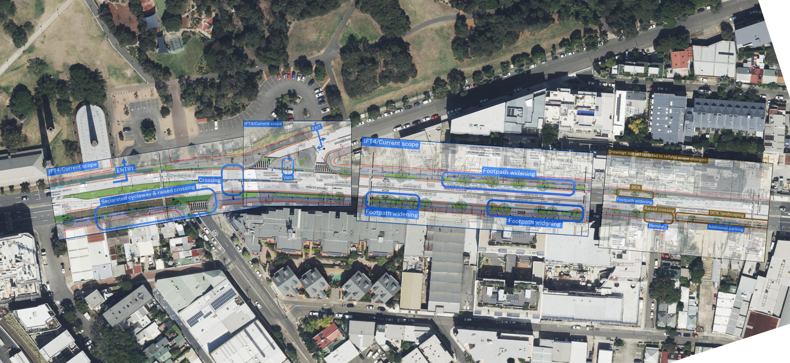
- The Addendum REF proposes to exclude any civil works on East of Mitchell Road (on Sydney Park Road)
- Why do the October 2024 internal TfNSW slides mention "Descoped as approved by MO Nov 2024"?
- Was the Mitchell Road and Sydney Park Road intersection re-included in scope due to community concerns?
- Was the Mitchell Road intersection (and other scope beyond the popup cycleway implementation) always planned to be implemented?
- Did Transport Minister Jo Haylen promise the original REF design?
- How did these scope cuts get approved?
- Are any features beyond Stage 1 scope funded?
- Is Barwon Park Road slip road being retained due to Transurban-owned Variable Message Sign?
- Is the Sydney Park Junction project a requirement of the WestConnex conditions of approval?
- The state of cycleway and footpath funding
- Timeline of the project
- Site photos
To long to read? Ask your favourite AI model with search mode enabled.
Maps
A brief recap – what is this and how did we get here?
The original plans for the Sydney Park Junction project were ambitious and well-received. In 2021 Bicycle NSW commented “The project will be of enormous benefit to the community” and that “This project sets an exciting precedent for better place outcomes throughout Sydney.”
In September 2024 I alerted the public to the concern that while the project hadn’t been cancelled, significant scope cuts were being made in private – within a month of construction starting. This blog post was followed by two excellent Sydney Morning Herald articles. My November 2024 article detailed how, after refusing to confirm any original scope elements would be included (that had been deleted), TfNSW communications & project management personnel requested Friends of Erskineville share elements of the project that are “super important” or features they wanted the TfNSW team to consider.
In the second Sydney Morning Herald article the Minister’s Office…
…confirmed the upgrades would take place as the initial proposal publicly exhibited in 2021, including a cycleway to link Sydney Park and Mitchell roads and a new bus stop and pedestrian crossing to access Sydney Park.
“In a silently uploaded document, a major Sydney intersection lost its upgrade”, Daniel Lo Surdo, November 10, 2024, Sydney Morning Herald
Before this confirmation, TfNSW was drafting an Addendum Review of Environmental Factors (Addendum REF) to permit significant scope changes to be made (“Spreadsheet regarding Sydney Park Junction Project, dated 31 October 2024”, 25T-1420 Decision), and changes to scope requiring “Additional assess.” (and whether covered by Addendum REF draft) continued to be discussed afterwards (Presentation titled “Sydney Park Junction: Changes to Scope”, “Internal presentation of Sydney Park Junction Project, dated 14 November 2024”, 25T-1420 Decision).
One agenda item of a briefing to the Minister’s Office (“dated October 2024”) was “Changes to Design since REF Determination”, which described 5 significant “Changes to design since REF Determination” (including “Removed extension of cycleway between Mitchell Road to Euston Road”). However, it neglected to mention the scope exclusions made for cost cutting reasons documented that same month in an internal spreadsheet.
Earlier in the month, a similar internal presentation noted a next step as “Concurrence on the estimate to be undertaken – noting scope exclusions/inclusions” – highlighting the cost estimate of changed scope hadn’t yet been made. (“Internal presentation of Sydney Park Junction Project, dated October 2024”). The “next step” of “MO briefing to endorse way forward” appears to confirm this was an earlier meeting.
In fact, there were so many scope changes, that a spreadsheet dated 31st October 2024 was created to keep track of them all. By the 14th of November 2024, it appears there was an effort to count them all – a report noted that “14 changes to scope since the project was assessed have been identified” (out of 33 “key features”) (pg. 9). Some “key features” aren’t mentioned here (“Relocating existing VMS and CCTV camera” is listed as a “key feature” of the 2021 REF (pg. 26,27) and it is not counted in this report – so perhaps 14 changes is an underestimate. Additionally, not all scope reductions are captured as a key feature removal – for example, the 2021 REF included “On the western side of Mitchell Road between Sydney Park Road and the limit of the proposal area, a new off-road separated cycleway would be provided.” (pg. 69)
Please refer to the source documents as there are too many scope changes to easily summarise here.
The community will not be consulted on the Addendum REF (“6. Next Steps”, slide from “Internal presentation of Sydney Park Junction Project, dated October 2024”, GIPA 25T-1420 page 45).
How did this public confirmation from the Transport Minister in the “most widely read masthead in the country” that “upgrades would take place as the initial proposal publicly exhibited in 2021” turn into almost half of all key features being modified or removed due to “Funding constraint (utility impacts)” and “…funding constraints (associated drainage, utility and pavement works)”? (GIPA pg. 33)
If funding for active transport within TfNSW was increased from the 0.2% of all the total NSW transport funding to 20% as recommended by the UN, as per recommendation 16 of the Parliament of NSW inquiry into “Use of e-scooters, e-bikes and related mobility options” (2025-02-13) which the NSW Government “Support in principle” (2025-05-13), and as per the second TfNSW recommendation to the Transport Minister on the 19th of September 2024 (“note the opportunities and funding requirements to improve active transport outcomes”) – perhaps these scope changes made without public consultation behind closed doors would not be necessary.
I don’t believe there has been any significant increase in state or federal funding for active transport announced (let me know if I’ve missed something!)
More detailed answers to Jenny Leong’s questions in NSW Parliament
I am thankful for the initiative and excellent questions asked by Jenny Leong in the Legislative Assembly of NSW Parliament 2024-11-20: https://www.parliament.nsw.gov.au/la/papers/pages/qanda-tracking-details.aspx?pk=101985
The Minister’s response only seems to concretely answer 3 of the 23 questions.
This lack of detail raises questions: Was the Minister fully informed about the changes? Did TfNSW provide comprehensive advice regarding the project’s scope alterations?
The limited information provided suggests potential gaps in communication between TfNSW and the Minister.
1. Regarding the revision of plans for Sydney Park Junction:
(a) What is the updated timeframe for revising the plans?
An Addendum REF to rationalise the reduced scope (which will not go through community consultation) is due Q1 2025 (Slide “Staged delivery, page 24, Sydney Park Junction – MO Update, October 2024, GIPA 25T-1420)
I directly asked TfNSW when the Addendum REF is due in the 2025-05-01 City of Sydney Cycleway Advisory Meeting (which I attend on behalf of Better Streets), and the answer of the representative was they do not know (as documented in minutes).
(b) What is the expected delivery date?
“Start Construction – Q3 2025”. In Phase 2, stage 1B estimate, Internal presentation of Sydney Park Junction Project, dated October 2024. GIPA 25T-1420 page 24.
Estimated completion date of construction is not specified.
(c) Are any elements of the project still being considered for removal by Transport for NSW?
Yes, plenty – too many for me to easily summarise. An internal TfNSW presentation (item 3) states (page 9):
14 changes to scope since the project was assessed have been identified.
Page 9, Sydney Park Junction: Changes to Scope, Item 3 (“dated 14 November 2024”), GIPA 25T-1420
Changes were identified by comparing the project’s 33 key features in the Submissions Report with the current scope of the project, and the IFT2 drawings were compared to the latest IFT drawings to visualise the changes.
I think this figure might actually be higher – for example, “Relocating existing VMS and CCTV camera” is listed as a “key feature” of the 2021 REF (pg. 26,27) and it is not counted in this report.
Changes to scope are detailed on page 12 (Internal presentation of Sydney Park Junction Project, dated 14 November 2024). See also the spreadsheet from page 4 (item 2).
(d) Is the revision happening due to funding shortfalls as stated by Transport for NSW and, if so, how much additional funding is needed to complete the plans as they were exhibited in 2021?
Yes.
The comment on the plan to retain the existing Mitchell Rd intersection (ie. a creative way of saying removing plans for the protected bicycle intersection) includes “Funding constraint (utility impacts).”
Regarding landscaping: “Landscaping removed on Sydney Park Road due to funding constraints (associated drainage, utility and pavement works)”
(Slide titled “Appendix A: Changes to Design since REF Determination”, Briefing to MO regarding Sydney Park Junction Project, dated October 2024, page 33, item 4). That is – the Ministers Office was briefed on this.
Additionally in CoS document “TRANSPORT FOR NSW’S CONCEPT DESIGN PLANS (5 MARCH 2020) CITY OF SYDNEY’S COMMENTS Actions for Transport for NSW 23 April 2020”, regarding Sydney Park Road:
The aim of this was to reduce the extent of works in order to stay within TfNSW budget.
How much additional funding is needed to complete the plans as they were exhibited in 2021? I haven’t been able to find any budget information.
2. Has the Road User Space Allocation Policy been corrected applied at the intersection of Sydney Park Road with Mitchell Road and what was the process of checking the compliance of the de-scoped project with other Transport for NSW strategies including the Walking Space Guide, the NSW Movement and Place Framework and the Cycleway Design Toolbox?
The GIPA docs don’t really address this, however it may be of interest that the removal of signalisation on Barwon Park Road has the comment “This is a community request and aligned with movement and place guidelines” (page 7, item 2)
Additional context of this community request is supplied on page 44:
This was to address IWC and Crown Street resident’s concerns regarding rat running due to signalisation. Providing an unsignalized intersection at Barwon Park Road is aligned with Transport’s Road User Space Allocation Policy and with place and movement functions.
(Slide “5. Recent Stakeholder Concern”, Internal presentation of Sydney Park Junction Project, dated October 2024 GIPA item 5, GIPA 25T-1420)
I haven’t dived into this but I’m unsure if this claim is correct.
Note also that the right hand side cuts off of the image on page 13 – the original design (IFT2) had signals on both sides of Barwon Park Rd, just out of frame, and close to where the mid block crossing has been moved. This may imply a reduction in Sydney Park Rd crossing points from four to two.
(3) Can you confirm if existing road space will be reallocated for the cycleway linking Sydney Park Road and Mitchell Road, rather than using the grass verge which would require the removal of a large number of mature trees?
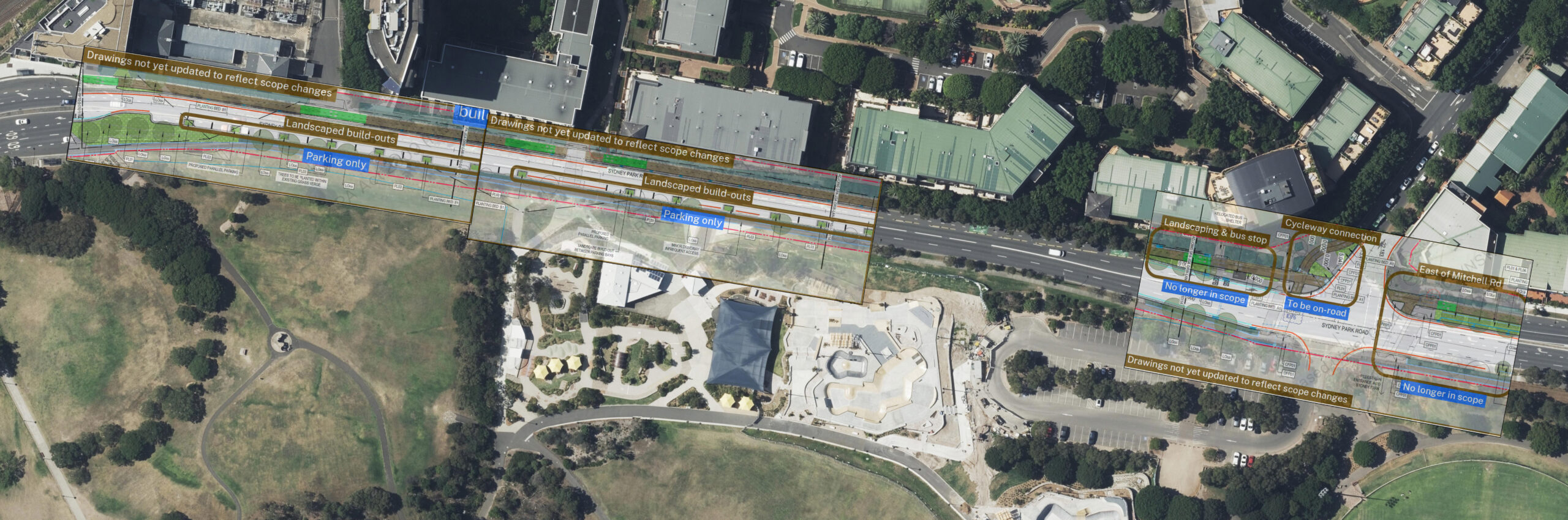
It appears so – an on road cycleway seems to be the preferred plan (page 21). However “Appendix D: Connecting to Mitchell Road Cycleway” (page 55, Internal presentation of Sydney Park Junction Project, dated October 2024 GIPA item 5) shows 2 options, option 2 of which is so vague the design is a pink cloud around where it might land!
The spreadsheet on page 5 (GIPA Item 2, Spreadsheet regarding Sydney Park Junction Project) has unclear headings, but mentions under “Sydney Park Road and Mitchell Road intersection” both an on road facility and shared crossing option with “Retain existing lane configurations”
(4) Is the Government still intending to deliver all elements of the approved project scope including:
(a) New bus stop at Sydney Park Rd/Mitchell Rd intersection?**
No. As TfNSW is not building the cycleway between Mitchell Rd and Euston Rd, they don’t believe they need to relocate the existing bus stop from there:
“Bus relocation not required as cycleway no longer impacts it”, page 33
“No longer providing new bus facility on SPR due to no impact on the existing location. Bus Stop on Princes Highway near the Short Street intersection – still to be relocated” (page 5)
(b) Pedestrian crossing on western arm of the Sydney Park Rd/Mitchell Rd intersection?
Yes. One of the few things mentioned in Haylen’s response
Transport for NSW is liaising with City of Sydney and Inner West Council to finalise the design for the project, which includes the delivery of a new cycle path connection between Sydney Park Road and the Mitchell Road cycleway, as well as a pedestrian crossing on the western leg of the Sydney Park Road intersection.
(c) Dynamic community space for parklets on both sides of Princes Highway?
No. In some areas this will be widened footpaths instead (which personally, I think is a positive change – but a scope change nonetheless). The dynamic community spaces seemed too easy to turn into car parking – in fact, for one segment they are being turned into parking (south of Short St, page 15).
- “Dynamic Community Spaces were removed as Council asset team did not want to maintain it (page 33)
- “Landscaping removed on Sydney Park Road due to funding constraints (associated drainage, utility and pavement works)” (page 33)
- “Designed assuming WC would provide ‘parklets’ which could be removed for e.g. food trucks during events.” (page 14)
- “Was to be managed by Inner West Council (IWC) with use at their discretion. IWC did not want to take on asset management.” (page 14)
Slight concession:
“Providing an additional landscaping pit between Barwon Park Road and Short Street mid-block intersection and on Sydney Park Road between the indented bus bays and through lanes.” (page 7)
However: “Parking instead of footpath widening Footpaths up to Short Street and cycleway to May Street. (page 4)
(d) Landscaped buildouts on Sydney Park Road and Princes Highway?
No. “Landscaping removed on Sydney Park Road due to funding constraints (associated drainage, utility and pavement works)”
(Slide titled “Appendix A: Changes to Design since REF Determination”, Briefing to MO regarding Sydney Park Junction Project, dated October 2024, page 33, item 4). That is – the Ministers Office was briefed on this.
(e) 50+ new trees?
I’m unable to answer this – I didn’t spot any mentions in the GIPA, and otherwise haven’t heard any information regarding this.
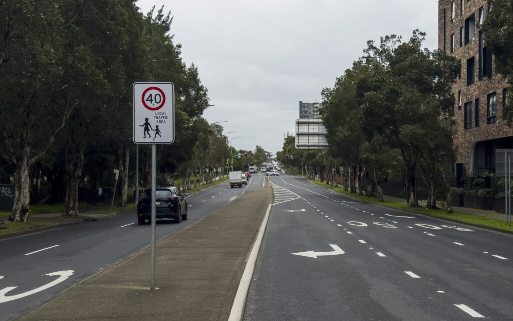
(f) Reducing the design speed in the project area to 40 km/h or below?
On the Princes Highway – yes – I think. Both the scope spreadsheet (page 5), and retained features list (page 10) suggest this change will still be included:
Reducing the posted speed limit on Princes Highway from 60 kilometres per hour to 40 kilometres per hour from Campbell Street to Goodsell Street (page 5, GIPA Item 2, Spreadsheet regarding Sydney Park Junction Project, dated 2024-09-31).
Though alarmingly there is a comment in the same spreadsheet stating “Check if it is extending down to Campbell Street” (ie. the full extent of the scope).
It’s unclear if this is a guarantee of implementation, or a promise to review the speed limit upon completion. In a slide titled “5. Recent Stakeholder Concerns” (page 43) in the “Sydney Park Junction Internal Update” (October 2024) there is this row from a table:
Date: September 2024 From: Lord Mayor Clover Moore Concerns: Princes Highway no longer reduced to 40km/hr Comments: As per the REF display 2021, Transport for NSW will extend the 40km/hr on Princes Highway to Short Street following a speed review upon completion of Sydney Park Junction project.
However, there’s also something strange going on here. The Minister’s response to Jenny Leong’s question included:
“Transport for NSW has already redirected freight traffic and reduced speeds to 40 km/h on the Princes Highway to King Street and Sydney Park Road corridors”
This is a terribly challenging sentence to parse – what does it mean?
Does it mean that the speed limit has been changed to 40km/h through the intersection from the Princes Highway to King St / Sydney Park Road? That was completed a few months before November 2021 according to OpenStreetMap edit history – before the start of the project.
Does it mean that the speed limit is now 40km/h on the Princes Highway?
Well – by that interpretation – the statement is false. I checked on the 16th of May 2025 – the speed limit is still 60km/h on the Princes Highway between Campbell St and a few metres south of Goodsell Street. If you care to check the coordinates of the speed sign on OpenStreetMap you can do that here (see Mapillary info on the same date for more street imagery). This also aligns with the data on the TfNSW speed zones interactive map: https://opendata.transport.nsw.gov.au/data/dataset/speed-zones/resource/5c81e2c6-c153-41e7-8d1f-49ff1d920643
In this case, it appears TfNSW mislead the Minister. A slide titled “Communications and Engagement Strategy” of the Ministers Update presentation (page 28, MO Update October 2024) states:
To date, as part of the Sydney Park Junction project, Transport has: implemented new speed limits of 40km/h on the Princes Highway between Campbell Street and May Street …
Unless the speed limit was temporarily changed before October 2024 and later reverted, the available data does not support this claim.
While it may appear minor, this point constitutes a substantial portion (perhaps one-third) of the Minister’s response and merits clarity.
(g) Removing the slip lane at Sydney Park Rd/Princes Highway intersection?
No. It appears TfNSW is not redesigning it because they don’t have permission or it costs too much to relocate the Transurban owned Variable Message Sign.
“VMS sign relocation – owned by Transurban and there is no location to move” and “No longer relocating VMS” on page 16.
(h) New mid-block pedestrian crossing on Princes Highway north of Short Street?
I think so. I assume this exists in the current plans, but it is not shown in the IFT4/current scope plans because it isn’t changed (“A new signalised pedestrian crossing on Princes Hwy north of Short St to improve access across Princes Hwy” is under “Key features maintained within the scope” on page 10).
(i) New mid-block pedestrian and cyclist crossing on Princes Highway between May Street and Goodsell Street?
Moved I think. “Relocated mid-block intersection to south of May Street – Short Street mid-block intersection will be provided”
(j) Separated cycleway on the western side of King Street between May Street and St Peters square?
Yes.
“Separated cycleway on Princes Highway between Sydney Park Road to Barwon Park Road with a mid-block crossing past May Street”
(Current Project Scope, page 41, slide “2. Project Objectives”, “Internal presentation of Sydney Park Junction Project, dated October 2024
GIPA item 5″.
(k) Separated cycleway on the southern side of Sydney Park Road between Princes Highway and Mitchell Road?
Not on the southern side, but the temporary popup cycleway on the north side was retained in stage 1 and is complete.
(l) Separated cycleway on the western side of Mitchell Road between Sydney Park Road and existing cycleway?
I think this is considered part of the Mitchell Rd & Sydney Park Rd intersection, and so refer to answer for 4a. The cycleway north of the intersection has already been built by the City of Sydney.
The Addendum REF proposes to exclude any civil works on East of Mitchell Road (on Sydney Park Road)
The lack of any civil works east of Mitchell Road means any road space reallocation must be done with paint – which is not in line with the City of Sydney’s recomendation or TfNSW Beyond the Pavement standard.
This also results in the removal of hundreds of metres of cycleway, which even if they couldn’t connect to any cycleways at Euston Road – would greatly benefit residents along the medium density development in the area.
The City of Sydney recommended in April 2020:
Retain car parking lane and as per previous discussions include new street trees at 14 metre centres, in line with the parking bays – see Attachment 2. This helps to visually narrow the road and reduce speeds in line with the Beyond the Pavement to make self-explaining road environments.
CoS comments on TfNSW concept design plans (23 April 2020, on plans dated 5 March 2020)
From the Beyond the Pavement TfNSW standard:
Consider road width narrowing
Consider the potential for transferring traffic lanes (particularly ones that were historically added as the traffic volumes increased) to footpath space, parking and cycle ways and the potential for incorporating trees. A narrower road carriageway creates a strong visual cue as to the speed drivers should travel.
Safely introduce tree planting
Consider the potential for tree planting in towns as visual cues to encourage slower speeds but also create a cooler environment and improve the overall liveability. Slower speeds and road narrowing create opportunities for canopy cover over road and footpath space, and create a street atmosphere less dominated by traffic.
From “3.8.6 Considerations for bypassed roads”, “Beyond the Pavement” standard, TfNSW Standards Portal
Why do the October 2024 internal TfNSW slides mention “Descoped as approved by MO Nov 2024”?
Item 5, titled “Internal Update … October 2024” includes “Western leg crossing at Mitchell Road and Sydney Park Road intersection” …”Descoped as approved by MO Nov 2024 and in July 2024.” (page 44).
“MO briefing to endorse way forward” is on the next page as a “Next step”, which I assume refers to the Item 4 presentation (as presentation is titled MO Update and was dated the same month).
The item 4 presentation (marked October 2024) included “RECOMMENDATION 1. That the Minister for Transport: 2. Approves the staged delivery of Sydney Park Junction”.
The timeline of decision-making remains unclear. It’s possible these comments were prepared in anticipation of a Ministerial decision.
Was the Mitchell Road and Sydney Park Road intersection re-included in scope due to community concerns?
Yes. GIPA 25T-1420 includes that:
Due to community concerns on the 1.8m shared path width. Transport is investigating cycleway connection options between Sydney Park Road to Mitchell Road on-road cycleway.
Slide titled “5. Recent Stakeholder Concerns”, GIPA item 5, “Internal presentation of Sydney Park Junction Project” dated October 2024, page 44, GIPA 25T-1420
Was the Mitchell Road intersection (and other scope beyond the popup cycleway implementation) always planned to be implemented?
No. As of October 2024, not even the contract for design work for any scope beyond Stage 1A had been signed. That this design work could be a variation suggests it was not originally intended to be done before the public backlash or ministerial intervention.
Remaining design works (Stage 1B and Stage 2) to be undertaken by Jacobs as a variation/new contract or within Transport – TBC Timing to be confirmed by I&P
- Slide titled “6. Next Steps”, GIPA item 5, “Internal presentation of Sydney Park Junction Project” dated October 2024, page 44, GIPA 25T-1420
Note that Stage 1A is “Two-way separated cycleway on Sydney Park Road (extent of existing pop-up cycleway) connecting to existing shared path at either end with a wide flared ramp entry”.
Did Transport Minister Jo Haylen promise the original REF design?
Yes.
See the Sydney Morning Herald article on this 2025-05-27: “The transport minister made a safety promise. Four days later, it was torn apart”.
On November 10th, 2024, the Sydney Morning Herald reported that
Haylen’s office confirmed the upgrades would take place as the initial proposal publicly exhibited in 2021, including a cycleway to link Sydney Park and Mitchell roads and a new bus stop and pedestrian crossing to access Sydney Park.
It remains unclear whether the deviations from the initial proposal since this statement resulted from miscommunication, lack of directive authority, or other factors.
An “Internal presentation of Sydney Park Junction Project” dated 14 November 2024 (GIPA item 3, GIPA 25T-1420 page 8) states that 14 changes to scope since the project was assessed have been identified. It details that changes were identified by comparing the project’s 33 key features in the Submissions Report with the current scope of the project.
How did these scope cuts get approved?
According to these new documents “Descoped Sydney Park Road approved by MO [ministers office] Nov 2024 and in July 2024.” (page 44, GIPA 25T-1420).
The following quote from an opinion piece – if referring to this project – suggests that the Minister was not told.
A motorway project which included active transport links had all of those important details removed without the Minister being told, and this has exposed some of the people who aren’t following what the policies say or what the Minister wants.
Fiona Campbell, interview: “How Sydney has rebranded itself from the “city that hates bikes”, Zag Daily, Sela Musa, 13 December 2024
It remains unclear how these scope changes were processed and whether full Ministerial oversight was maintained (if referring to this project).
Are any features beyond Stage 1 scope funded?
As of October 2024 – no. Funding for any design work beyond Stage 1A does not appear to be confirmed, let alone construction.
Remaining design works (Stage 1B and Stage 2) to be undertaken by Jacobs as a variation/new contract or within Transport – TBC Timing to be confirmed by I&P
Slide titled “5. Next Steps”, item 4, “Briefing to MO regarding Sydney Park Junction Project, dated October 2024”, GIPA 25T-1420 page 45
Another page in these documents states “Stage 2 if approved will result in scope similar to REF display on Princes Highway.”
Is Barwon Park Road slip road being retained due to Transurban-owned Variable Message Sign?
Unclear. Comments in GIPA 25T-1420 suggest this intersection is not being redesigned into a signalised, non-slip lane intersection because TfNSW does not have permission, funding, or location to move the sign to.
See “VMS sign relocation – owned by Transurban and there is no location to move” and “No longer relocating VMS” on page 16.
Is the Sydney Park Junction project a requirement of the WestConnex conditions of approval?
Yes. If B51 states, “All identified works arising from this condition are to be implemented by the Proponent.”, and B50 states “The Review must identify (and consider), but not be limited to: … (c) the King Street Gateway Project, including potential Princes Highway traffic calming initiatives;”, then a reasonable person would consider the Sydney Park Junction Project (the new name for the King Street Gateway Project) to be a requirement of the WestConnex conditions of approval.
If B51 does not “identify” the “King Street Gateway Project”, then condition B51 does not meet the condition of approval of B50. Logically, for B50 and B51 both to be met, the Sydney Park Junction Project must be “implemented by the Proponent”.
In the words of Clover Moore: “The project is a condition of consent for WestConnex.” (Letter, 5th September 2024)
In the words of the Inner West council:
The project is not part of WestConnex, but is a requirement of New M5 Condition of Approval B44, which states: “The SSI [State Significant Infrastructure] must be designed to not preclude delivery of the King Street Gateway Project. Consultation with the relevant council(s) must be undertaken during detailed design of the SSI to facilitate integration of the two projects. Current traffic modelling and assessment, and the results of the Road network Performance Review Plan as required in Condition E40 wherever applicable, must be provided to the relevant authority and used in the development of the King Street Gateway Project.”
Notes from meeting between Inner West Council (IWC) & Roads & Maritime Services (RMS) re King Street Gateway project (WestConnex New M5) 27 April 2017 11am-12noon at Leichhardt Service Centre
Note this does not state it is part of WestConnex.
TfNSW claims delivery of the Sydney Park Junction Project is not a WestConnex Ministers Condition of Approval
The delivery of the Sydney Park Junction Project (also known as King Street Gateway Project) is not a WestConnex Ministers Condition of Approval as stated in B44, B50 and B51.
Slide titled “1. Ministers Condition of Approval (B44 & B50 & B51)”, Page 38, Sydney Park Junction Internal Update (October 2024), TfNSW, GIPA 25T-1420
It also includes on the same page:
The determined Sydney Park Junction REF states the following “The proposal is consistent with approval conditions B44, B50, B51 of the M8 Motorway (Stage 2) project by providing traffic calming initiatives along King Street/Princes Highway and Sydney Park Road and upgrading pedestrian and bicycle pathways within one kilometre of the St Peters Interchange.”
Original text of approval conditions
Referring to the original approval conditions (WestConnex Stage 2 – New M5, SSI 6788, including Mod 1-6, https://www.linkt.com.au/content/dam/linkt/sydney/westconnex-m8/WestConnex_M8_New_M5_CoA.pdf)
B44
The SSI must be designed to not preclude delivery of the King Street Gateway Project. Consultation with the relevant council(s) must be undertaken during detailed design of the SSI to facilitate integration of the two projects. Current traffic modelling and assessment, and the result of the Road Network Performance Review Plan as required in condition E40 where applicable, must be provided to the relevant authority and used in the development of the King Street Gateway Project.
B50
The Proponent must undertake a Pedestrian and Cycleway Network Review. The Review must be prepared and approved by the Secretary within six months from the date of this approval (or as otherwise agreed by the Secretary) to identify pedestrian and cycle facilities that are to be provided by the Proponent as part of the SSI. The Review must be prepared by a suitably qualified and experienced person(s) that has been approved by the Secretary. The Review must be undertaken in consultation with the relevant councils and Bicycle NSW and address the matters raised during consultation. The Review must identify (and consider), but not be limited to:
(a) current and future land use and associated pedestrian and cycle demand and needs;
(b) pedestrian and cycle impacts associated with the project;
(c) the King Street Gateway Project, including potential Princes Highway traffic calming initiatives;
(d) Alexandra Canal initiatives;
(e) regional and local pedestrian and cycling strategies;
(f) pedestrian and cycle safety, accessibility and connectivity, including to the public realm;
(g) intersection and signal phasing opportunities to reduce waiting and crossing times for pedestrians and cyclists;
(h) provision of upgraded cycle and pedestrian facilities within 1,000 metres of the boundary of the St Peters Interchange, apart from the areas addressed in conditions B62(c) and B64; and
(i) concept designs for pedestrian and cycleway infrastructure and implementation timeframes.The Review is also to consider the delivery of the ‘M5 East Green Link’ between Kingsgrove and Mascot approved as part of the M5 East Motorway project. The review shall address past constraints to the delivery of this project and options to overcome these constraints.
The Review must not result in a reduced level of cycle and pedestrian infrastructure as identified in the documents referred to in condition A2, unless required by these conditions.
B51
A detailed Pedestrian and Cycle Implementation Strategy must be submitted to the Secretary within 12 months of the date of this approval (or as otherwise agreed by the Secretary) and implemented at the commencement of project operations, except as permitted by this approval. The strategy must be prepared in consultation with relevant councils and Bicycle NSW. The Strategy must be consistent with the approved Pedestrian and Cycleway Network Review and include:
(a) pedestrian and cycle engineering and safety standards;
(b) a safety audit of existing and proposed pedestrian and cycle facilities to address the above standards (including the shared path audit undertaken for the King Georges Road Interchange Project SSI-6547);
(c) details of selected routes and connections to existing local and regional routes; (d) timing and staging of all works;
(e) infrastructure details, including lighting, safety, security, and standards compliance;
(f) signage and wayfinding measures; and
(g) details of associated landscaping works.The Strategy shall be endorsed by a suitably qualified and experienced person(s) approved by the Secretary. The endorsement shall address each of the listed matters in this condition.
All identified works arising from this condition are to be implemented by the Proponent.
The state of cycleway and footpath funding
The active transport budget for the entire state of NSW was $38.5 million in 2022/2023 – 0.2% of all the total NSW transport funding over the same duration, and 0.188% of the WestConnex motorway sale figure. On the 13th of February 2025, the Parliament of New South Wales released the report of an inquiry into “Use of e-scooters, e-bikes and related mobility options”, which included this recommendation:
That the NSW Government, in allocating funds to active transport in the NSW Budget, ensure better alignment with the proportion of active transport trips taken and the United Nations recommendation for active transport to be allocated 20 per cent of transport budgets.
Recommendation 16, Parliamentary Inquiry into “Use of e-scooters, e-bikes and related mobility options”, NSW Legislative Council, Final report, 2025-02-13.
The NSW Government delivered a response Tuesday 13th May 2024 that they “Support in principle” this recommendation (which even included “The NSW Government is also delivering improvements to Transport assets, by doing things like improving traffic signals to better prioritise pedestrians…” – perhaps one day this will be verifiable with open data)
Jenny Aitchinson’s comments in the recent ROM cycling and micromobility plan are encouraging:
Safe infrastructure designed for children benefits all riders, making cycling more accessible for people of all ages and abilities. To achieve this, we need increased investment in safe and connected active transport infrastructure.
Ministers’ foreword (pg. 4), Regional and Outer Metropolitan Cycling and Micromobility Plan 2025-2035, May 2025
Timeline of the project
See timeline at https://jakecoppinger.com/2024/11/sydney-park-junction-november-2024/#aioseo-an-unofficial-timeline-of-sydney-park-junction-project
I directly asked TfNSW when the Addendum REF is due in the 2025-05-01 City of Sydney Cycleway Advisory Meeting, and the answer of the representative was they do not know.
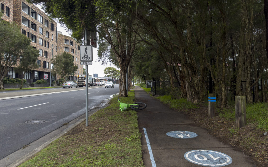
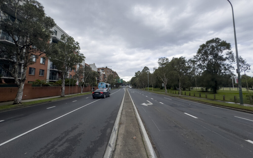
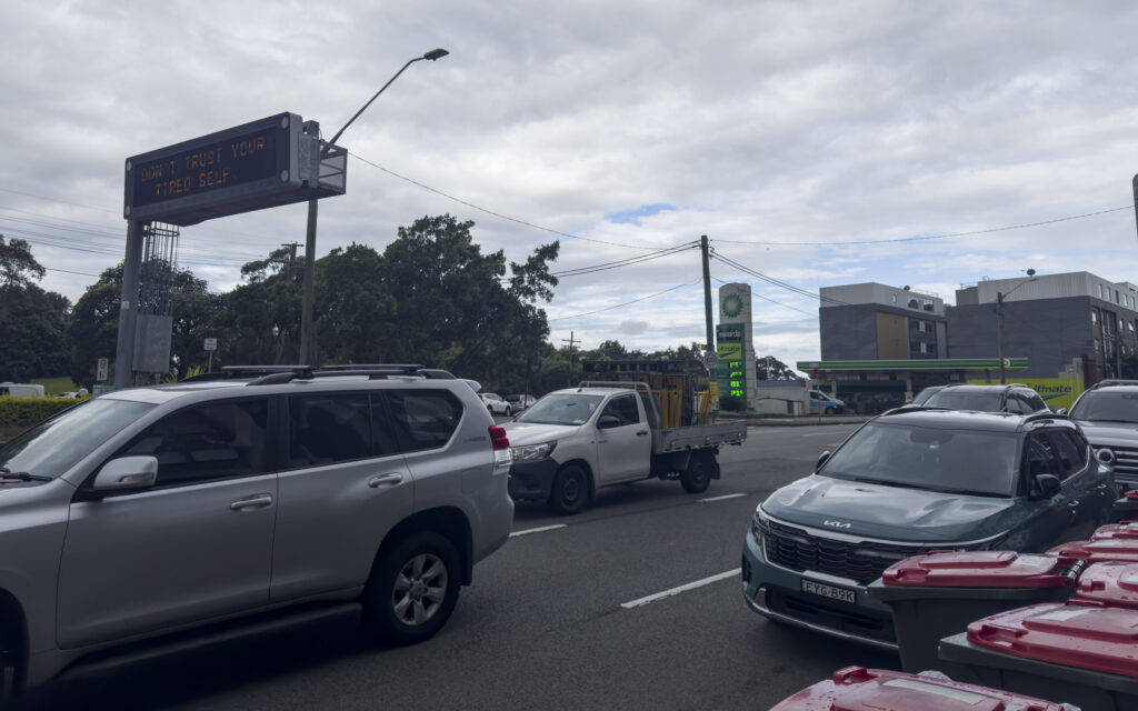
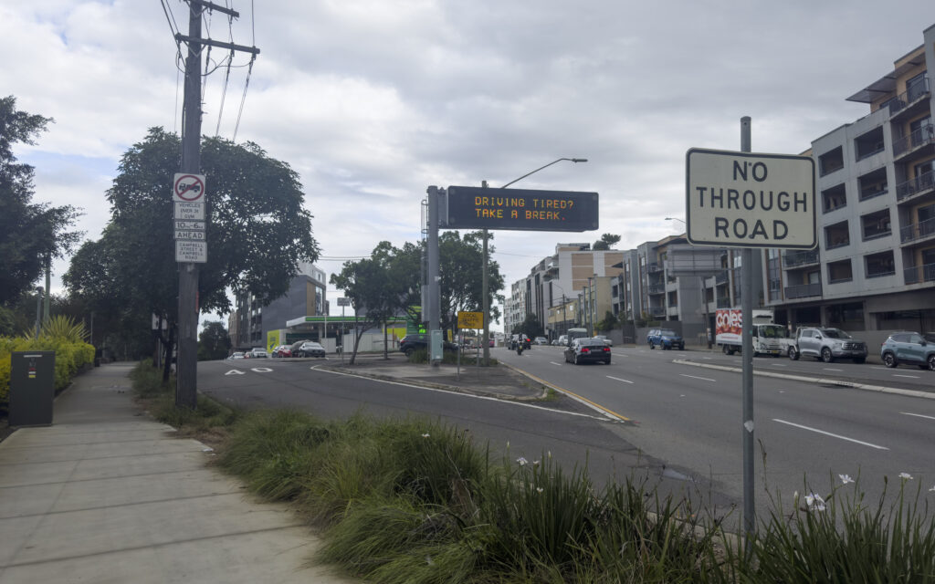
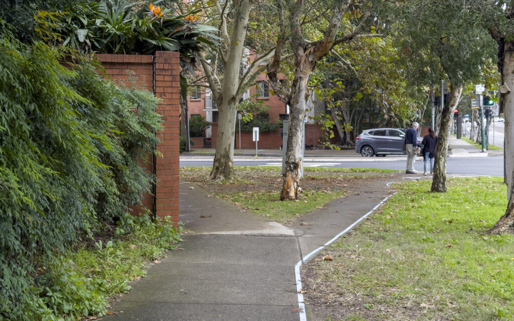
Site photos
Leave a Reply