The first piece of rail infrastructure in the Eastern Suburbs since the 1979 Bondi Junction line, the CBD & South East Light Rail received funding in 2012 and started construction in 2014, with the line opening on 14/12/19 (to Randwick).
I undertook a four-year project to document the construction over 6 focus trips at various stages of development, as well as after the opening of the Randwick segment.
The UNSW/Kingsford segment is due to open in March 2020.
The route is about is good at it can get for a transit corridor with bidirectional peak flows of students to UNSW, office workers to the city, and health professionals to the hospital.
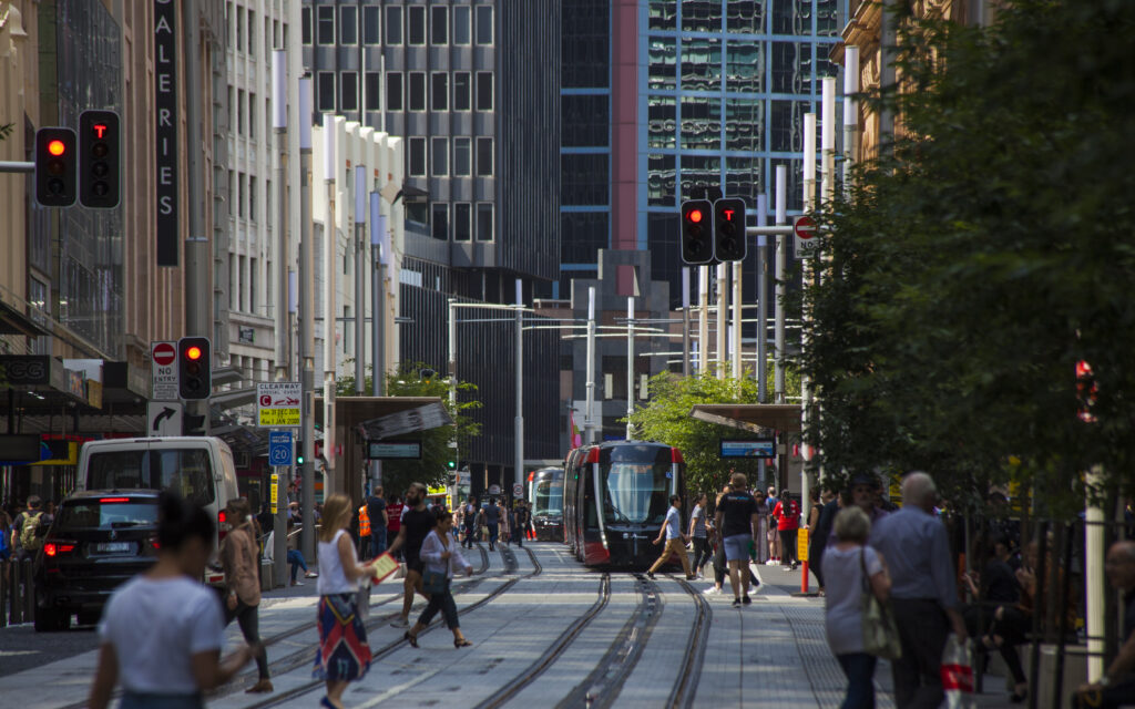
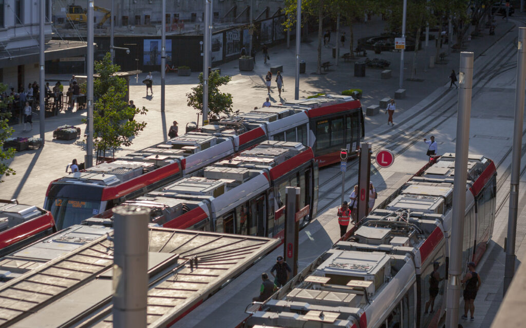
That being said I do think it should have been heavy rail. It’s slow, like slowest in the world, 50 minutes Randwick to Circular Quay , 11.16km/h average, slow. Off peak buses run that in 35 min! Chances are they’re running to a “fat” timetable with long station dwell times to judge passenger behaviour, and should be able to get to 40mins end to end, but it’s always going to be slow. The line will be over crush capacity in the near future, with little ability to increase throughput. Trams already run attached together in 67m long monsters to reduce traffic light cycles required.
Was it worth building? While unbearably slow, the stations are literally level with street footpath, making it ridiculously accessible, and it seems to be well used already. I would have rathered a pedestrianised George St, with rapid bus corridor all along Anzac Parade, and built the rumored Maroubra Metro sooner.
Historical context
In the 1950’s Sydney had the largest tram network in the Southern Hemisphere. With the postwar shift in transit planning to the US mindset of prioritising private cars, the state government closed all lines, removed overhead wires overnight, tarred over tracks and burned the trams in Randwick (at the depot north of the racecourse) to ensure they could not run again.
The 1979 Bondi Junction train line was originally planned to continue to Charing Cross, Frenchmans Road, Randwick Junction, University of NSW and Kingsford, however was shortened in 1967 for budget reasons.
Leaked government documents suggest a 2036 Metro line to Randwick, Maroubra Junction & Malabar, which would probably open up the gun range near the national park to development and serve the huge new developments in Maroubra Junction.
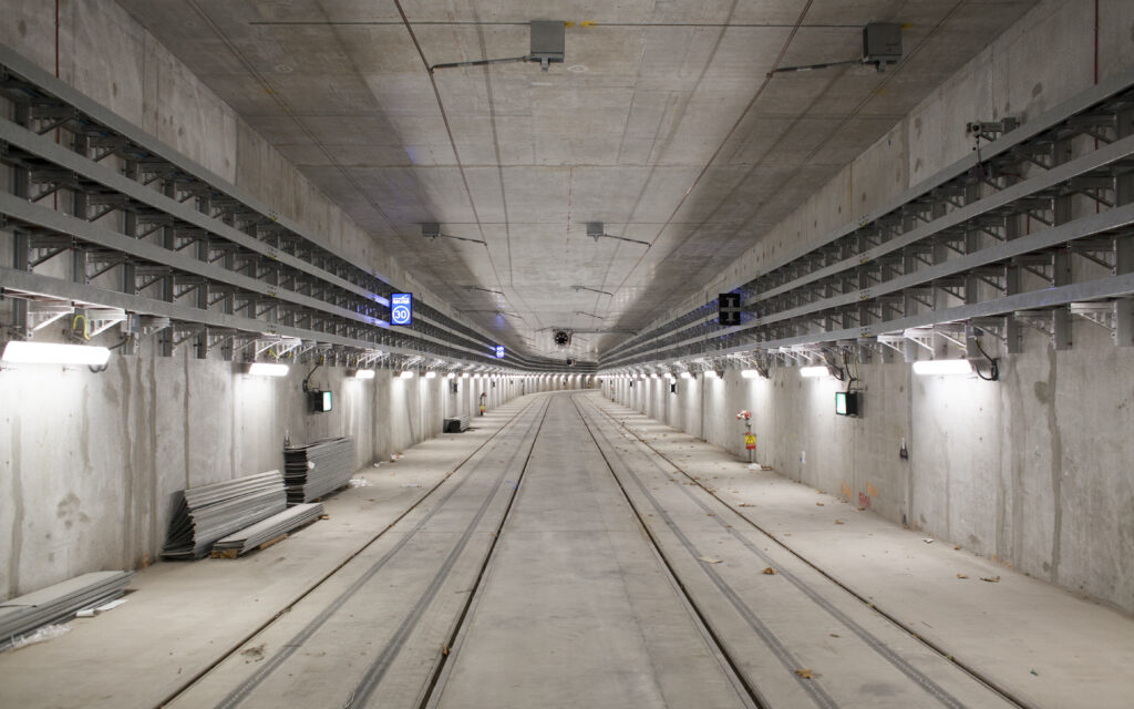
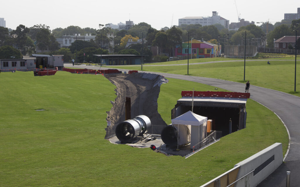
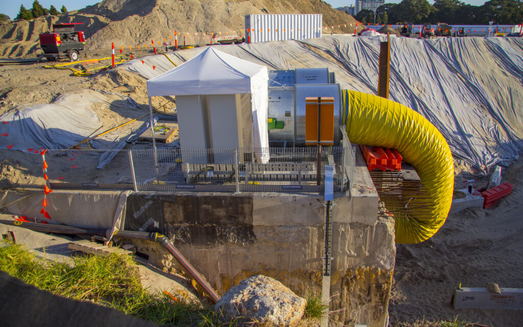
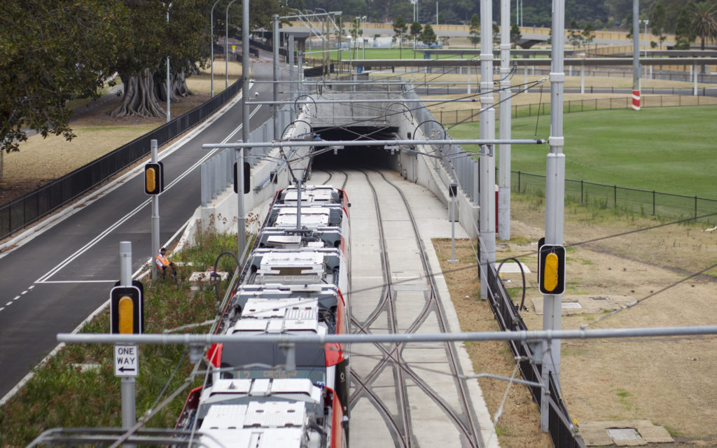
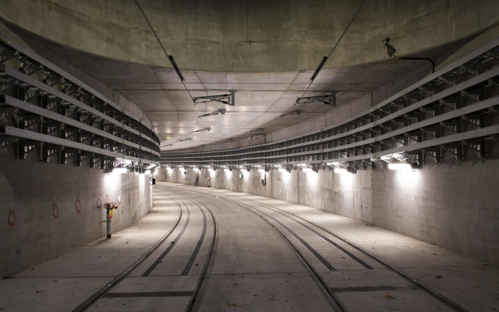
Moore Park Tunnel
It would be an amazing cycle route into the city, however the government decided against a foot/cycle path citing safety concerns of it being long and without sightlines around the corner.
Note: It’d be a really bad idea going in the tunnel now. When I shot these there was no rail traffic, the tunnel was fully illuminated and I noted the overhead wires were grounded.
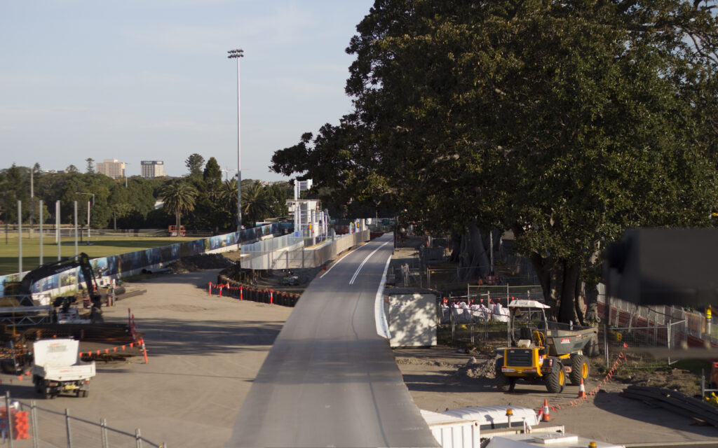
The entire tunnel was built cut and cover. Anzac Parade (and the bike path) was duplicated with a slight curve while the tunnel was dug under the original road, and then traffic was switched back. Note: This isn’t the diverted Anzac Parade, it’s the busway.
Albert Tibby Cotter Bridge
Eastern Tunnel Entrance

Moore Park ripped oven for cut and cover construction. Most of the tunnel had been built at this point, this is the access segment.
Moore Park Cut & Cover
Moore Park Tunnel Eastern Portal
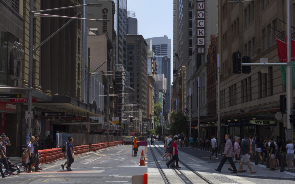
George Street
Probably the best thing to come out of the project in my opinion is the pedestrianisation of George Street. It feels a lot more lively. There are people eating on the street, buskers playing without road noise, children playing. There was a lot of opposition at the start due to changing bus routes, and the huge amount of disruption to local businesses. I think the result is similar to Martin Place; it’s unimaginable to go back now.
George St & Market St
Surry Hills
Devonshire St and Crown St
Devonshire St & Bourke St
Circular Quay
The CQ junction is beautiful and functional. Interchange between light rail, heavy rail, bus and ferry is possible with a short walk at street level. The large public square (closed to cars) means crowding isn’t usually an issue.
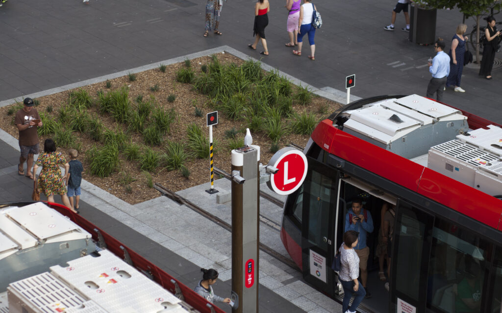
It’s really slow (at least for now) on the George Street section, but this shot highlights just how accessible (for those in wheelchairs, the elderly and the lazy) the trams are from the street footway.
Other Infrastructure
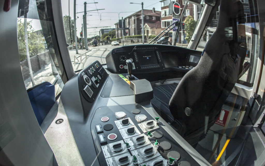
From what I could guess after watching closely, the accelerator/throttle chooses a speed and then software chooses the acceleration curve to apply.
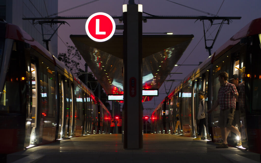
17/12/19
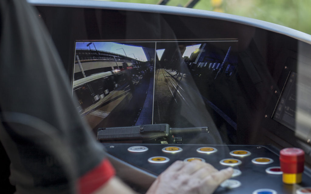
Similar to the door cameras used in Sydney Trains
At Town Hall station you’ll see the trams dropping their pantographs as they transition to battery/switched third rail
Shot 15/12/19 at 17mm, thanks Dean for letting me borrow your lens!
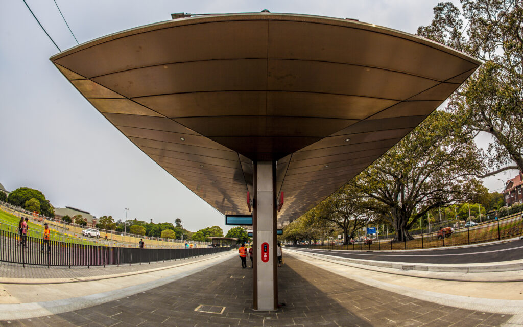
My most trusted designer friend reckons these copper roofed stations will date really quick!
Shot 3/11/19 from Harry Seidler’s Grosvenor Place during Sydney Open.
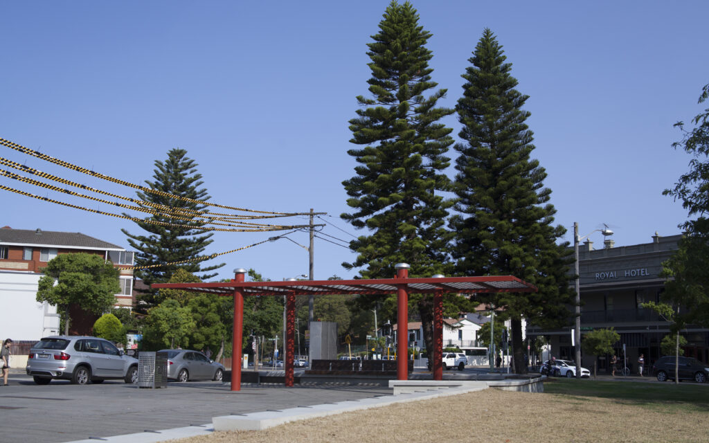
Originally the Randwick terminus would be in High Cross Park, however after a campaign to save the park TfNSW and Randwick Council moved the terminus to High Street just past the Prince of Wales Hospital.
A hidden electricity substation was still built in the park with a concrete surface covering it
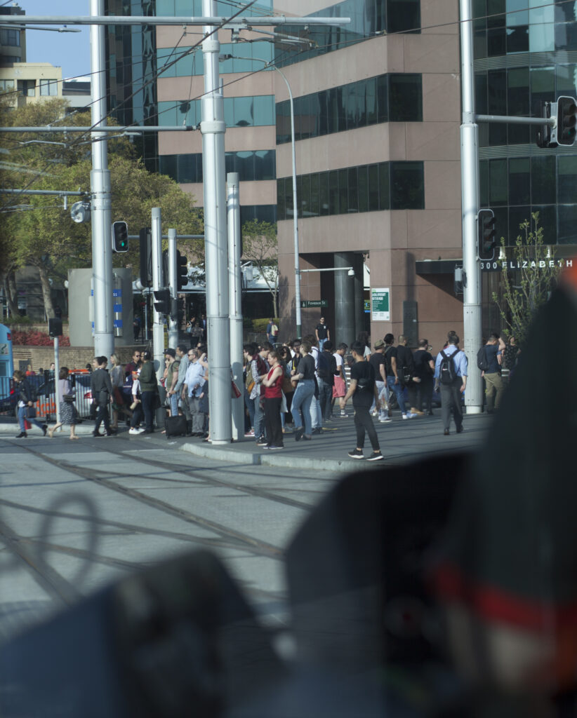
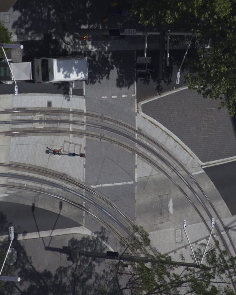
Shot 17/12/19. Prior to the opening, Transport for NSW’s coordinator general Marg Prendergast was concerned about pedestrian behaviour around the trams leading to near misses. This intersection east of Central Station is possibly the busiest pedestrian intersection in Sydney. The addition of a cycle path and extremely narrow island between the road and the light rail crossings, along with the lights not being coordinated between those crossings, leads to large crows with nowhere to go when the trams are coming. In my perfect world the street would be closed to cars, but it’s a pretty major bus thoroughfare due to the large railyards blocking access further south.
Leave a Reply