Category: Urbanism

  • Observations from Australia’s first Micromobility Conference

    Observations from Australia’s first Micromobility Conference

    Over the weekend I attended Australia’s first micromobility conference. The sessions were organised into themes reflecting the challenges Australia faces in transitioning it’s transport network and urban planning – from car and highway dominated streets to a safer, lower emission and more pleasant city permitting cycling, walking and other journeys.

  • Visualising Sydney bus congestion with Marey charts

    Visualising Sydney bus congestion with Marey charts

    As a side project I built Sydney Transit Graph – a visualisation of real-time Sydney bus congestion. Each line on the graph (a Marey chart) represents a bus completing its route (percentage) over time.

  • Mapping Sydney Billboards: Every QMS advertising panel in Sydney

    Mapping Sydney Billboards: Every QMS advertising panel in Sydney

    Map live at SydneyAdvertisingMap.com. See also: Max Bo’s analysis of how many placed next to Telstra telephones: https://observablehq.com/@mjbo/sydney-qms-panel-public-telephone-pairings If you live in Sydney you will have seen them – the 86 inch advertising screens in the City of Sydney Council. These advertising panels are known as communication pylons in the language of the developer approvals.…

  • The Drying Green opening – a new Green Square park

    The Drying Green opening – a new Green Square park

    On Saturday the 15th of October, Clover Moore (Lord Mayor of the City of Sydney) opened The Drying Green, the new centerpiece park of Green Square. It’s been in construction since March 2018 and includes areas of grass, wetlands which filter stormwater before it enters the wider system, and a barbecue and seating area. It…

  • The Best Apps for Bicycle Directions

    The Best Apps for Bicycle Directions

    Even though some cities have dedicated bicycle infrastructure, it’s of no use if you don’t know where it is. While Google Maps is excellent for car navigation (and the dominant market leader), it often has patchy cycle infrastructure coverage and tends to generate cycle routes on busy roads. The best dataset of cycle infrastructure worldwide…

  • Construction of the Sydney CBD & South East Light Rail

    Construction of the Sydney CBD & South East Light Rail

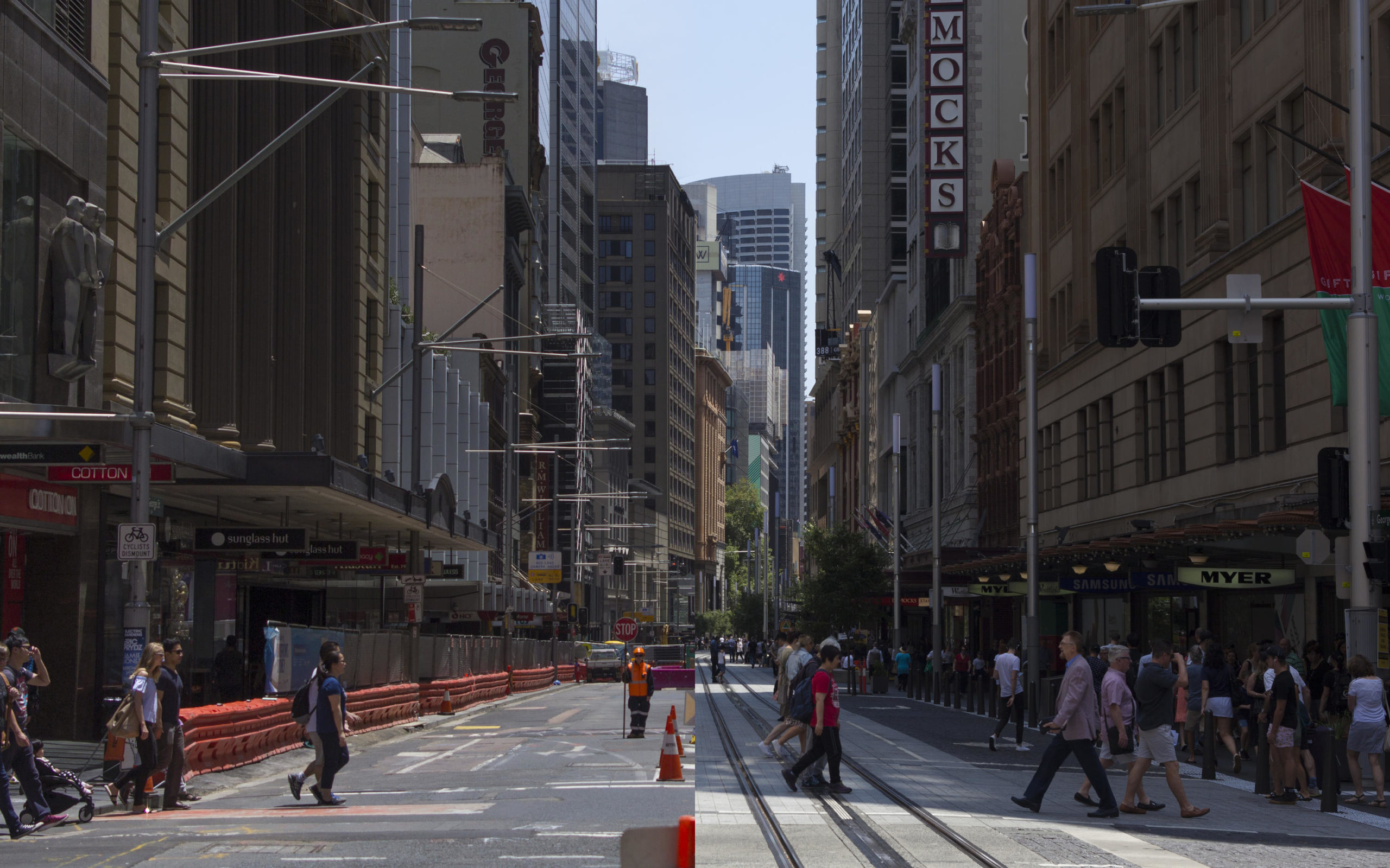
    I undertook a four-year project to document the construction over 6 focus trips at various stages of development, as well as after the opening of the Randwick segment.