Category: Tech
-
Introducing the Heart Foundation’s Community Walkability Map
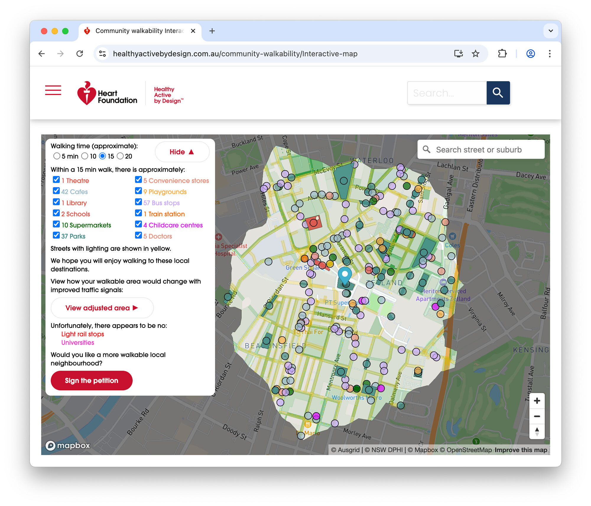
I’m pleased to share the completion of a recent commercial engagement with the Heart Foundation: the Community Walkability Map, a new interactive tool designed to help communities understand and advocate for more walkable, healthier neighbourhoods.
-
Shining a Light on the Traffic Signals of Sydney
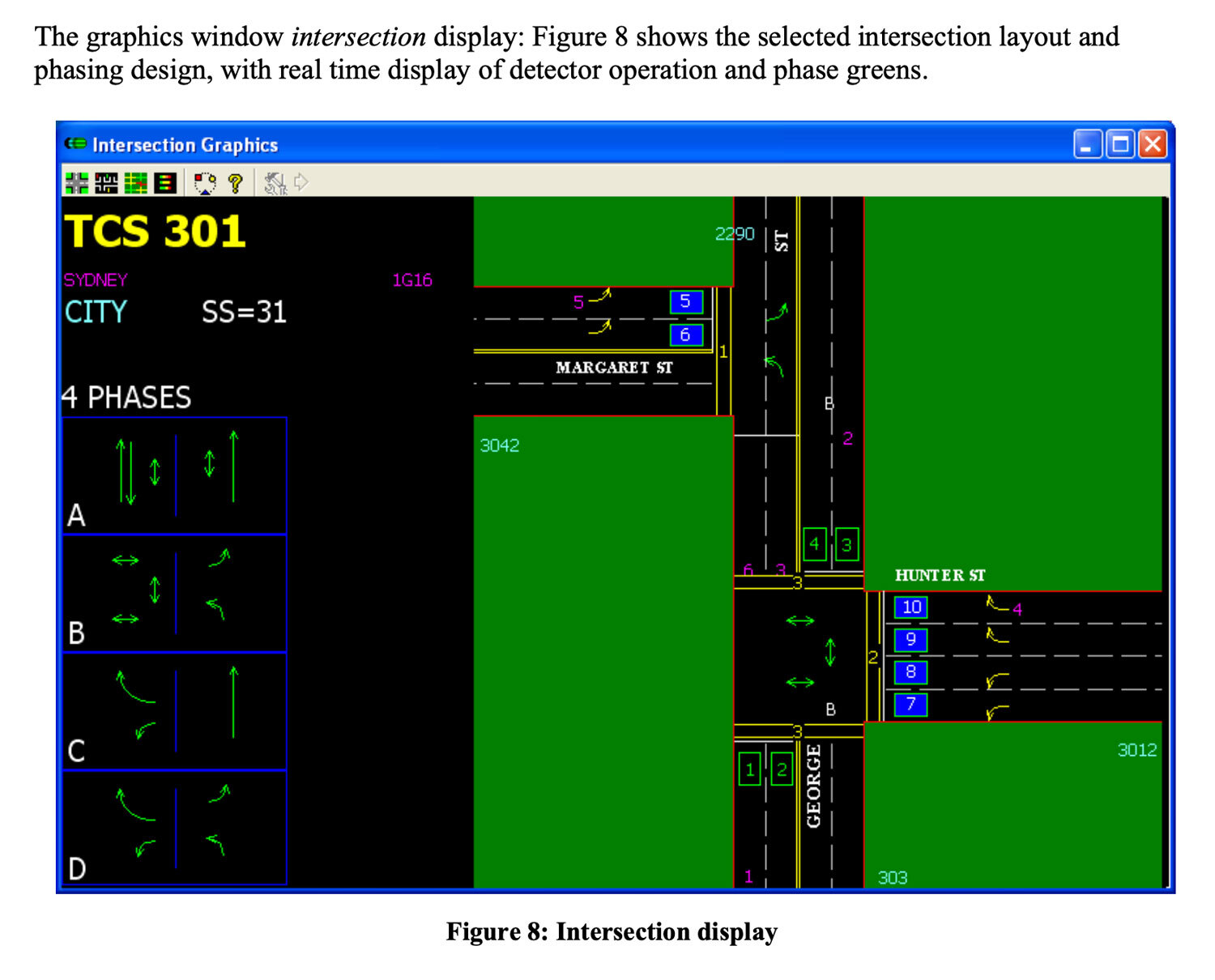
This blog post provides an overview of traffic signal operation in Sydney (focusing on the inner city), based on technical documentation, conversations with government & industry experts and data I’ve collected after building Better Intersections.
-
Mapping pedestrian traffic light timing in Sydney, Australia
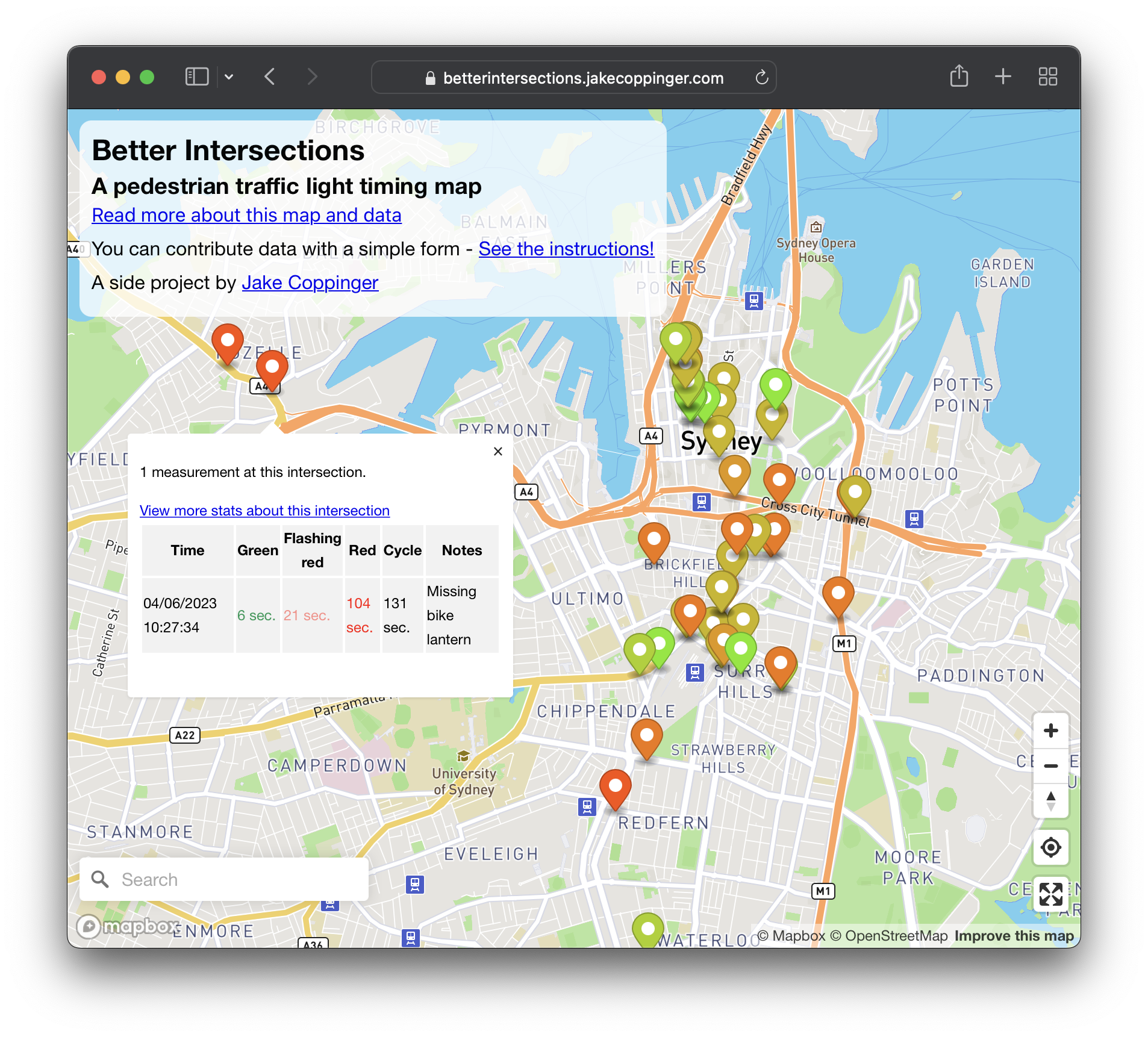
Better Intersections is a tool to record and visualise timing details for pedestrian and bicycle signals. In the absence of traffic light timing data, and as we hold hope for it to become publicly available; the aim of Better Intersections is to crowdsource measurements and inform where positive changes could be made.
-
Subterranean Sydney: A cross-section of Town Hall Station made with iPhone LiDAR
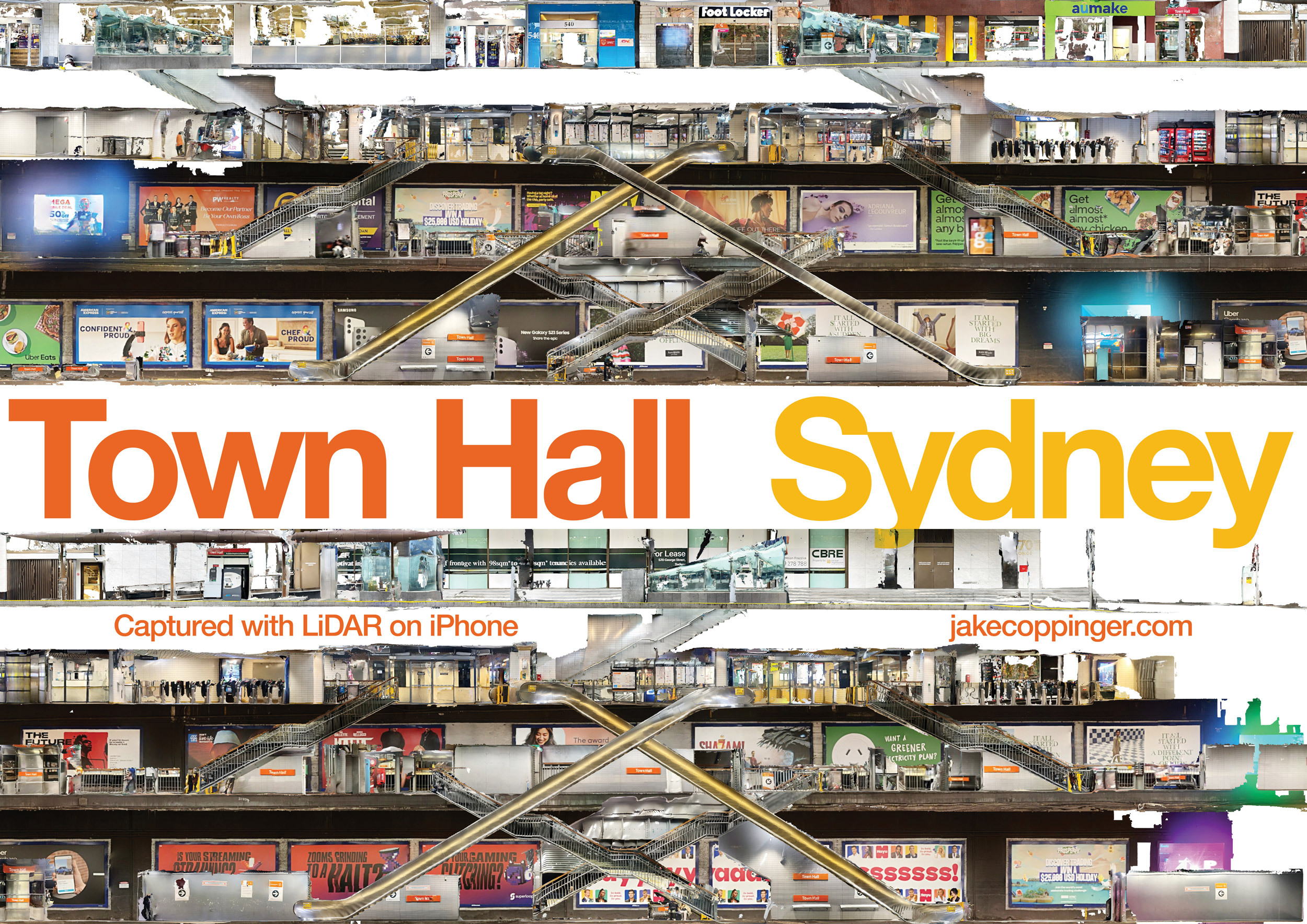
Using just an iPhone with LiDAR to create a cross-section 3D model and image of Town Hall Station with the LiDAR sensor on an iPhone.
-
Generating aerial imagery with your iPhone’s LiDAR sensor
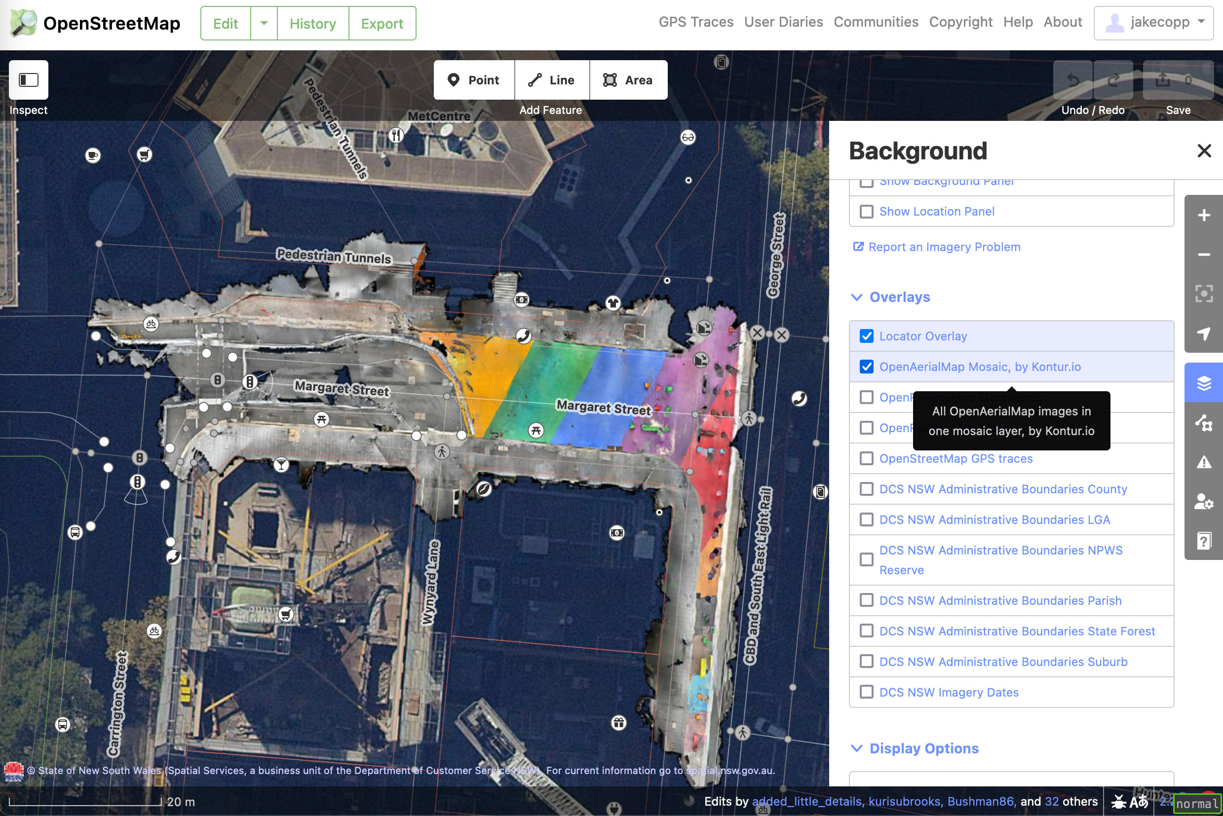
This technical guide details how you can create your own aerial imagery and 3D models of streets with the built in iPhone LiDAR sensor and open source tools in the OpenDroneMap package.
-
Lane-accurate street maps with OpenStreetMap – writing a vector tileserver for osm2streets
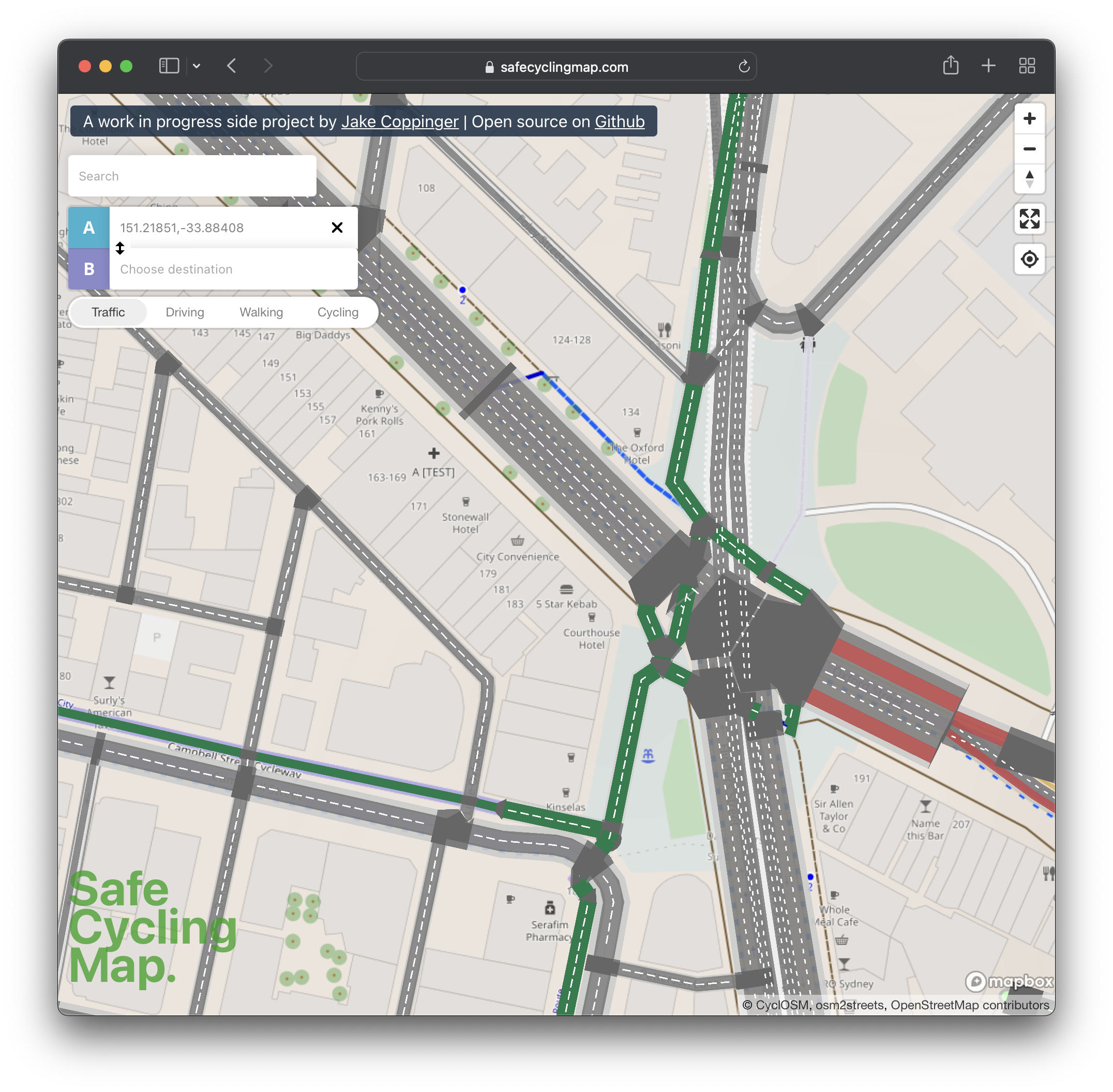
I’ve built safecyclingmap.com, an open-source proof of concept map that renders cycleways and streets down to the individual lanes, to assist cyclists picking safe routes in cities with little dedicated cycling infrastructure.
-
Creating aerial imagery with a bike helmet camera (GoPro) and OpenDroneMap
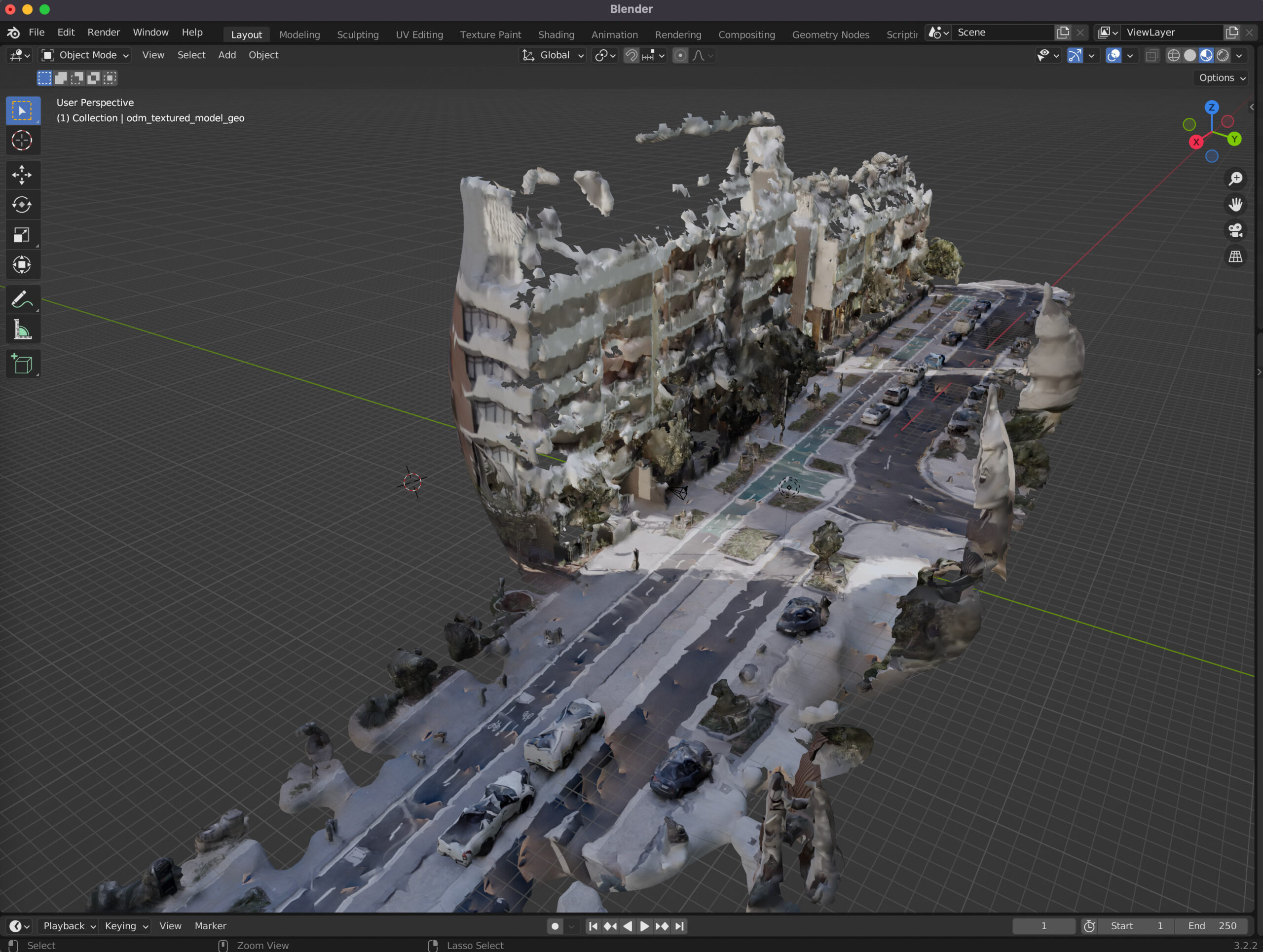
This technical guide details how you can create your own orthorectified (aka satellite view/bird mode) imagery, point clouds and 3D models of streets with nothing but a 360 degree camera mounted on bicycle helmet, and the open source photogrammetry software OpenDroneMap.
-
Visualising Sydney bus congestion with Marey charts
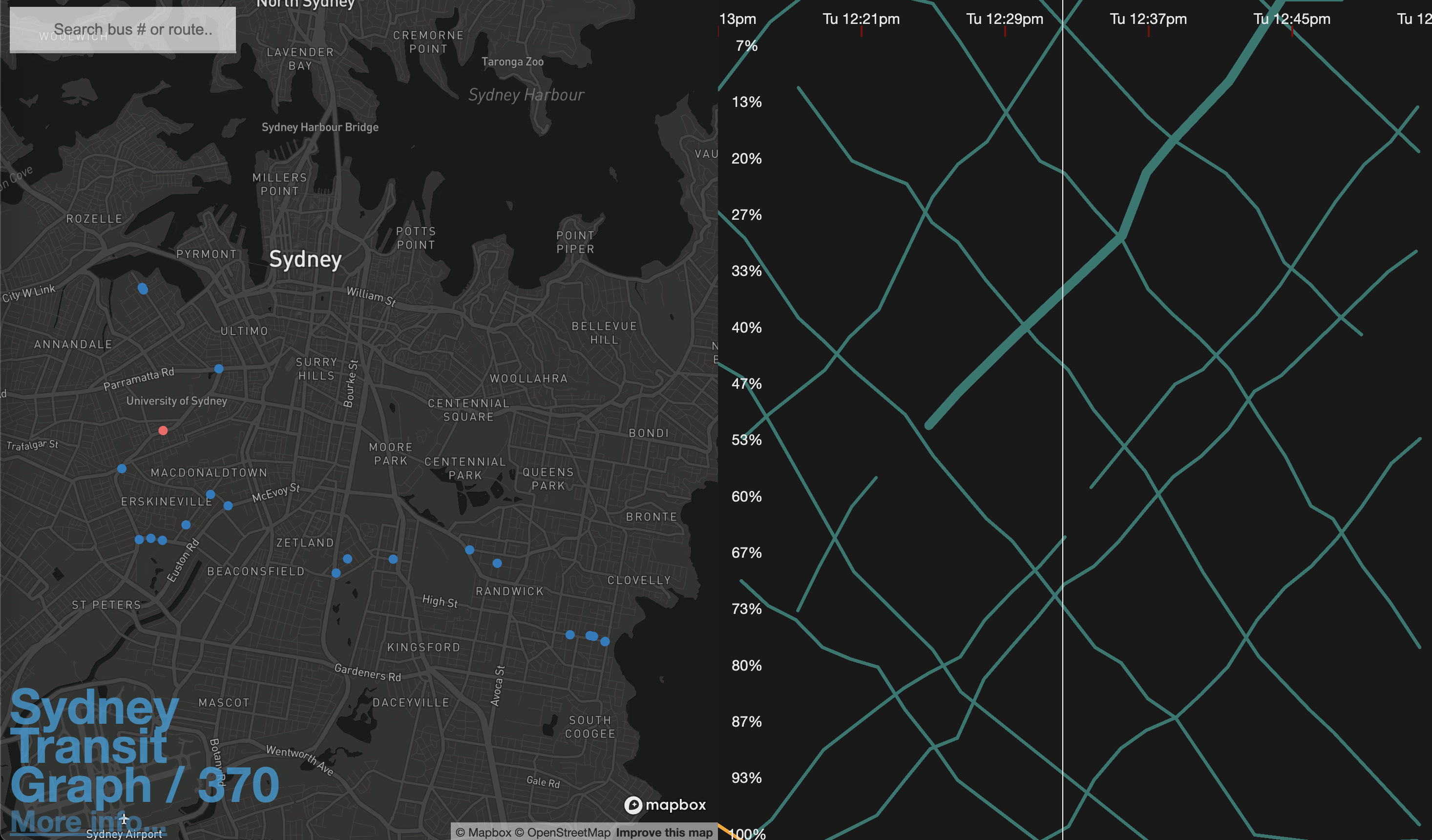
As a side project I built Sydney Transit Graph – a visualisation of real-time Sydney bus congestion. Each line on the graph (a Marey chart) represents a bus completing its route (percentage) over time.
-
How I helped ~6,000 Australians find a vaccine appointment
In mid 2021 Australia had an acute vaccine shortage for various reasons, which meant vaccine appointments were extremely hard to come by – NSW had just declared a national emergency. To help Australia increase it’s vaccination rate ASAP I built GPVaccineSearch.com over a few weekends in July/August, an open-source vaccine appointment search engine, as a…