This is a lightly edited version of a submission I wrote on behalf of Better Streets for the public comment opportunity regarding the North Bondi Shops and Bus Terminus Upgrade. I made sure to reference relevant TfNSW Guidelines, Austroads specifications, Waverley council documents and research on best practice urbanism, and received review from other members of Better Streets.
The concept designs were created in the context of challenging constraints from council (18 car parks, possibly expanding to 20) and TfNSW (need to fit in 4 full size articulated buses with required pedestrian sightlines for zebra crossing, large bus turning circles at each end).
I welcome constructive criticism or any other insights you might have, either as a comment below, via Mastodon or privately to [email protected].
Better Streets supports the improvements of the North Bondi Shops and Bus Terminus Upgrade with changes. The existing infrastructure is woefully inadequate, unsafe and not fit for purpose for the safety and accessibility for pedestrians and cyclists, which also impacts local businesses. We welcome many positive improvements however also detail concerns below.
Better Streets is Australia’s peak body for improving our streets. The Better Streets coalition includes a large number of volunteers and organisations – these members and our aims are listed at betterstreets.org.au.
Better Streets supports all the stated project aims with the exception of “Retain the number of existing parking spaces”. Reasoning based on peer reviewed evidence with references to TfNSW guidelines and Austroads specifications is provided below.
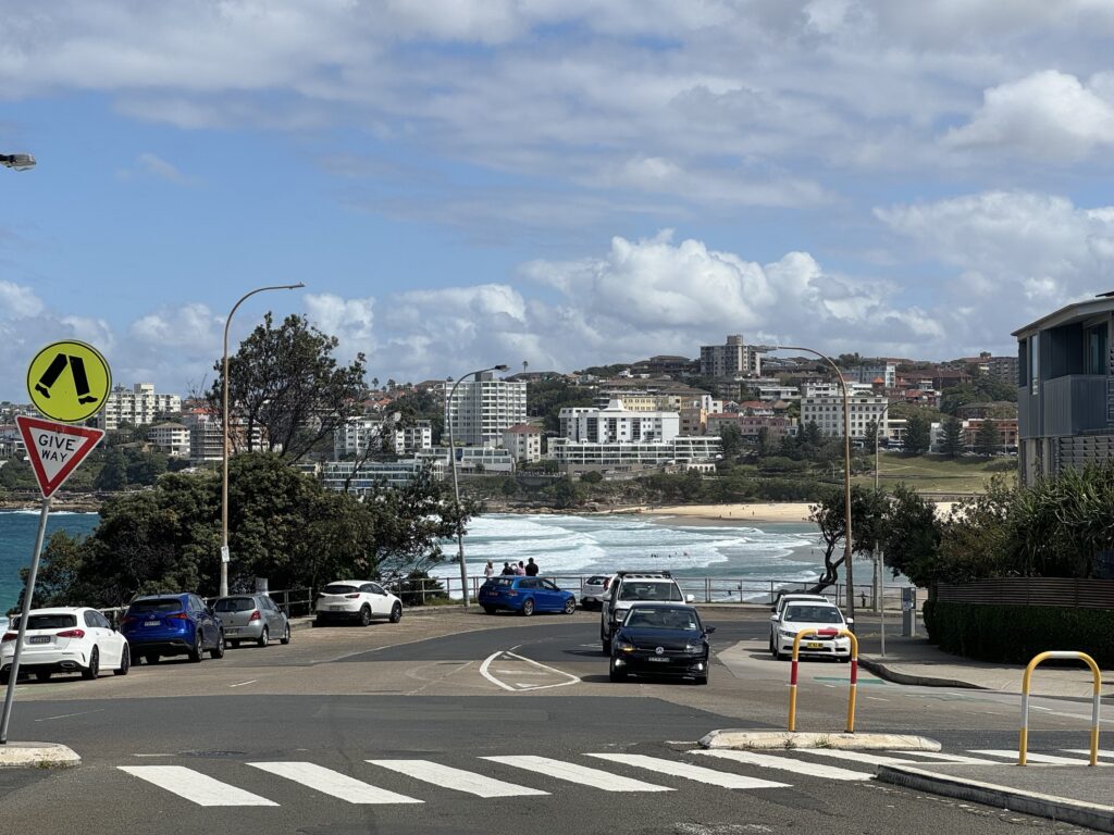
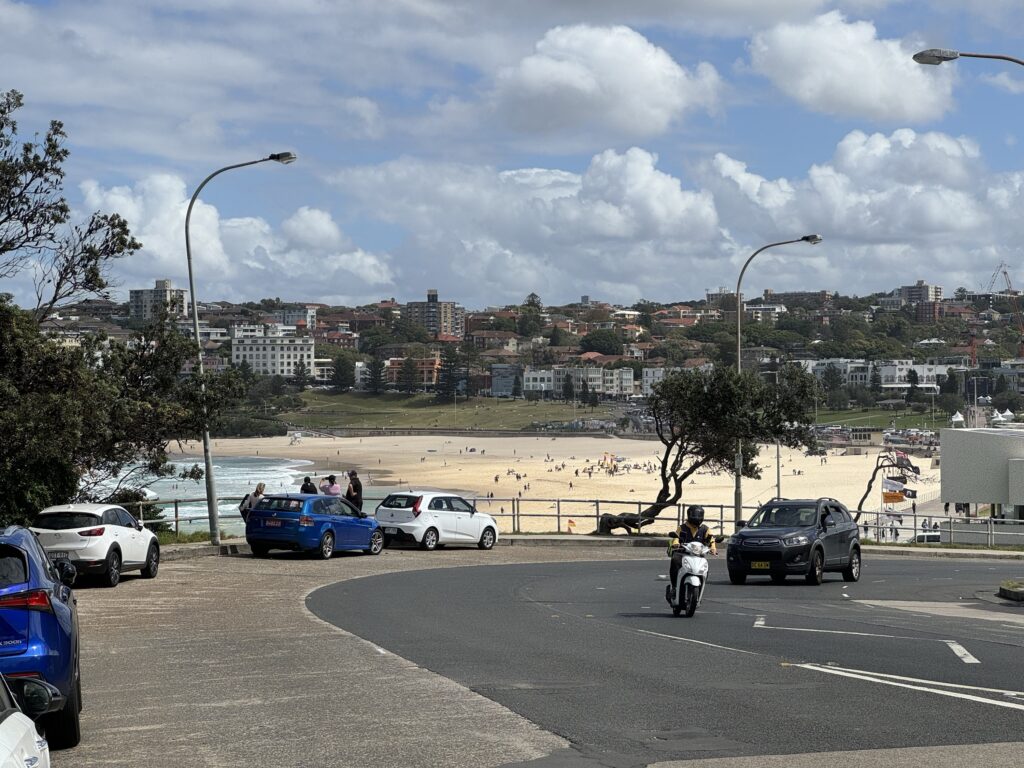
Assuming all motorists use the free parking for the maximum amount of time, there are 20 available sessions of 30 minutes per car park per day. This means the 18 retained car parks potentially only service 360 car drivers per day. Bondi Beach (120 metres away) receives up to 40,000 visitors per day and while Opal patronage per bus stop is not available, it is the terminus of a bus route that in 2019 carried an average of 22,000 people per day, 8.7 million commuters per year, the busiest in NSW. This is a terribly inequitable use of at least 155 square metres of public land with views of Bondi Beach.
- 1. Footpaths and walking
- 3. Car parking
- 3.1 This is the terminus of the busiest bus route in NSW
- 3.2 Issues with perpendicular parking
- 3.3 The large perceived road width will increase driver speed and crash risk
- 3.4 If parking is retained, it should be paid
- 3.5 Car parking concerns in the media demonstrate a lack of engagement with local businesses
- 4. Cycling
1. Footpaths and walking
Better Streets welcomes improvements to the footpaths and walking amenity in this area, however the proposed design does not meet TfNSW guidelines for walking space for this street type.
The project says it aims to:
- Improve pedestrian safety throughout the village
- Create a contemporary village atmosphere that encourages dining and shopping
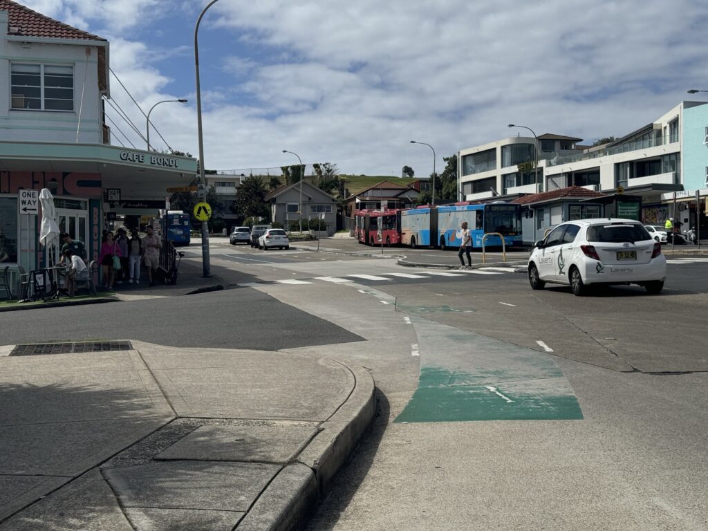
This section of Campbell Parade is not only a busy terminus bus station but a small commercial centre.
Dimensions of the footpaths are not specified on the concept diagram (it is after all a concept design) however the footpaths appear so narrow at parts there is no way to meet the TfNSW guidelines without a considerable redesign.
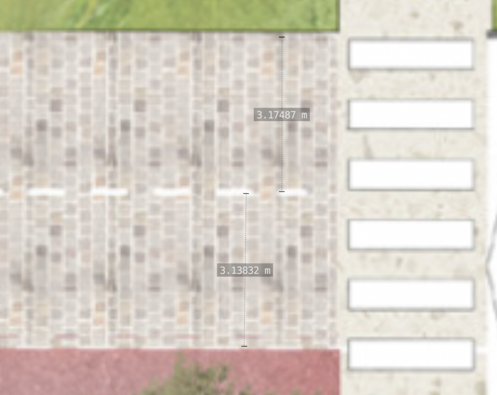
To estimate the proposed footpath widths of the concept model and take other comparisons, LiDAR scans on an iPhone were taken at 5cm resolution of both footpaths along with the street cross section at the specified location.
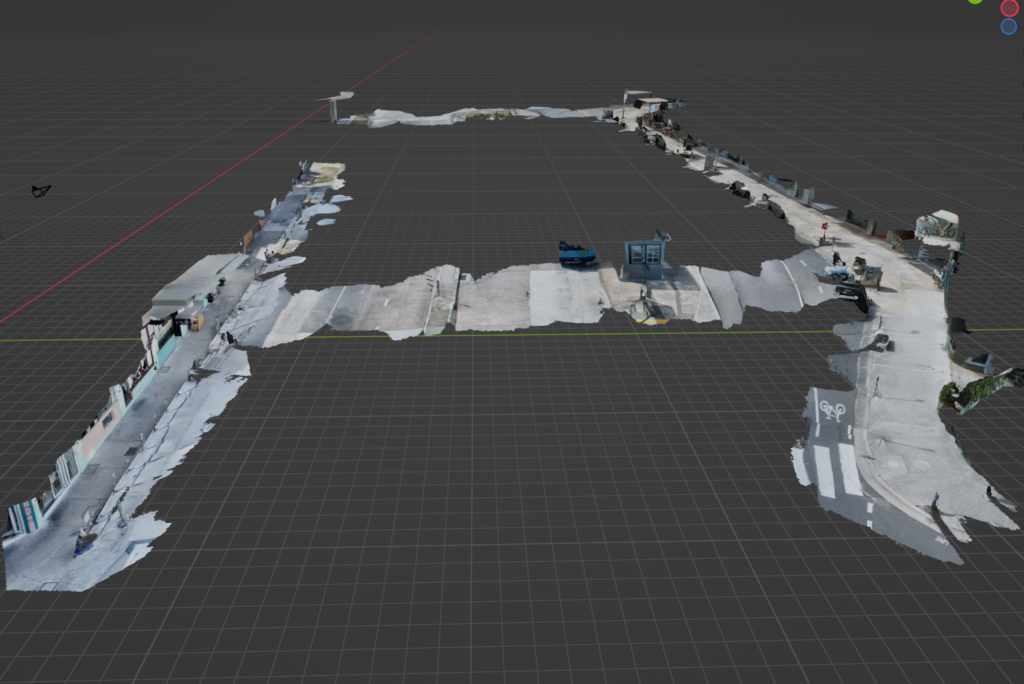
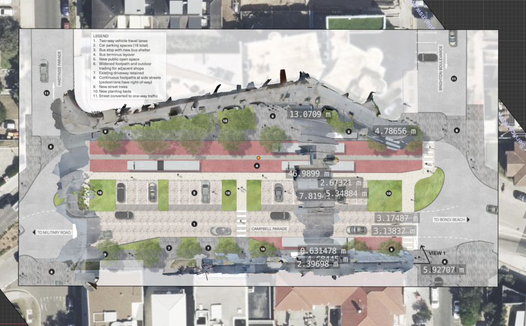
After scaling the concept image and NSW DCS imagery to match the 3D models assembled in 3D modelling software, the following are the estimated widths of various features.
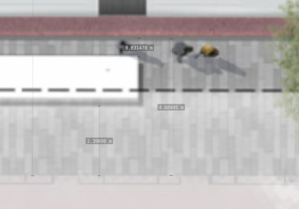
- Clear footpath width at NW bus stop (figure 3): ~2.4m
- Clear footpath width between fig 3 bus stop edge and kerb: ~0.6m
- Total footpath width at fig 3 including bus stop: ~4.7m
- Car road lane width: 3.2m
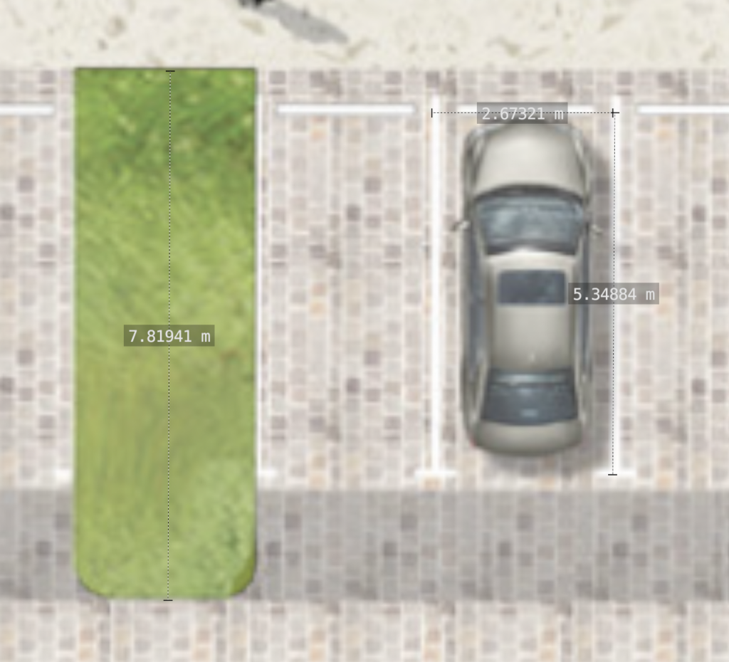
- Car park width (line centreline to centreline): 2.7m
- Car park height: 5.3m
- Car park height (curb to road lane edge): 7.8m
- Brighton Boulevard continuous footpath kerb to kerb width (figure8): 5.9m
- Min footpath width, kerb to shopfront, figure 9: 4.8m
- The road appears to rise 5 metres over 84 metres in a north-easterlydirection, a gradient of ~6%

These detailed 3d meshes and 3d model file with image overlays are available to download to reproduce these measurements.
Categorising by the TfNSW Walking Space Guide Summary the street should meet Type 5 criteria, which take the typical description of “Main street footpath — Very high activity”. The required clearance for Type 5 footpaths is 4.5 metres effective clearance (which excludes obstructions and the Kerbside Traffic Buffer).
The recommended Kerbside Traffic Buffer for a traffic speed limit of 50km/h is 1.65m, leading to a required total footpath width of 4.5 + 1.65 = 6.15m.
The Waverley’s People, Movement & Places — Strategy Report states a key issue identified is “Insufficient space for pedestrians on footpaths”, and a key action area is “Widen footpaths along Campbell Parade and directly adjacent streets, including median widening on Campbell Parade.”
This street serves dual functions as a bus terminus and commercial retail street. Any decision to implement footpaths narrower than the TfNSW Walking Space Guide should be made with a very good reason stated publicly. Preserving 18 perpendicular car parks at the end of the busiest bus route in NSW is not a sufficient reason to contravene best practice TfNSW policy.
1.1 Continuous footpath treatments
Better Streets supports the implementation of continuous footpath treatments to improve street safety, however intersection widths may need to be revised.
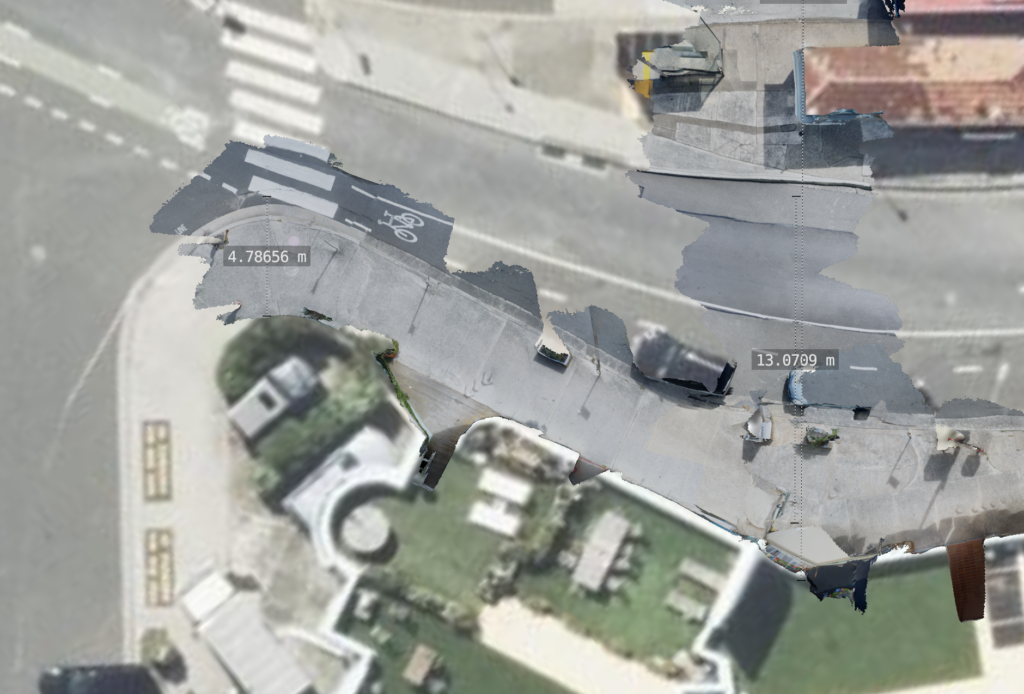
At Brighton Boulevard, the continuous footpath kerb to kerb width (at figure 8) is 5.9m.
Brighton Boulevard is currently a one way street north-east bound (and there is no indication of this changing), so while a contra-flow bicycle facility should be implemented, the road width should be narrowed for traffic calming. The concept design also displays a car facing in the wrong direction crossing this intersection. Depiction of this intersection as two way appears to be a mistake.
It is understood from the in-person consultation session that the continuous sidewalks on the right side of the concept are proposed to be 150mm above road level with a suitable gradient.
Bollards may create an ambiguous message contradicting that pedestrians have right of way on continuous footpaths, and should be removed if public safety can be preserved through other treatments.
The existing condition of crossings is in a dire and outdated state of repair, impacting accessibility and safety.
1.2 Zebra crossings and traffic calming
It is understood from the in-person consultation session that the entire patterned section of Campbell Parade is intended to be raised at 150mm (potentially with a cobblestone or other patterned treatment) with the footpath gradually rising to provide 150mm at bus stop boarding. The bus-only lanes opposite Campbell Parade are not currently proposed to be raised.
Better Streets supports a 30 kph speed limit in residential areas or areas with high pedestrian activity.
Better Streets supports raised zebra crossing treatments. We also support Campbell Parade being raised to signal it as a pedestrian focused space.
See the cycling section below for criticism regarding suitability as cycling infrastructure.
The Sydney Morning Herald’s article Why locals are fighting against a council’s plan to plant trees at North Bondi, Andrew Taylor, June 11, 2023 included the following on a previous draft design of the project:
Proposed traffic-calming measures such as a raised pedestrian crossing are also opposed by some councillors. “We believe that this would exacerbate an existing bottleneck, further increasing traffic congestion in one of three entrances into and out of Bondi Beach,” Goltsman said.
The Our Liveable Places Centres Strategy 2020 – 2036 suggested actions under “access” should include “Reduce and calm traffic movements to create safe pedestrian environments”
If the area is to maximise public space, create a contemporary village atmosphere that encourages dining and shopping, and improve pedestrian safety throughout the village, traffic calming should be a goal. Traffic calming and pedestrianisation has a positive impact on local businesses (Drennen, Emily. Economic Effects of Traffic Calming on Urban Small Businesses. 2003) (Hass-Klau, Carmen. “Impact of Pedestrianization and Traffic Calming on Retailing: A Review of the Evidence from Germany and the UK.” Transport Policy, vol. 1, no. 1, Oct. 1993, pp. 21–31).
Zebra crossings should be raised as traffic tables (or as a raised section) with a suitable incline for buses (to minimise discomfort and noise), speed limits should be reduced from 50kmh to 30kmh, and a separated cycleway should be installed (see below cycling section).
3. Car parking
Better Streets does not support the central car parking bays.
The implementation of these car parks also runs counter to the project goal of “Maximise areas for new public space”.
Section 3.1 shows this is a busy terminus and is well serviced by transit. 3.2 shows issues with perpendicular parking, including safety and future road space reallocation concerns. 3.3 discusses the safety risk of a wider road width. 3.4 discusses the merits of pricing parking at its true cost if any is retained. 3.5 shows misguided opinions of local businesses and demonstrates a lack of engagement with local businesses on how public space improvements, cycleways and transit improve business far more than car parking.
This proposal including 18 car parks appears to be a concession due to misplaced community concern that removing car parking would impact business.
Replacing on street parking with safe bike lakes has positive local economic impacts, and it is the job of governments and leaders to commuicate this. (Lee, Alison, and Alan March. “Recognising the Economic Role of Bikes: Sharing Parking in Lygon Street, Carlton.” Australian Planner, vol. 47, no. 2, June 2010, pp. 85–93) (Arancibia, Daniel, et al. “Measuring the Local Economic Impacts of Replacing On-Street Parking With Bike Lanes: A Toronto (Canada) Case Study.” Journal of the American Planning Association, vol. 85, no. 4, Oct. 2019, pp. 463–81) (Jeffe, Eric. “The Complete Business Case for Converting Street Parking Into Bike Lanes.” Bloomberg CityLab, 13 Mar. 2015) (Clifton, Kelly, et al. Consumer Behavior and Travel Choices: A Focus on Cyclists and Pedestrians. 2013)
This appears to be the latest of a large number of proposals, including 3 new concepts presented in 2023 and a 2016 consultation:
Fellow Liberal councillor Angela Burrill echoed the same sentiment when she spoke with City Hub, stating that the “3 new concepts are much the same as previously rejected by businesses in Council’s 2016 consultation.” “Concerns were raised about loss of parking and large palm trees blocking beach vistas,” Cr Burrill said. “7 years later and we’re back to square one with no clear plan to upgrade this important local centre.” (CityHub)
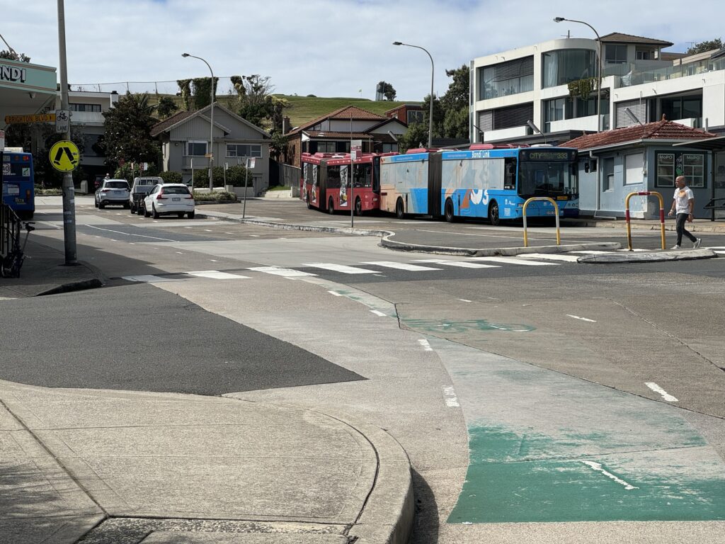
3.1 This is the terminus of the busiest bus route in NSW
The 333 is the busiest route in the entire state of NSW. In the year to September 2019, the route carried 8.7 million commuters, averaging 22,000 people per day. The southern end of the site is 120 metres from the sand of Bondi Beach with an estimated peak of 40,000 visitors per day in summer. Between the terminus interchange for such a busy bus route and a “contemporary village atmosphere that encourages dining and shopping” is not a suitable location to sandwich 18 perpendicular car parks.
3.2 Issues with perpendicular parking
The “Our Liveable Places Centres Strategy 2020 – 2036” suggested actions under “public realm” should include “Temporary activation such as pop-ups/ parklets”. Perpendicular bays in the centre of the road prevent road space reallocation adjacent to local businesses in future (unless at great cost).
The central car parking bays appear to be non-compliant with Austroads as they’re too long.
ABC News has reported (What’s with reverse angle parking in so many country towns?) that:
The Australian Standard for On-street parking spells out how each different arrangement should be laid out and the road widths required for each type. It lists 90 degrees as the angle that provides the most number of car parking spots, however the greater the angle, the greater the road width needed. The document says “all forms of angle parking present a greater hazard to road users than parallel parking” and the use of angle parking “may need to be considered in conjunction with other measures designed to lesson the adverse effects”.
The Austroads Guide to Traffic Management Part 11: Parking (2017) states under 8.5:
More roadway width is required for angle parking bays and associated parking manoeuvres. This requirement may present a problem for commercial vehicle parking as the increased length of those vehicles may encroach into traffic lanes. Hence adequate parallel parking space should be provided for those vehicles. All angle parking presents a greater hazard to road users than parallel parking. This situation is mainly due to the fact that parking at an angle always requires reversing which causes bottleneck effects in the moving traffic and may lead to collisions directly involving the reversing vehicle. There can be sight/visibility issues and increased conflict with pedestrians crossing midblock.
This information suggests 90 degree parking has been chosen to maximise car parking spaces at the expense of pedestrian safety, and road collision risk.
3.3 The large perceived road width will increase driver speed and crash risk
The long length of the car spaces (~7.8m including buffer space) will make the road reserve appear wider to drivers. When the road is perceived as wider, drivers increase speed, and thus crash risk increases (Road design factors and their interactions with speed and speed limits, Monash University Accident Research Centre – Report # 298, Jessica Edquist, Christina M. Rudin-Brown and Michael Lenn, 15 May 2009). This space should be given to footpath space instead.
3.4 If parking is retained, it should be paid
Parking spaces are currently signposted as 1/2 P 9am – 7pm (free parking, 30 minutes maximum).
If some car parking is retained, it should be paid parking to reflect the high demand in this location with a price set based on regular surveys to ensure a maximum 85% occupancy rate (Austroads, 2017).
Assuming all motorists use the free parking for the maximum amount of time, there are 20 available sessions of 30 minutes per car park per day. This means the car parking potentially services only 360 vehicles per day. Bondi Beach (120 metres away) receives up to 40,000 visitors per day and while Opal patronage per bus stop is not available, it is the terminus of a the very busy 333 route.
This is a terrible waste of at least 155 square metres of real estate with views of Bondi Beach in this very busy location.
Free parking has numerous negative externalities and a price would reflect this (“The High Cost of Free Parking.” Journal of Planning Education and Research, vol. 17, no. 1, Sept. 1997, pp. 3–20, https://doi.org/10.1177/0739456X9701700102](https://doi.org/10.1177/0739456X9701700102)
The Austroads Guide to Traffic Management Part 11: Parking (2017) states:
As pay parking generally results in reductions in car use and traffic congestion among other environmental benefits, it is one of the essential transport measures necessary to ensure the long-term viability of commercial centres.
“For traffic management — peak period fees should be high enough to encourage a shift in travel modes or times.” and “For parking management — fees during peak demand periods and at the most convenient locations should be high enough to generate a maximum 85% occupancy rate. If prices are too low, parking becomes saturated causing motorists to cruise around in search of a space. The target is to ensure that at times of peak demand, 15% of spaces (one in seven) are available.”
3.5 Car parking concerns in the media demonstrate a lack of engagement with local businesses
It is extremely common for local businesses around the world to “substantially misjudge customer travel modes, underestimating transit and active modes and overestimating automobile use” (Von Schneidemesser, Dirk, and Jody Betzien. “Local Business Perception vs. Mobility Behavior of Shoppers: A Survey from Berlin.” Findings, June 2021).
The Sydney Morning Herald reported on concerns of local businesses in response to 3 previous draft plans in mid 2023 which appears to have proposed removing parking (Why locals are fighting against a council’s plan to plant trees at North Bondi, Andrew Taylor, June 11, 2023.
This latest plan appears to be the latest in a succession of proposals. These previous draft plans do not appear to be public, and were unable to be found in the June 2023 or other months of Waverley council meeting agendas.
Quotes included:
Fellow councillor Leon Goltsman also said the options for the area included ideas such as fewer parking spaces and palm trees that have previously been rejected. “Wider footpaths? Yes. Palm trees blocking views? No,” he said. “Most importantly, let’s not cut parking and put our local businesses in a bind.”
Ropers Seaside Pharmacy owner John Roper said the retail strip needed to be tidied up and made safer for pedestrians, but the council’s plans would “basically do away with the business precinct”. Shops would be hidden behind nature strips, car parking spaces would be removed and “people will simply not be able to come here”, Roper said. “There won’t be anywhere to stop.”
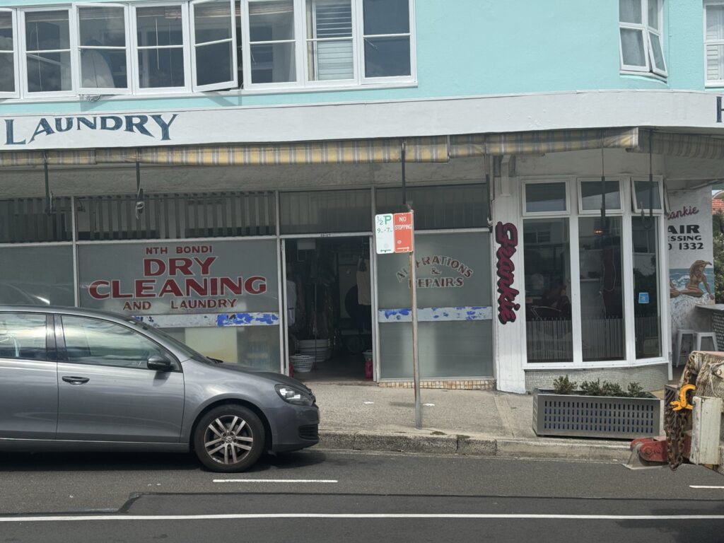
Cafe Bondi owner Danny Macri said the shopping strip needed more, not less, car parking.
North Bondi Precinct convenor Peter Quartly said any reduction in car parking spaces would face opposition from residents. “The old chestnut that residents use buses is wrong,” he said. “The buses are crowded especially during peak hours and there is nowhere to house any additional buses in the area.”
These quotes demonstrate a lack of engagement with local businesses of the benefits of removing car parking to implement wider footpaths, outdoor dining spaces and safe separated cycleways.
There is no evidence presented suggesting the majority of business customers arrive by car, and if there was there is no evidence this demand could not be shifted to walking/buses/cycling. This is lazy reporting by the Sydney Morning Herald to present these quotes without including the multitude of research papers across the last few decades regarding parking near high street businesses.
More confoundingly, survey after survey has shown that business owners overestimate how many of their customers drive to their stores, versus walking or biking. In a study of the effects of street improvements on a shopping corridor in Los Angeles published in 2012, more than half of the store owners on the bike-laned part of the boulevard thought most of their customers drove. The actual number was 15%. (Business Insider, 2024)
The quote from the North Bondi Precinct convenor claims that residents do not use buses, and in the next sentence that the buses are crowded especially during peak hours. In case this claim isn’t immediately identified as invalid, this is a terminus bus station – a terminus station means bus users must be local residents.
4. Cycling
Section 4.1 shows that Waverley council has endorsed policy itself to prioritising bicycles as a travel mode above private vehicles. Section 4.2 shows that this road is a critical segment of multiple priority designated bicycle routes across the council. Section 4.3 shows there is an existing “car door lane” painted cycleway. Section 4.4 shows why the street does not meet that TfNSW quietway facility type as described in the TfNSW Cycleway Design Toolbox. Section 4.5 shows that there are 18 car parks marked on the concept design and no bicycle parking.
Based on these reasons, Better Streets believes a safe separated cycleway should be implemented on the street to meet endorsed council transport policy and TfNSW guidelines. Additionally, sufficient bicycle parking should be provided at a minimum (guidelines and best practice suggest “lockable enclosures, shelter or compound” should be provided).
4.1 Expectation of safe cycling infrastructure
The project say it aims to:
- Implement sustainable elements where feasible
Waverley Council’s transport plan Waverley’s People, Movement and Places: where we go and how we get there was endorsed in December 2017. It states:
We will prioritise travel modes in the following order:
- Pedestrians
- Bicycles
- Public Transport
- Service vehicles and shared mobility
- Private vehicles
4.2 Place in cycling network road hierarchy
The current cycling map on the Waverley council website cycling page (with a copyright year of 2007!) states the north bondi shops portion of Campbell Pde makes up a segment of the “Coastline Cycle Route – South Head to Botany Bay” and is a designated “Local bicycle route on high-traffic street”.
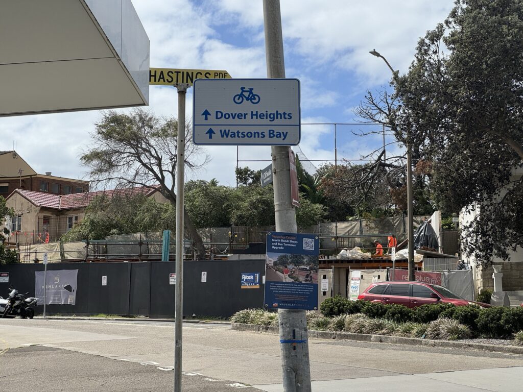
This section of Campbell Pde is on Council’s priority routes in the Waverley Bike Plan 2013 and forms segments of the Priority Waverley Bicycle Routes Route 1 and Route 6. North Bondi is marked as a “Destination Point” in this plan.
The current Waverley’s People, Movement and Places report, drafted in mid 2017 and endorsed in December 2017 states “The Waverley Bike Plan 2013 forms the core of Waverley’s current cycling infrastructure network but needs to be much more ambitious to achieve our community’s request for more separated safe cycling infrastructure.” – so the 2013 plan should be considered a minimum target rather than aspiration target.
The Our Liveable Places Centres Strategy 2020 – 2036 suggested actions under “18.5.3 Transport and Accessibility” include: “Improve cyclist safety: Improve local cycle route to create safer movement corridors for cyclists down Military Road, through North Bondi and towards Bondi Beach. Improve driver awareness and markings on road, and investigate the provision of a separated cycleway.”
It also states “For every person who commutes by bicycle to work or study, there is one less car on the road or taking up a bus seat. Whilst separated cycle lanes may take some on-street car parking spaces, when a bike rider reaches their destination they leave ample room for others to park their cars instead.” (pg. 20)
The Waverley’s People, Movement & Places — Strategy Report states a key issue identified is “Bondi Beach has very high mode share of bicycle riding, and would benefit from separated, high quality cycle paths along key routes.” with an action area of “Provide separated cycleways along routes of high demand (e.g. Campbell Parade)…”
4.3 Existing cycleway
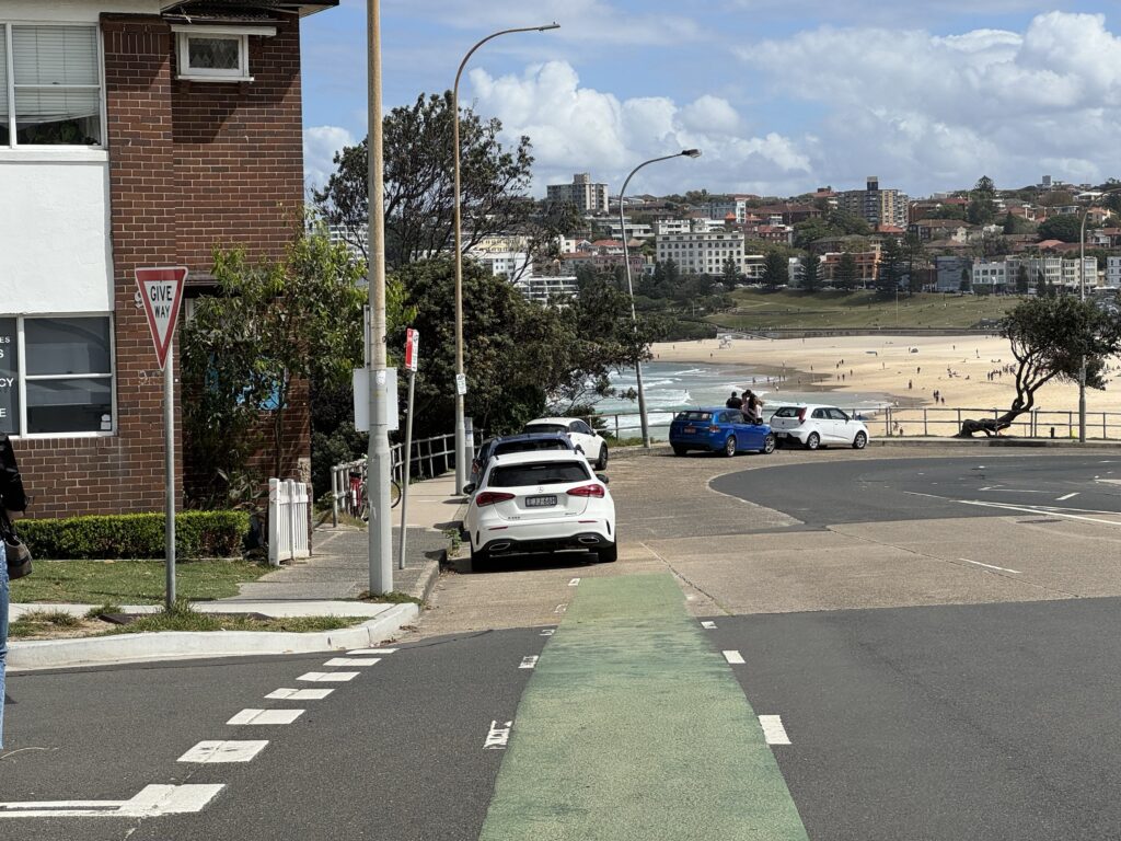
This section of Campbell Parade currently includes a painted bicycle lane.
Cycling infrastructure must not only be safe but should also be perceived to be safe so that people of all ages and abilities feel comfortable using the facilities.
This lane is right outside the car door zone which is not perceived or practically safe to ride in.
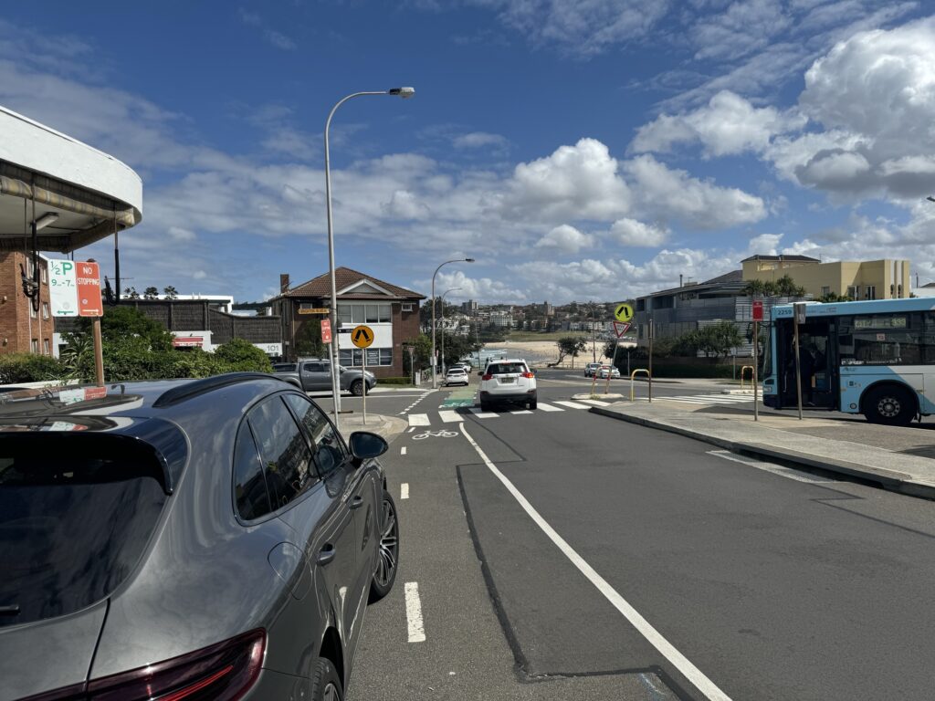
Paint is not infrastructure: it does not function as a safe cycleway and does not promote cycling, and also creates a perception that bicycles are not allowed to cycle in the traffic lane outside the dangerous door zone.
Additionally the lane ends abruptly, throwing cyclists into an unsigned merge into heavy traffic on a steep gradient.
4.4 Why the street isn’t suitable as a quietway facility type
It is understood from the in-person consultation session that the entire patterned section of Campbell Parade has the potential to be surfaced with a cobblestone or another patterned treatment and a reduced speed limit.
The quietway facilty type described in the TfNSW Cycleway Design Toolbox states several considerations for whether a quietway is suitable safe cycling infrastructure:
Low volume (>2,000 passenger car unit/day) and speed of motorised traffic Unsuitable on roads that carry a significant amount of through traffic, commercial vehicles or trucks, or are positioned along bus routes
- This road appears to have a high volume of vehicles, however councilhas not provided traffic counts
Not suitable as part of a high priority commuter cycling route unless key design elements are applied to provide crucial visual cues to all road users on appropriate speeds and behaviours
Quietways should be located on roadways with gentle (ideally flat) gradients as steep uphill sections would cause conflicts between motor vehicles and people cycling.
- The street has a considerable gradient, possibly 5 over 84 metres(6%) in a north-easterly direction
These factors suggest this street is not suitable to meet the requirements of a “quietway” facility type, so this does not function as safe cycling infrastructure (in the absence of a separated cycleway).
Cobblestone or other rough road treatments do not support cycling. They also increase road noise, which should be minimised so the street can function as “…a contemporary village atmosphere that encourages dining and shopping”
4.5 The design doesn’t include any bicycle parking (but includes 18 car parks)
The proposed concept plan has 18 car parks (covering over 155 square metres based on the estimated measurements) and no marked bicycle parking – let alone bicycle lockers, wide parking for cargo bikes or E-bike chargers. The Waverley Council: Our Liveable Places Centres Strategy 2020 – 2036 states that increased bicycle parking reduces the need for car-parking:
“For every person who commutes by bicycle to work or study, there is one less car on the road or taking up a bus seat. Whilst separated cycle lanes may take some on-street car parking spaces, when a bike rider reaches their destination they leave ample room for others to park their cars instead.” (pg. 20)
The Austroads Guide to Traffic Management Part 11: Parking (2017) states: “Bicycle parking facilities should be provided in small clusters within 100 m of common commuting and recreational destinations of bicycle trips such as schools, shopping centres, railway stations, bus terminals/interchanges, workplaces, sportsgrounds etc.”.
Table C9 1: Classification of bicycle parking facilities states for “Bike-and-ride commuters at railway and bus stations” the parking classification is “Fully enclosed individual locker”, and for “Regular employees, students regular bike-and-ride commuters” the facility description is “Lockable enclosure, shelter or compound fitted with class 3 facilities where cyclist is responsible for locking their bicycle within the communal enclosure”.
Along with ample supply of bicycle stands to support short trips to the local shops, more substantial bicycle enclosures, shelters or lockers should be considered for commuters. The Our Liveable Places Centres Strategy 2020 – 2036 suggested actions under “18.5.3 Transport and Accessibility” include: “E-bike chargers: Provide e-bike chargers and share bike pick-up/drop-off zones.”