Category: Infrastructure
-
Creating aerial imagery with a bike helmet camera (GoPro) and OpenDroneMap
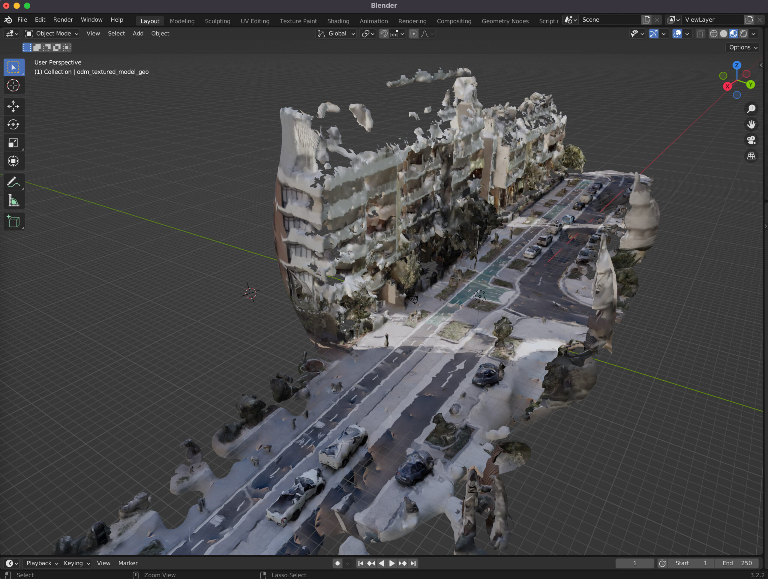
This technical guide details how you can create your own orthorectified (aka satellite view/bird mode) imagery, point clouds and 3D models of streets with nothing but a 360 degree camera mounted on bicycle helmet, and the open source photogrammetry software OpenDroneMap.
-
Observations from Australia’s first Micromobility Conference
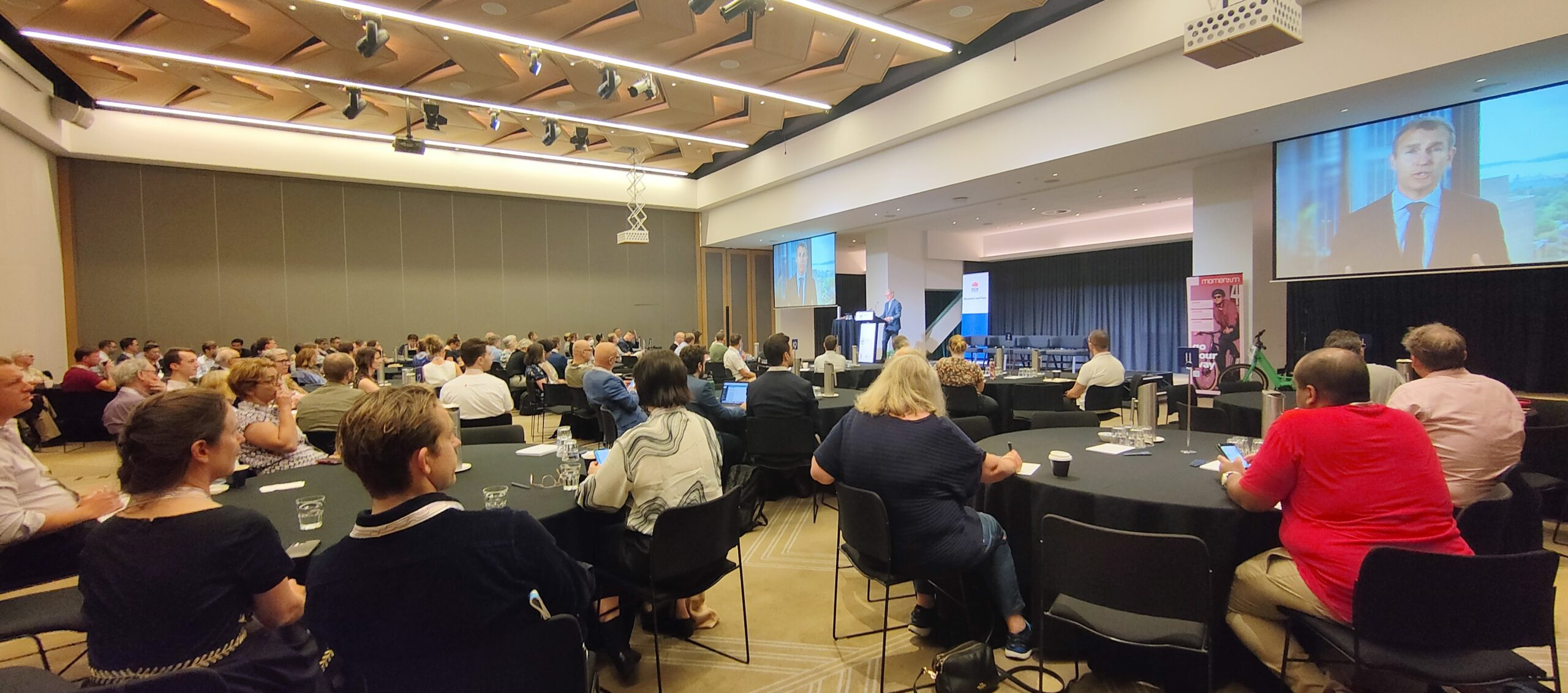
Over the weekend I attended Australia’s first micromobility conference. The sessions were organised into themes reflecting the challenges Australia faces in transitioning it’s transport network and urban planning – from car and highway dominated streets to a safer, lower emission and more pleasant city permitting cycling, walking and other journeys.
-
Mapping Sydney Billboards: Every QMS advertising panel in Sydney
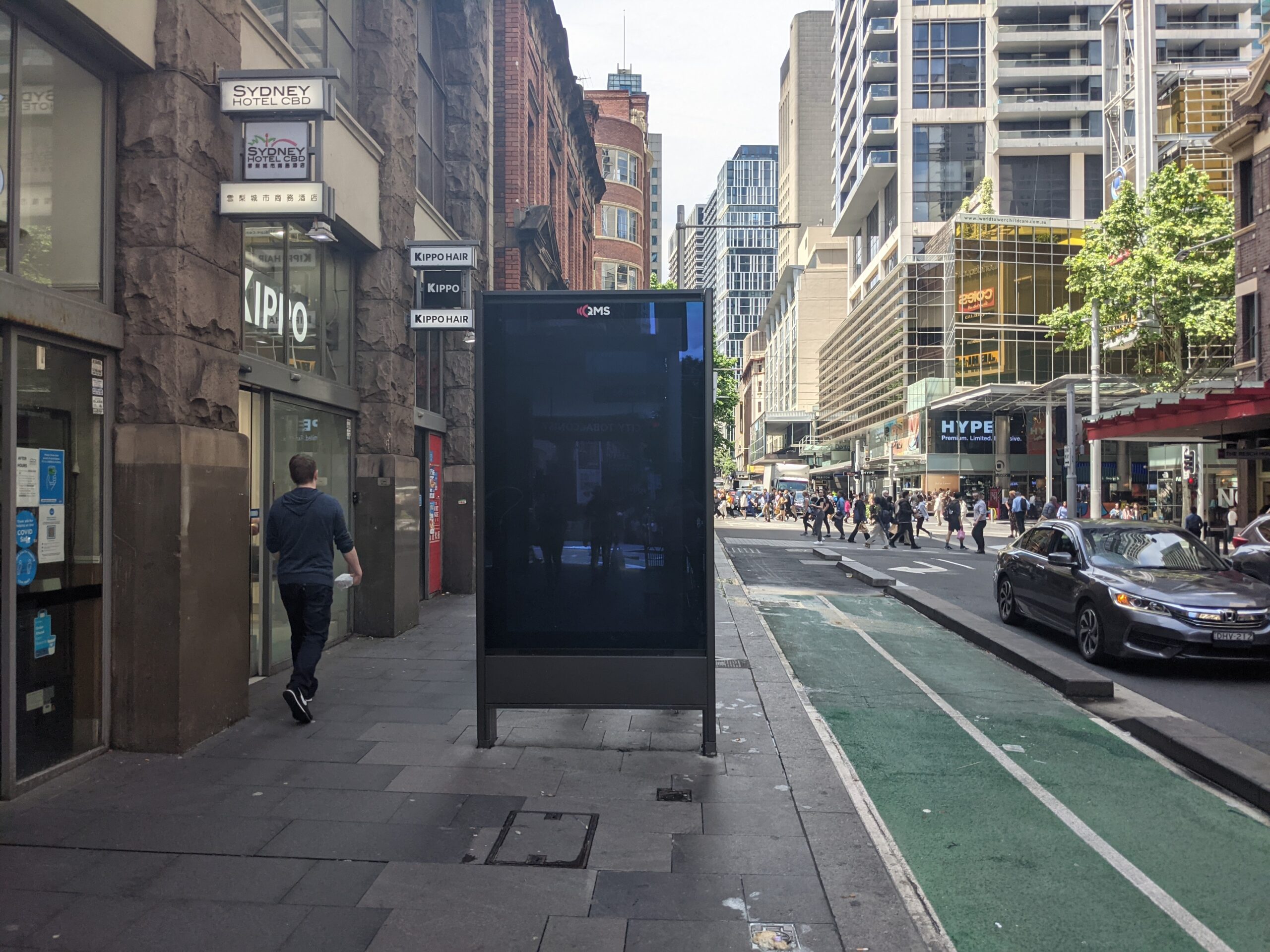
Map live at SydneyAdvertisingMap.com. See also: Max Bo’s analysis of how many placed next to Telstra telephones: https://observablehq.com/@mjbo/sydney-qms-panel-public-telephone-pairings If you live in Sydney you will have seen them – the 86 inch advertising screens in the City of Sydney Council. These advertising panels are known as communication pylons in the language of the developer approvals.…
-
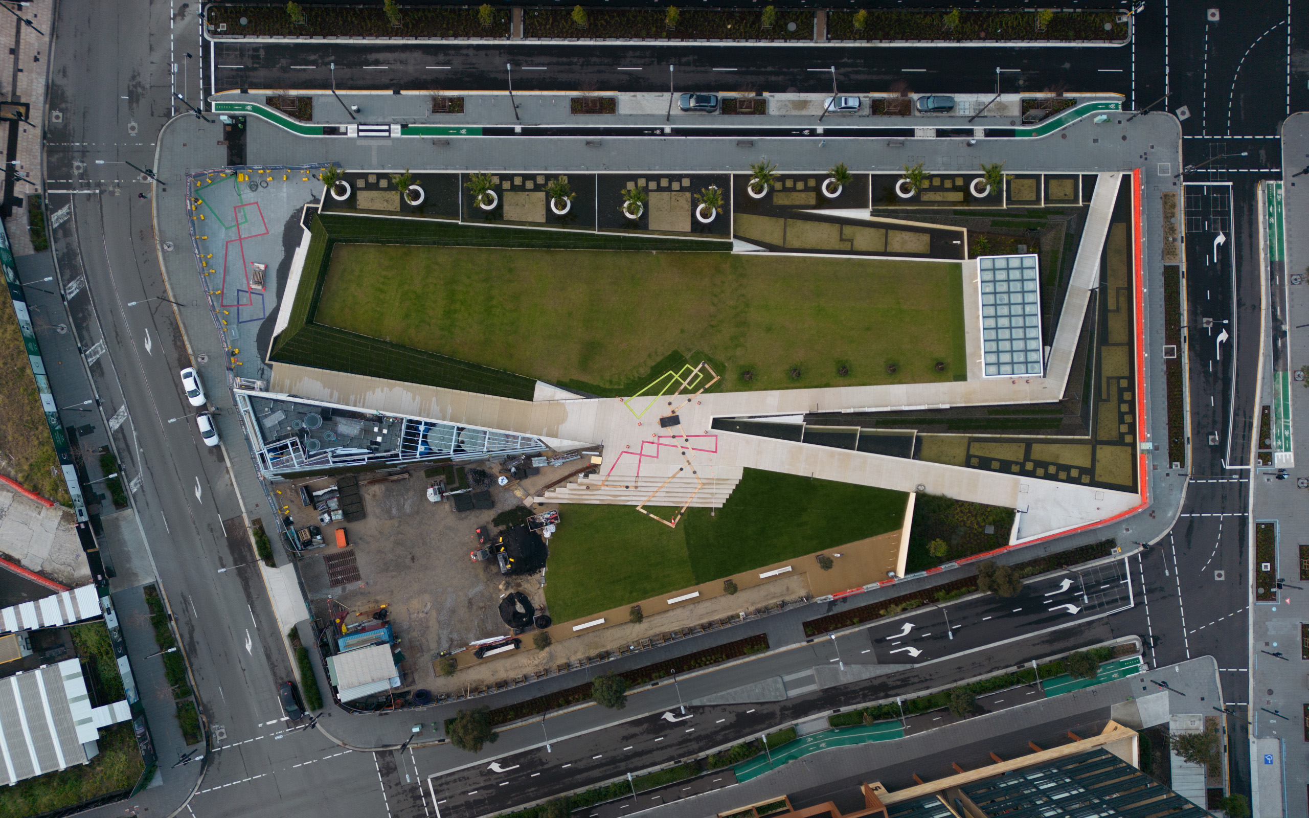
The Drying Green opening – a new Green Square park
On Saturday the 15th of October, Clover Moore (Lord Mayor of the City of Sydney) opened The Drying Green, the new centerpiece park of Green Square. It’s been in construction since March 2018 and includes areas of grass, wetlands which filter stormwater before it enters the wider system, and a barbecue and seating area. It…