Tag: TfNSW
-
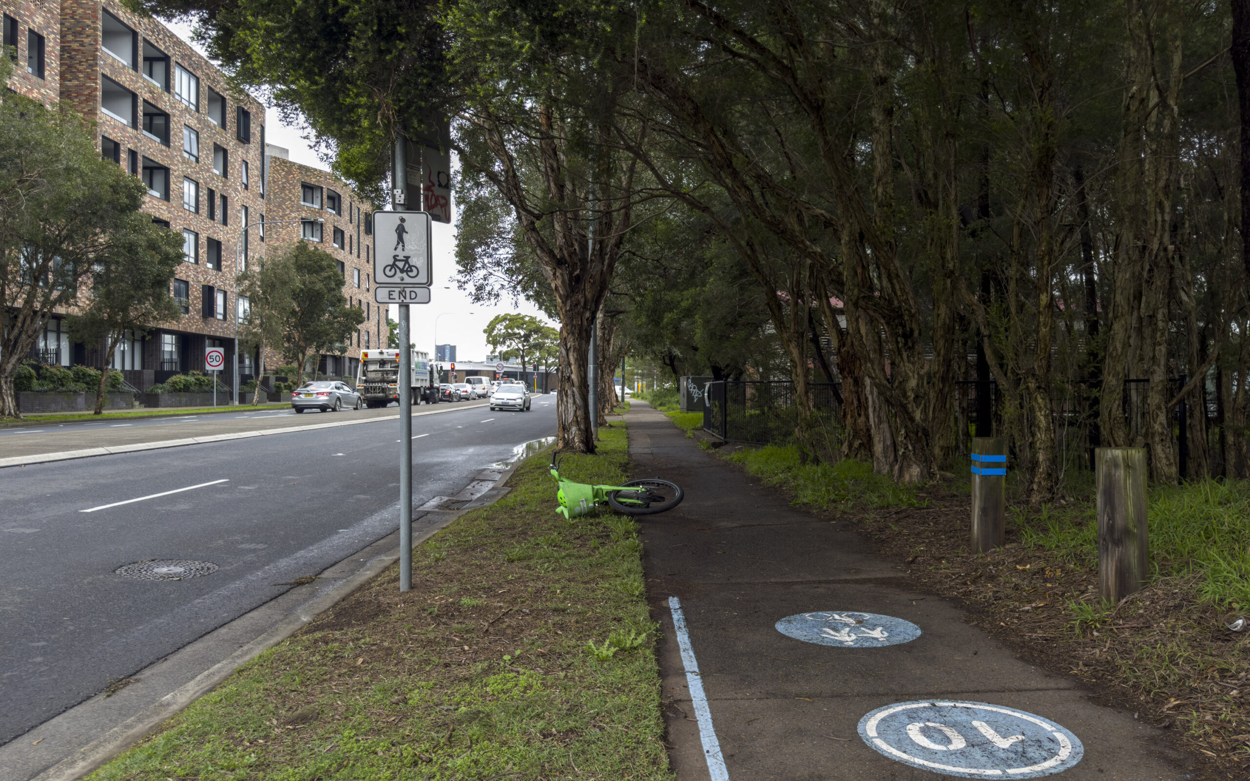
Better Streets Submission for Walking and Cycling Improvements between South Eveleigh and Waterloo Metro (Henderson Road)
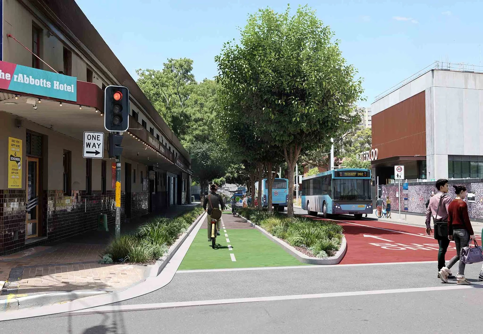
I wrote this submission on behalf of Better Streets for the proposed Walking and Cycling Improvements between South Eveleigh and Waterloo Metro (Henderson Road).
-
Have you heard of the Southern Arterial Route?
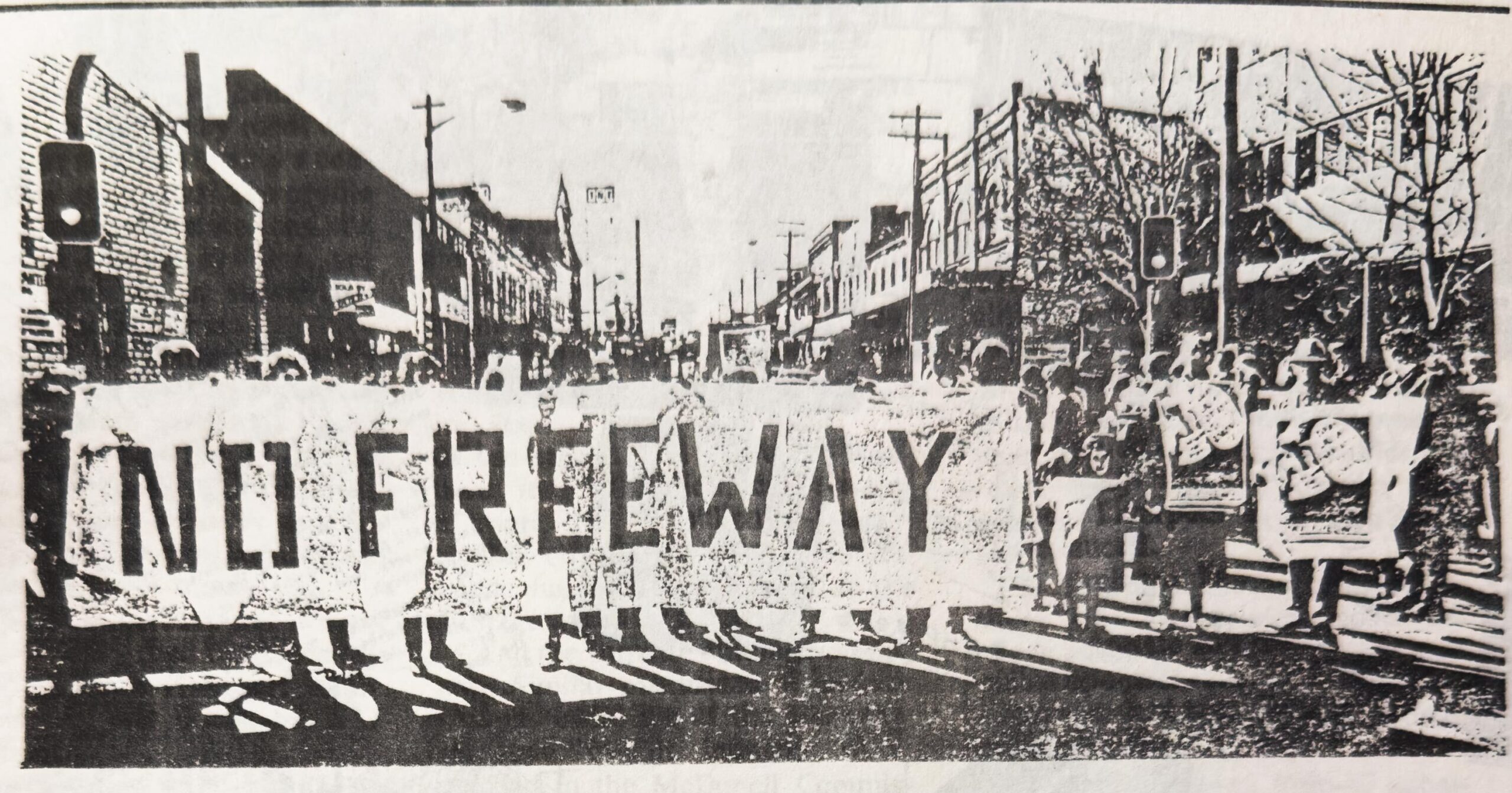
Have you heard of the Southern Arterial Route in Sydney? I hadn’t either – but you won’t be able to unsee the scar through Ultimo, Chippendale, Redfern and Waterloo. Here’s a ~12,000-word Wikipedia article with 153 references – with page numbers, for every sentence – to bring you and your search engine up to speed.
-
Why Won’t the Media Report Accurately on Road Deaths?
Yesterday, a man in his 30s riding a Lime e-bike, motor-limited to 25km/h, was struck by a 28-year-old man driving a garbage truck at Little Regent Street and Broadway, Ultimo – and died at the scene. This is a legal e-bike, and the man was just a few hundred metres from Sydney’s Central Station.
-
List of pedestrian, cyclist and personal mobility device road deaths in NSW in 2025
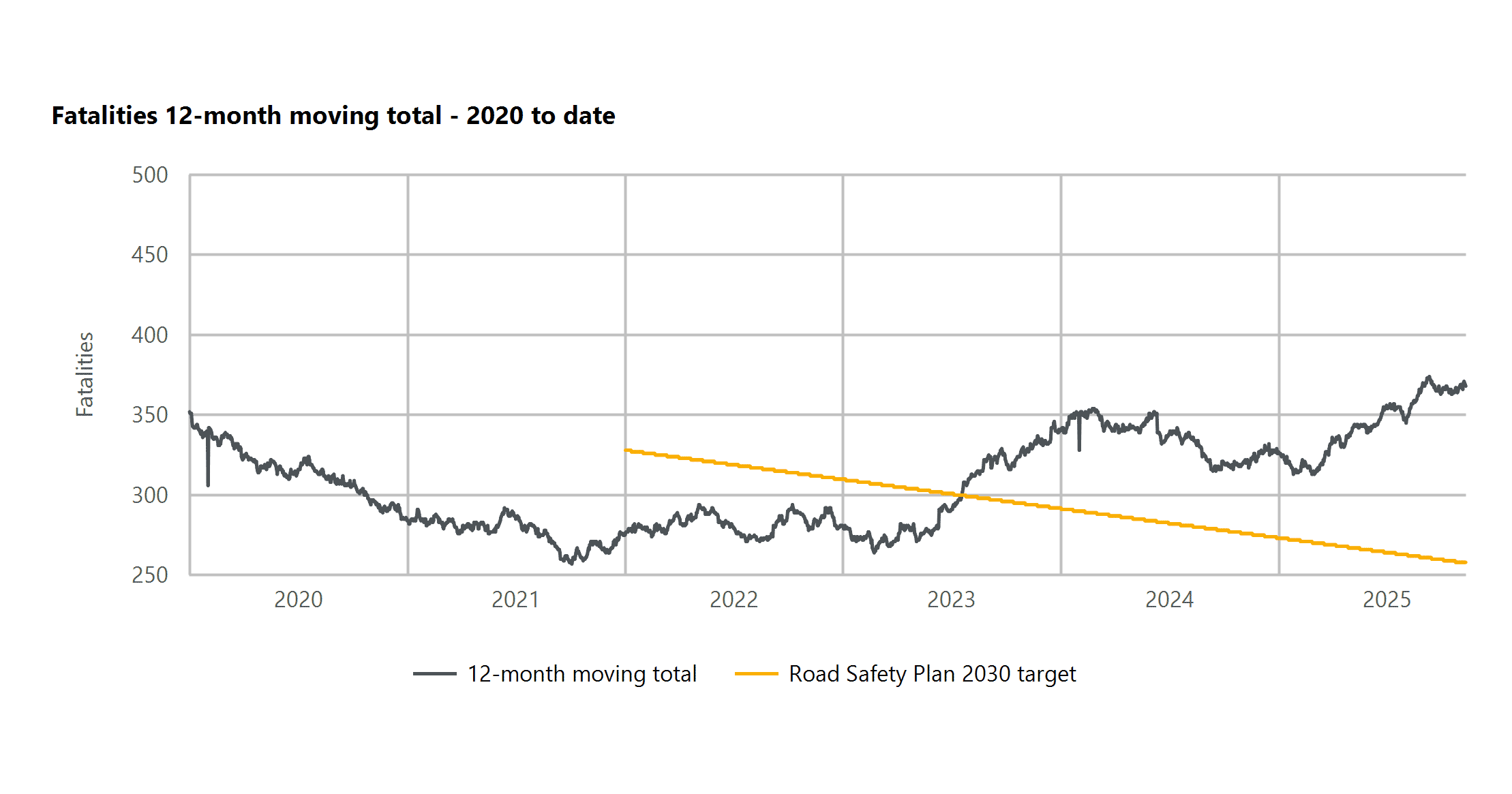
This page is a list of pedestrian, cyclist and personal mobility device road deaths across New South Wales (Australia) in 2025, sourced from NSW Police press releases and daily government statistics. It is not guaranteed to be complete or up to date; BITRE monthly bulletins should be referenced for complete statistics (though preliminary and subject…
-
Green Lights More Often: The Secret 2018 Study of Sydney’s Traffic Signals
On the 7th of January 2018, Transport for NSW (TfNSW) pulled off something extraordinary – and I personally paid $441 to obtain the previously secret reports documenting it. With such impressive results, why doesn’t TfNSW do it again?
-
Not enough funding for Sydney Park Junction – Addendum REF to cut scope
On the 20th of November 2024, Jenny Leong (the Green’s MP for Newtown) asked the State Minister for Transport 21 detailed questions in NSW Parliament regarding the status and fate of the infamous TfNSW Sydney Park Junction project. The public received a response from the Minister for Transport on the 20th of December 2024, which only included answers…
-
No Signal for Pedestrian Safety: TfNSW Refuses Signal Data During National Road Safety Week
This week is National Road Safety Week. Traffic injury is the biggest killer of Australian children under 15 and the second-biggest killer of all Australians aged between 15 and 24. 50 people walking are killed on NSW roads and streets every year and this figure is trending up. Many of these people are killed waiting…
-
Better Streets submission to the Epping Bridge Project
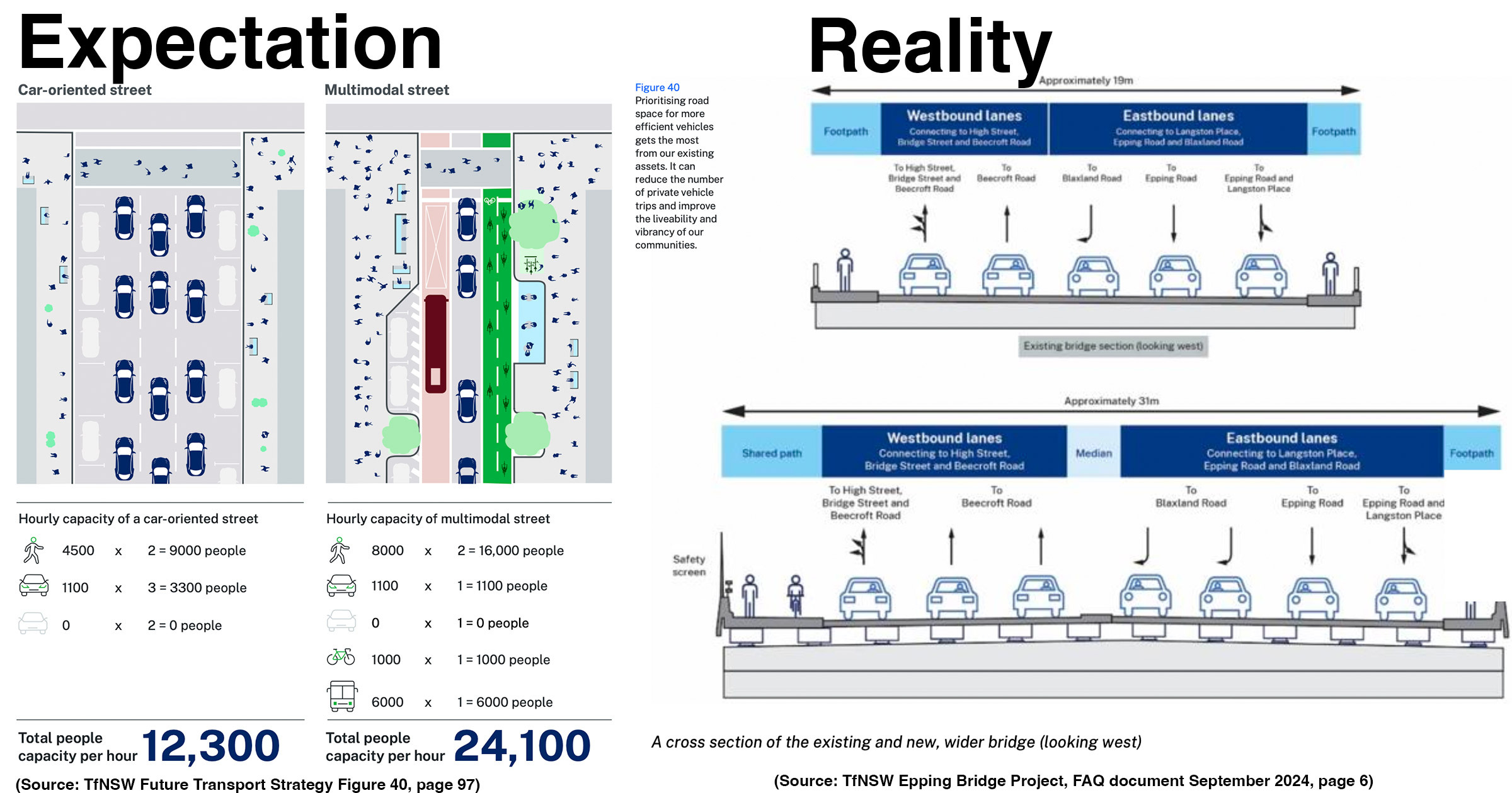
The Epping Bridge Project is first and foremost a road widening project (5 car lanes to 7 car lanes). It does not follow Transport for NSW’s own Road User and Space Allocation Policy or Movement & Place design framework, and at $220 million costs double the allocation for active transport for the entire state over…
-
Another broken WestConnex promise: secret Sydney Park Junction design changes
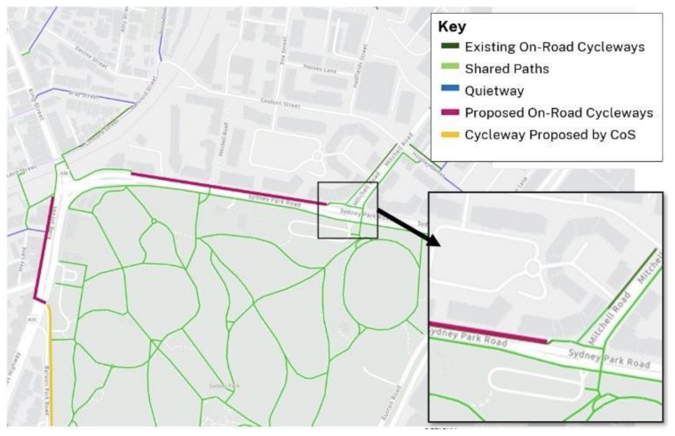
Ever wondered why there are random dead ends for cycle paths in Sydney? This is a deep dive on how one particular missing link might not get fixed after more than seven years of planning. Let this be a record of how hard it is to get safe cycling intersections built in Sydney, even when…
-
Why Did the Chicken Catch the Metro? Because It Was Faster Than Crossing the Road…
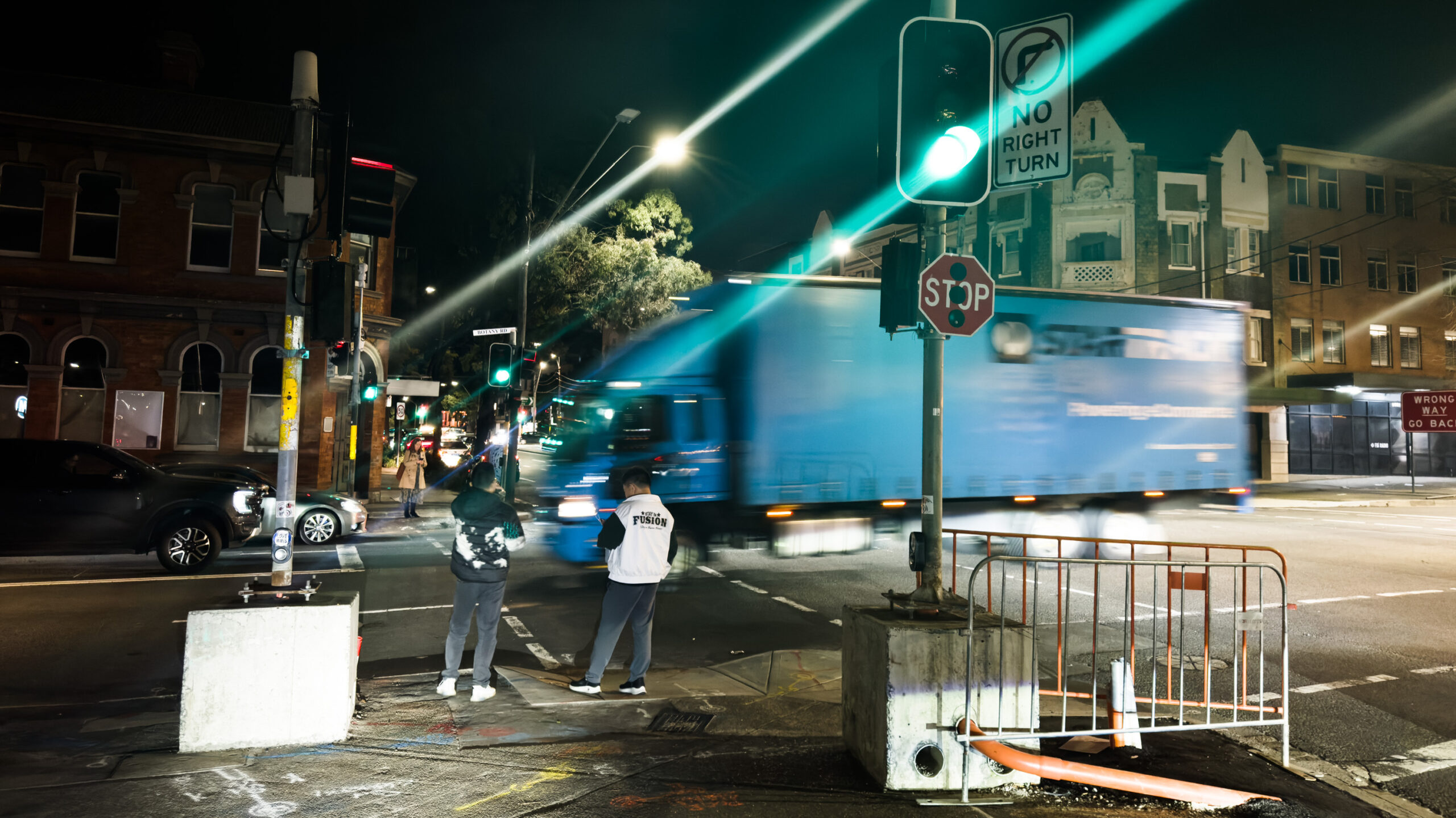
Sydney’s phenomenal new metro takes only ~100 seconds (1m40s) to travel from Central Station to the new Waterloo Station. However, you could be stuck waiting up to ~111 seconds (1m 51s) to cross Botany Rd just outside the Waterloo metro station when you arrive!
-
Shining a Light on the Traffic Signals of Sydney
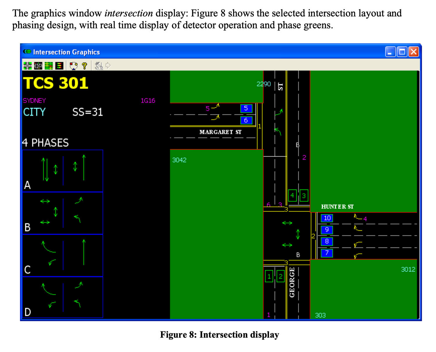
This blog post provides an overview of traffic signal operation in Sydney (focusing on the inner city), based on technical documentation, conversations with government & industry experts and data I’ve collected after building Better Intersections.
-
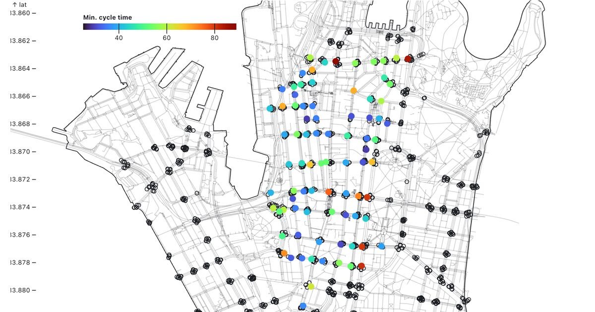
Mapping pedestrian traffic light timing in Sydney, Australia
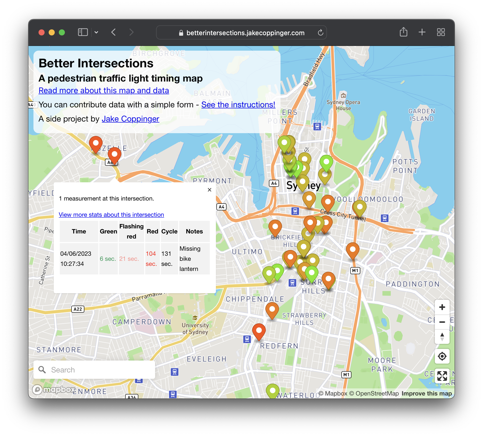
Better Intersections is a tool to record and visualise timing details for pedestrian and bicycle signals. In the absence of traffic light timing data, and as we hold hope for it to become publicly available; the aim of Better Intersections is to crowdsource measurements and inform where positive changes could be made.
-
Canada Bay Council plans to remove Heath St cycleway due to a misleading traffic report
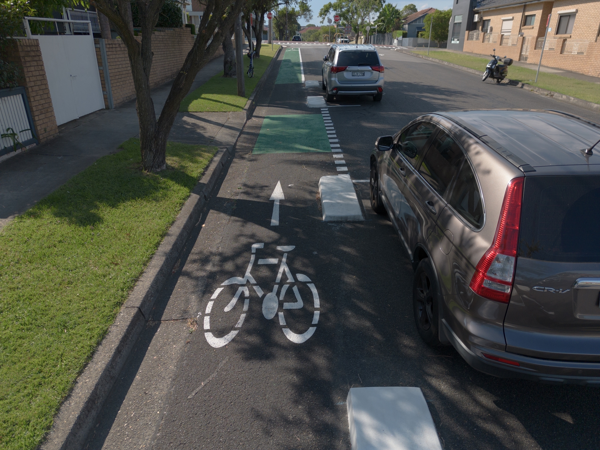
Canada Bay Council plans to remove the cycleway it received $7m of state funding for. In this analysis I outline errors and flaws in the engineering report recommending the removal (which has now been hidden from the Canada Bay Council website).
-
Visualising Sydney bus congestion with Marey charts
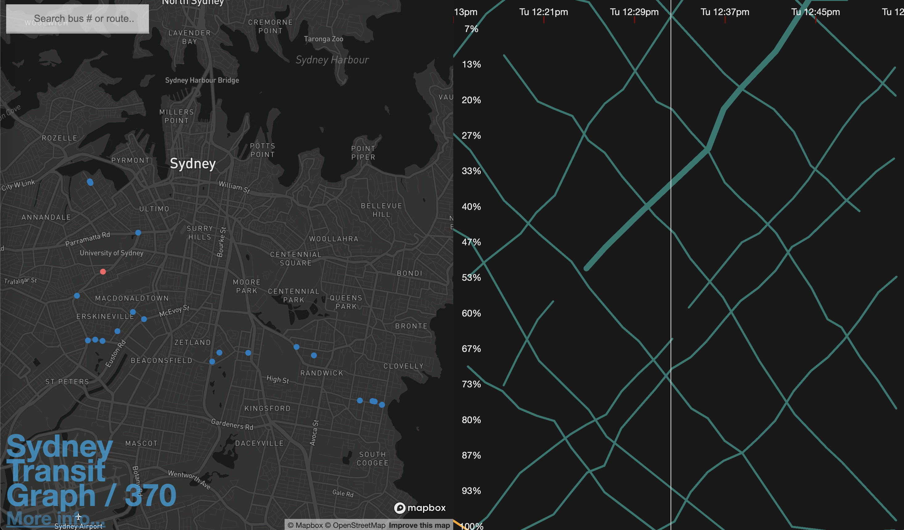
As a side project I built Sydney Transit Graph – a visualisation of real-time Sydney bus congestion. Each line on the graph (a Marey chart) represents a bus completing its route (percentage) over time.