Tag: map
-
Introducing the Heart Foundation’s Community Walkability Map
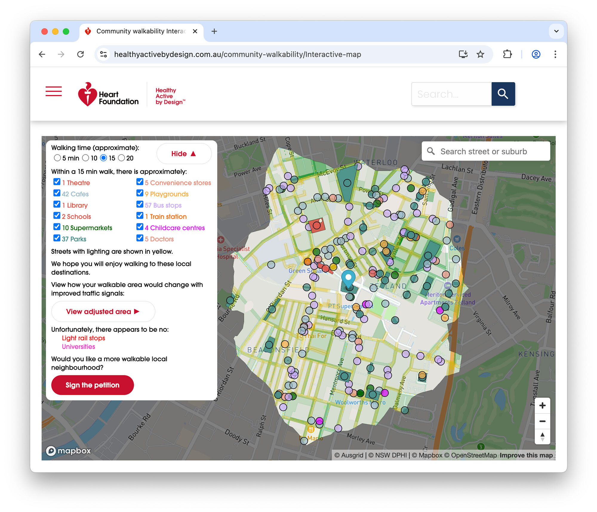
I’m pleased to share the completion of a recent commercial engagement with the Heart Foundation: the Community Walkability Map, a new interactive tool designed to help communities understand and advocate for more walkable, healthier neighbourhoods.
-
Mapping Sydney Billboards: Every QMS advertising panel in Sydney
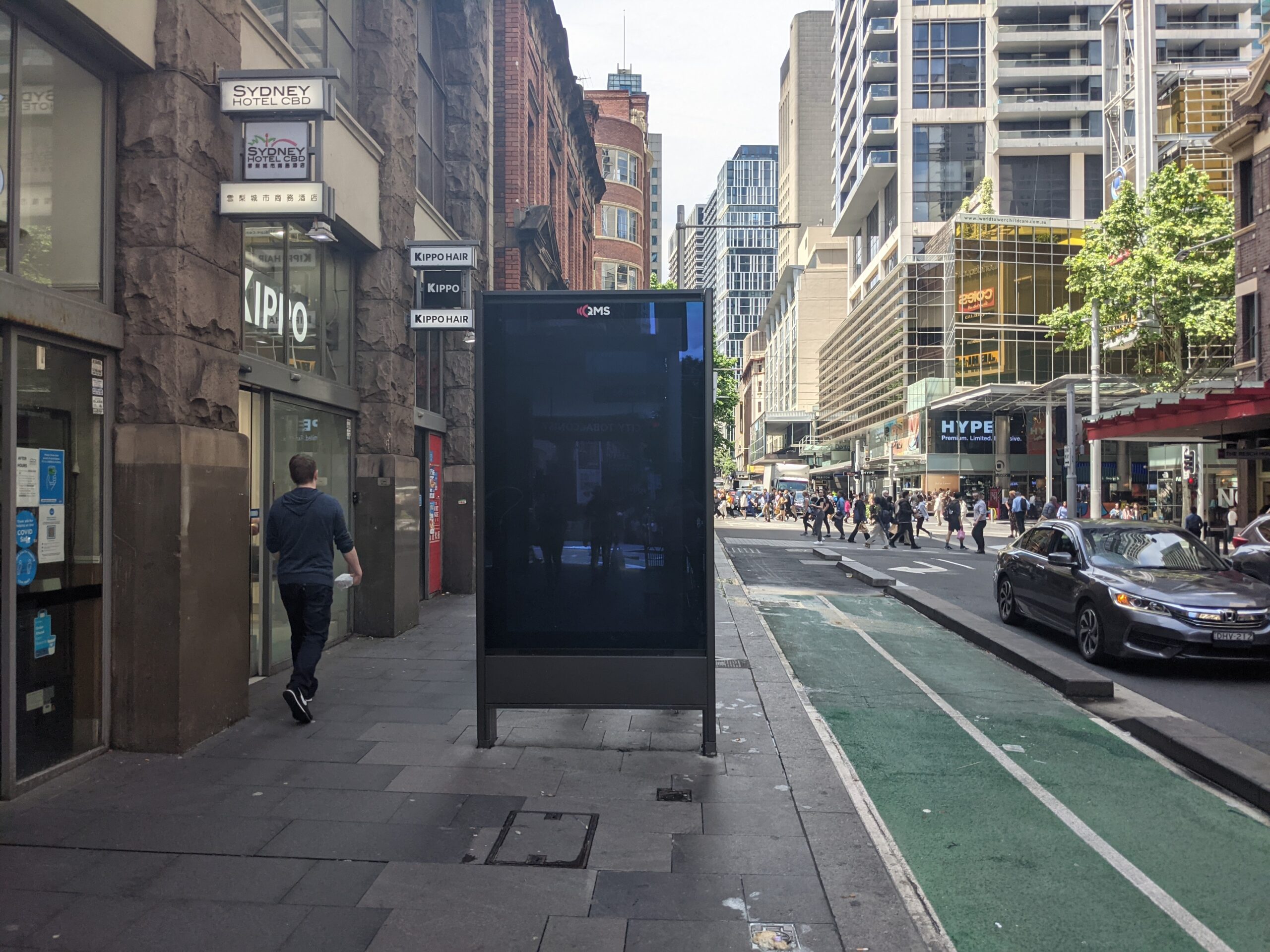
Map live at SydneyAdvertisingMap.com. See also: Max Bo’s analysis of how many placed next to Telstra telephones: https://observablehq.com/@mjbo/sydney-qms-panel-public-telephone-pairings If you live in Sydney you will have seen them – the 86 inch advertising screens in the City of Sydney Council. These advertising panels are known as communication pylons in the language of the developer approvals.…